Lipljan
| Lipljan Lipjan or Lipjani (Albanian) Липљан/Lipljan (Serbian) | |
|---|---|
| Town and municipality | |
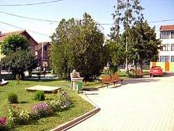 | |
 Lipljan Location in Kosovo | |
| Coordinates: 42°32′N 21°06′E / 42.533°N 21.100°E | |
| Country | Kosovo[lower-alpha 1] |
| District | District of Pristina |
| Government | |
| • Mayor | Imri Ahmeti LDK |
| Area | |
| • Total | 338 km2 (131 sq mi) |
| Elevation | 563 m (1,847 ft) |
| Population (2014) | |
| • Total | 58,373 |
| • Density | 170/km2 (450/sq mi) |
| Time zone | CET (UTC+1) |
| • Summer (DST) | CEST (UTC+2) |
| Postal code | 14000 |
| Area code(s) | +383 38 |
| Car plates | 01 |
| Website |
kk |
Lipljan (on Serbian, Липљан) or Lipjan (on Albanian, Lipjani), is a town and municipality in the District of Pristina of central Kosovo.[lower-alpha 1]
Name
The name of the town, Lipljan, is derived from the Serbian lipa, "linden tree", referring to the local foliage.[1] The name lipa is often used in South Slavic toponyms.[1] The Roman city of Ulpiana was located near Lipljan and it was named in honor of the Roman Emperor Marcus Ulpius Nerva Traianus. In the early Middle Ages in was part of the Bulgarian Empire and a diocese of the Bulgarian Patiarchate. The neo-Latin form Lypenion for the city occurs for the first time in a Byzantine text from 1018 AD that confirmed the town as an episcopal seat of the Bulgarian Archbishopric of Ohrid following the Byzantine conquest of Bulgaria in the same year.[2]
Municipality
- Akllap/Oklap
- Babush i Muhaxherëve/Muhadžer Babuš
- Baicë/Banjica
- Banullë/Bandulić
- Breg i Zi/Crni Breg
- Brus/Brus
- Bujan/Bujance
- Bukovicë/Bukovica
- Divlakë/Divljaka
- Dobrajë e Madhe/Velika Dobranja
- Dobrajë e Vogël/Mala Dobranja
- Dobrotin/Dobratin
- Donja Gušterica/Gushtericë e Ulët
- Gadime e Epërme/Gornje Gadimlje
- Gadime e Ulët/Donje Gadimlje
- Gllanicë/Glanica
- Gllavicë/Glavica
- Gllogoc/Glogovce
- Gornja Gušterica/Gushtericë e Epërme
- Grackë e Vjetër/Staro Gracko
- Grackë e Vogël/Malo Gracko
- Gumnasellë/Guvno Selo
- Hallaç i Madh/Veliki Alaš
- Hallaç i Vogël/Mali Alaš
- Hanroc/Androvac
- Janjevo/Janjevë
- Kleçkë/Klečka
- Kojskë/Konjsko
- Konjuh/Konjuh
- Kraishtë/Krajište
- Krojmir/Krajmirovce
- Leletiq/Laletić
- Lepina/Lepi
- Lipjan/Lipljan
- Lipovica
- Livađe/Livagjë
- Llugaxhi/Lugadžija
- Llugë/Lug
- Magura
- Marec/Marevce
- Medvec/Medvece
- Mirenë/Mirena
- Okosnicë/Okosnica
- Plitkoviq/Plitković
- Poturoc/Poturovce
- Qellapek/Čelopek
- Qylagë/Čučuljaga
- Radevo/Radevë
- Resinoc/Rusinovce
- Ribar i Madh/Veliko Ribare
- Ribar i Vogël/Malo Ribare
- Ruboc/Rabovce
- Rufc i Ri/Novo Rujce
- Rufc i Vjetër/Staro Rujce
- Shalë/Sedlare
- Shisharkë/Šišarka
- Skulanevo/Skullan
- Sllovi/Slovinje
- Smallushë/Smoluša
- Suvi Do/Suhodoll
- Teqë/Teća
- Topličane
- Torina/Torinë
- Trbovce/Tërbuc
- Varigoc/Varigovce
- Vërshec/Vrševce
- Vogaçicë/Vogačica
- Vrelo
- Vrellë e Goleshit/Goleško Vrelo
- Zlokućane
History
Roman period
Ulpiana played an important role in the development of the most important cities in the Roman province of Dardania.
Middle Ages
Lipljan was the seat of medieval Eparchy of Lipljan that existed up to the beginning of 18 century. The Gračanica monastery was built in 1321, on the ruins of two older churches.
Demographics
| Ethnic Composition, Including IDPs | |||||||||||||
| Year/Population | Albanians | % | Serbs | % | Croats | % | Others | % | Total | ||||
|---|---|---|---|---|---|---|---|---|---|---|---|---|---|
| 1961 census | 24,433 | 60.98 | 10,902 | 27.21 | 3,304 | 8.25 | 1,431 | 3.57 | 40,070 | ||||
| 1991 census | 53,730 | 77.36 | 9,713 | 13.99 | 2,914 | 4.20 | 3,094 | 4.45 | 69,451 | ||||
| January 1999 (OSCE est.) | 62,706 | 81.3 | 9,985 | 13.0 | N/A | N/A | 5,834 | 7.6 | 77,087 | ||||
| 2000 (OSCE est.) | 63,478 | 83.3 | 9,300 | 12.2 | 363 | 0.5 | 1,890 | 2.6 | 76,143 | ||||
See also
- Municipalities of Kosovo
- Cities and towns in Kosovo
- Populated places in Kosovo
- Staro Gracko massacre
Notes and references
Notes:
- 1 2 Kosovo is the subject of a territorial dispute between the Republic of Kosovo and the Republic of Serbia. The Republic of Kosovo unilaterally declared independence on 17 February 2008, but Serbia continues to claim it as part of its own sovereign territory. The two governments began to normalise relations in 2013, as part of the Brussels Agreement. Kosovo has received formal recognition as an independent state from 111 out of 193 United Nations member states.
References
- 1 2 Skok, Petar (1988) [1971]. Etimologijski rječnik hrvatskoga ili srpskoga jezika (in Serbo-Croatian). 2. Zagreb: Jugoslavenska akademija znanosti i umjetnosti. pp. 305–306. ISBN 86-407-0064-8.
- ↑ Collective (1965). Greek Sources about Bulgarian History (GIBI), volume VI (in Bulgarian and Greek). Sofia: Bulgarian Academy of Sciences Press. p. 44.
| Wikimedia Commons has media related to Lipjan. |
External links
Coordinates: 42°31′48″N 21°08′19″E / 42.53000°N 21.13861°E
| Ferizaj District |  | |
|---|---|---|
| Gjakova District | ||
| Gjilan District | ||
| Mitrovica District | ||
| Peć District | ||
| Pristina District | ||
| Prizren District | ||
1 Kosovo is the subject of a territorial dispute between the Republic of Kosovo and the Republic of Serbia. The Republic of Kosovo unilaterally declared independence on 17 February 2008, but Serbia continues to claim it as part of its own sovereign territory. The two governments began to normalise relations in 2013, as part of the Brussels Agreement. Kosovo has received formal recognition as an independent state from 111 out of 193 United Nations member states. | ||
| | |||||||||
|---|---|---|---|---|---|---|---|---|---|
| Rank | Name | Districts | Pop. | Rank | Name | Districts | Pop. | ||
 Pristina  Prizren |
1 | Pristina | Pristina | 204,721 | 11 | Suva Reka | Prizren | 59,681 |  Ferizaj (Uroševac)  Peć |
| 2 | Prizren | Prizren | 186,986 | 12 | Orahovac | Gjakova | 58,908 | ||
| 3 | Ferizaj (Uroševac) | Ferizaj (Uroševac) | 101,174 | 13 | Lipljan | Pristina | 56,643 | ||
| 4 | Peć | Peć | 97,890 | 14 | Mališevo | Prizren | 57,301 | ||
| 5 | Gjakova | Gjakova | 94,543 | 15 | Skenderaj (Srbica) | Mitrovica | 51,746 | ||
| 6 | Podujevo | Pristina | 83,425 | 16 | Vitina | Gjilan | 46,742 | ||
| 7 | Mitrovica | Mitrovica | 80,623 | 17 | Deçan | Peć | 41,173 | ||
| 8 | Gjilan | Gjilan | 80,525 | 18 | Istok | Peć | 39,604 | ||
| 9 | Vučitrn | Mitrovica | 64,578 | 19 | Klina | Peć | 39,208 | ||
| 10 | Glogovac (Drenas) | Pristina | 60,175 | 20 | Kosovo Polje (Fushë Kosova) | Pristina | 37,048 | ||