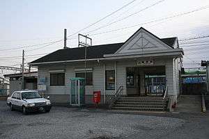
Komono Station
Komono Station 菰野駅 | |
|---|---|
 Komono Station | |
| Location |
892 Komono-Tatsumino, Komono, Mie (三重県三重郡菰野町大字菰野字辰巳野892) Japan |
| Operated by | Kintetsu Railway |
| Line(s) | Yunoyama Line |
| History | |
| Opened | 1913 |
| Traffic | |
| Passengers (FY2010) | 1369 daily |
Komono Station (菰野駅 Komono-eki) is a railway station on the Yunoyama Line in Komono, Mie Prefecture, Japan, operated by the private railway operator Kintetsu Railway. Komono Station is 11.3 rail kilometers from the terminus of the line at Kintetsu-Yokkaichi Station.[1]
Lines
Station layout
Komono Station has an island platform and a side platform serving three tracks. This makes it possible for trains running in opposite directions one the single-line Yunoyama Line to pass each other at this station. Platform 3, for use by dead-head trains is no longer in use. Passengers going between the station entrance and platform 2 must cross the train tracks via a level crossing.
Platforms
| 1 | ■ Yunoyama Line | for Yokkaichi • Nagoya • Osaka |
| 2 | ■ Yunoyama Line | for Yunoyama-Onsen |
Adjacent stations
| « | Service | » | ||
|---|---|---|---|---|
| Yunoyama Line | ||||
| Sakura | Local | Naka-Komono | ||
Usage
Komono Station is used primarily by morning and evening commuters to school and work. According to a study conducted on November 8, 2005, there are 2385 people that pass through this station daily. This makes it the:
- 181st busiest Kintetsu station (out of 323 total stations at the time).
- 35th busiest Kintetsu station in Mie Prefecture (out of 116 total stations at the time).
- 4th busiest station on the Yunoyama Line (out of 10 total stations).
History
Komono Station opened on June 1, 1913 as a station on the Yokkaichi Railway. Due to mergers, station fell under the ownership of the Mie Railway on March 1, 1931, and under the Sangu Express Electric Railway (Sanco) on February 11, 1944. On February 1, 1964, the railway division of Sanco split off into a separate company, which came under the ownership of the Mie Electric Railway. The Mie Electric Railway became part of the Kintetsu group on April 1, 1965. [2] Support for PiTaPa and ICOCA began on April 1, 2007.
Surrounding area
- Komono High School
- Komono Public Hospital
- National Route 306
- National Route 477
References
External links
| Wikimedia Commons has media related to Komono Station. |
- (in Japanese) Kintetsu: Komono Station
Coordinates: 35°00′31″N 136°31′02″E / 35.0087°N 136.5173°E