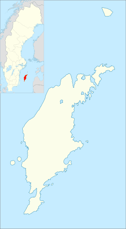
Klintehamn
| Klintehamn | |
|---|---|
|
Boat to Stora Karlsö at Klintehamn harbor | |
 Klintehamn | |
| Coordinates: 57°24′N 18°12′E / 57.400°N 18.200°ECoordinates: 57°24′N 18°12′E / 57.400°N 18.200°E | |
| Country | Sweden |
| Province | Gotland |
| County | Gotland County |
| Municipality | Gotland Municipality |
| Area[1] | |
| • Total | 2.12 km2 (0.82 sq mi) |
| Population (31 December 2014)[2] | |
| • Total | 1,350 |
| • Density | 643/km2 (1,670/sq mi) |
| Time zone | CET (UTC+1) |
| • Summer (DST) | CEST (UTC+2) |
Klintehamn is a locality on the Swedish island of Gotland with 1,350 inhabitants in 2010.[2] It is a shipping port on the west coast of Gotland where timber and agricultural products are shipped to mainland Sweden. The harbor also has a marina for small boats. During summer, ferries depart daily from the harbor to Stora Karlsö island.[3]
In 1897, a railway was built from Klintehamn to Romakloster for transporting sugar beets to the sugar refinery in Roma.[4][5]
References
- ↑ "Tätorternas landareal, folkmängd och invånare per km2 2005 och 2010" (in Swedish). Statistics Sweden. 14 December 2011. Archived from the original on 10 January 2012. Retrieved 10 January 2012.
- 1 2 "Gotland i siffror 2015" [Gotland in numbers 2015]. www.gotland.se. Gotland Municipality. Retrieved 25 May 2016.
- ↑ Enderborg, Bernt. "Klintehamn". www.guteinfo.com. Guteinfo. Retrieved 26 May 2016.
- ↑ Enderborg, Bernt. "Tjuls järnvägsstation" [Tjuls railway museum]. www.guteinfo.com. Guteinfo. Retrieved 26 May 2016.
- ↑ "Tjuls Järnvägsmuseum" [Tjuls railway museum]. www.gotland.net. Gotlands Media AB. Retrieved 26 May 2016.
External links
| Wikimedia Commons has media related to Klintehamn. |
This article is issued from
Wikipedia.
The text is licensed under Creative Commons - Attribution - Sharealike.
Additional terms may apply for the media files.

