Killyneary

Killyneary (from Irish: Coill an Aoire meaning 'The Wood of the Shepherd') is a townland in the civil parish of Templeport, County Cavan, Ireland. It lies in the Roman Catholic parish of Templeport and barony of Tullyhaw.
Geography
Killyneary is bounded on the north by Brackley, Templeport townland, on the west by Derrymony townland, on the south by Erraran and Bawnboy townlands and on the east by Carrick East townland. Its chief geographical features are Brackley Lough, forestry plantations, streams, dug wells and a spring well.
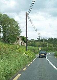
Killyneary is traversed by the national secondary N87 road (Ireland), minor roads and rural lanes.
The townland covers 152 statute acres.[1]
History
The 1609 Baronial Map depicts the townland as Killinirie.[2]
The 1665 Down Survey map depicts it as Carronary.[3]
The 1662 Hearth Money Rolls show no Hearth Tax payers in Killyneary.
In the Templeport Poll Book of 1761 there were only two people registered to vote in Killyneary in the Irish general election, 1761[4] - Henry Pratt and Richard Jackman. They were entitled to two votes. Both voted for Lord Newtownbutler (later Brinsley Butler, 2nd Earl of Lanesborough) who was elected Member of Parliament for Cavan County and for George Montgomery (MP) of Ballyconnell who lost the election. Absence from the poll book either meant a resident did not vote or more likely was not a freeholder entitled to vote, which would mean most of the inhabitants of Killyneary.
The Tithe Applotment Books for 1827 list nine tithepayers in the townland.[5]
Griffith's Valuation of 1857 lists seven landholders in the townland.[6]
In the 1901 census of Ireland, there are five families listed in the townland, [7] and in the 1911 census of Ireland, there are only three families listed in the townland.[8]
Antiquities
There do not seem to be any structures of historical interest in Killyneary.
References
- ↑ "IreAtlas". Retrieved 29 February 2012.
- ↑ National Archives Dublin
- ↑ Trinity College Dublin: The Down Survey of Ireland.
- ↑
- ↑
- ↑
- ↑ Bawnboy/Killyneary /
- ↑ Bawnboy/Killyneary / Census of Ireland 1911
External links
Coordinates: 54°04′31″N 7°48′37″W / 54.07514°N 7.810271°W
