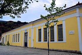
Doliana
| Doliana Δολιανά | |
|---|---|
 Doliana | |
| Coordinates: 37°25′51″N 22°40′48″E / 37.430820°N 22.680075°ECoordinates: 37°25′51″N 22°40′48″E / 37.430820°N 22.680075°E | |
| Country | Greece |
| Administrative region | Peloponnese |
| Regional unit | Arcadia |
| Municipality | North Kynouria |
| Elevation | 90 m (300 ft) |
| Community[1] | |
| • Population | 846[2] (2011) |
| Time zone | EET (UTC+2) |
| • Summer (DST) | EEST (UTC+3) |
| Postal code | 220 01 |
| Area code(s) | 27550 |
Doliana (Greek: Δολιανά) is a community of the municipality North Kynouria, in eastern Arcadia, Greece. It consists of the villages Ano Doliana, Dragouni, Kato Doliana, Kouvlis, Prosilia and Rouneika. The population of the community is 846 (2011 census). The largest village of the community is Kato Doliana with 595 inhabitants which is considered a traditional settlement. It partly serves as the winter residence of the population of Ano Doliana.

Kato Doliana is situated on the left bank of the river Tanos, on the south slopes of mountain Zavitsa. Particularly interesting are the natural caves that have formed due to the erosion of the terrain caused by the flow of the river. In Kato Doliana, with its very good climate and its impressive olive plantation, the visitor will find traditional coffee shops and tavernas. In the area, apart from the Villa of Herodes Atticus at Eva, one can also visit the ancient settlements of Kourmeki and Tsiorovos and the Byzantine Women's Monastery of Loukou.

Historical population
| Year | Population |
|---|---|
| 1928 | 1.796 |
| 1940 | 1.680 |
| 1951 | 1.650 |
| 1961 | 1.497 |
| 1971 | 1.404 |
| 1981 | 1.338 |
| 1991 | 933 |
| 2001 | 867 |
| 2011 | 846 |
See also
References
- ↑ "Απογραφή Πληθυσμού - Κατοικιών 2011. ΜΟΝΙΜΟΣ Πληθυσμός" (in Greek). Hellenic Statistical Authority.
- ↑ Hellenic Statistical Authority - Table. The De Jure (registered) population 2011