Journal Square–33rd Street
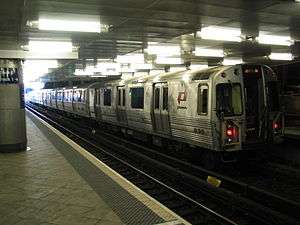 Train at the Journal Square station | |||||||||||||||||||||||||||||||||||||||||||||||||||||||||||||||||||||||||||||||||||||||||||||||||||||||||||||||||||||||||||
| Overview | |||||||||||||||||||||||||||||||||||||||||||||||||||||||||||||||||||||||||||||||||||||||||||||||||||||||||||||||||||||||||||
| Type | Rapid transit | ||||||||||||||||||||||||||||||||||||||||||||||||||||||||||||||||||||||||||||||||||||||||||||||||||||||||||||||||||||||||||
| System | Port Authority Trans-Hudson | ||||||||||||||||||||||||||||||||||||||||||||||||||||||||||||||||||||||||||||||||||||||||||||||||||||||||||||||||||||||||||
| Status | Operational | ||||||||||||||||||||||||||||||||||||||||||||||||||||||||||||||||||||||||||||||||||||||||||||||||||||||||||||||||||||||||||
| Locale | Hudson County, New Jersey and Manhattan, New York | ||||||||||||||||||||||||||||||||||||||||||||||||||||||||||||||||||||||||||||||||||||||||||||||||||||||||||||||||||||||||||
| Termini |
Journal Square (west) 33rd Street (east) | ||||||||||||||||||||||||||||||||||||||||||||||||||||||||||||||||||||||||||||||||||||||||||||||||||||||||||||||||||||||||||
| Stations | 8 | ||||||||||||||||||||||||||||||||||||||||||||||||||||||||||||||||||||||||||||||||||||||||||||||||||||||||||||||||||||||||||
| Operation | |||||||||||||||||||||||||||||||||||||||||||||||||||||||||||||||||||||||||||||||||||||||||||||||||||||||||||||||||||||||||||
| Owner | Port Authority of New York and New Jersey | ||||||||||||||||||||||||||||||||||||||||||||||||||||||||||||||||||||||||||||||||||||||||||||||||||||||||||||||||||||||||||
| Operator(s) | Port Authority Trans-Hudson | ||||||||||||||||||||||||||||||||||||||||||||||||||||||||||||||||||||||||||||||||||||||||||||||||||||||||||||||||||||||||||
| Character | Surface and underground | ||||||||||||||||||||||||||||||||||||||||||||||||||||||||||||||||||||||||||||||||||||||||||||||||||||||||||||||||||||||||||
| Technical | |||||||||||||||||||||||||||||||||||||||||||||||||||||||||||||||||||||||||||||||||||||||||||||||||||||||||||||||||||||||||||
| Line length | 5.7 miles (9.2 km) | ||||||||||||||||||||||||||||||||||||||||||||||||||||||||||||||||||||||||||||||||||||||||||||||||||||||||||||||||||||||||||
| Track gauge | 4 ft 8 1⁄2 in (1,435 mm) | ||||||||||||||||||||||||||||||||||||||||||||||||||||||||||||||||||||||||||||||||||||||||||||||||||||||||||||||||||||||||||
| Electrification | Third rail | ||||||||||||||||||||||||||||||||||||||||||||||||||||||||||||||||||||||||||||||||||||||||||||||||||||||||||||||||||||||||||
| |||||||||||||||||||||||||||||||||||||||||||||||||||||||||||||||||||||||||||||||||||||||||||||||||||||||||||||||||||||||||||
Journal Square–33rd Street is a rapid transit service operated by the Port Authority Trans-Hudson (PATH). It is colored yellow on the PATH service map and trains on this service display yellow marker lights.[1] This service operates from Journal Square in Jersey City, New Jersey by way of the Uptown Hudson Tubes to 33rd Street in Midtown Manhattan, New York.[1] The 5.7-mile (9.2 km) trip takes 22 minutes to complete.[2]
This service operates as a direct service from 6:00 AM to 23:00 (11:00 PM) on weekdays.[3] At other times, this service is replaced with the Journal Square-33rd Street (via Hoboken) service.[3]
After the September 11 attacks destroyed the World Trade Center station, service on this line was suspended during overnight hours with all service provided by the Newark - 33rd Street via Hoboken line until Exchange Place reopened on June 29, 2003.
After Hurricane Sandy devastated the PATH system in October 2012, service on this line was suspended. Once the line resumed service in early November, service was temporarily extended to Newark Penn Station until the Newark - World Trade Center line resumed service on November 26. During the first few weeks of service after the hurricane, the stations at Christopher Street and 9th Street were closed due to overcrowding concerns.
Station listing
| PATH Services | |
Route map: Google
References
- 1 2 "PATH Maps". The Port Authority of New York and New Jersey. Retrieved March 31, 2011.
- ↑ "PATH Facts & Info". The Port Authority of New York and New Jersey. Retrieved March 31, 2011.
- 1 2 "PATH Full Schedules". The Port Authority of New York and New Jersey. Retrieved March 31, 2011.
PATH (Port Authority Trans-Hudson) | ||
|---|---|---|
| Services |  | |
| Night and weekend services | ||
| Stations | ||
| Infrastructure | ||
| Historical | ||
| Related | ||