Jangalpara
| Jangalpara জঙ্গলপাড়া | |
|---|---|
| Census Town | |
 Jangalpara  Jangalpara Location in West Bengal, India | |
| Coordinates: 22°43′54″N 88°12′25″E / 22.731751°N 88.2068378°ECoordinates: 22°43′54″N 88°12′25″E / 22.731751°N 88.2068378°E | |
| Country |
|
| State | West Bengal |
| District | Hooghly |
| Nearest City | Serampore |
| Population (2011) | |
| • Total | 7,478 |
| Languages | |
| • Official | Bengali, English |
| Time zone | IST (UTC+5:30) |
| Vehicle registration | WB |
| Lok Sabha constituency | Serampore |
| Vidhan Sabha constituency | Chanditala |
| Website |
wb |
Jangalpara (Bengali: জঙ্গলপাড়া ) is a census town in Chanditala I CD Block in Srirampore subdivision of Hooghly district in the state of West Bengal, India. It is under Chanditala police station.
Geography
Jangalpara is located at: 22°43′54″N 88°12′25″E / 22.731751°N 88.2068378°E [1]
It is 28 km from District headquarters Hooghly.[2]
Demographics
As per 2011 Census of India, Jangalpara had a total population of 7,478 of which 3,752 (50%) were males and 3,726 (50%) were females. Population below 6 years was 724. The total number of literates in Jangalpara was 5,736 (84.93% of the population over 6 years). [3]
Transportation
- Railway
Baruipara railway station its nearest railway station. at Howrah-Bardhaman chord Kolkata Suburban Railway . The main road is SH-15 It is the main artery of the town and it is connected NH-2
- Bus Route
- 26 Bonhooghly – Chapadanga
Education
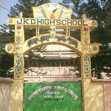
Jangalpara Krishnarampur Deshapran High School
Category :Co-ed Subject Offer :Arabic, Bio-Science, Bengali (A), Chemistry, Economics, English (B), Geography, History, History, Mathematics, Philosophy, Physics, Sanskrit
Health
Jangalpara P.H.C & Rural Training Under Chanditala I unit. It has all necessary primary facilities, outdoor facilities for general patients. ("Hooghly.gov.phc".)
References
- ↑ "banglarbhumi.gov.in". WEST BENGAL ->HUGLI(হুগলী) ->CHANDITALA - I(চণ্ডীতলা-১) Mouza Information.
- ↑ "Hugli district census handbook" (PDF). Retrieved 27 February 2016.
- ↑ "C.D. Block Wise Primary Census Abstract Data(PCA)". 2011 census: West Bengal – District-wise CD Blocks. Registrar General and Census Commissioner, India. Retrieved 14 June 2016.
Cities, towns and locations in Hooghly District | |||||||||
|---|---|---|---|---|---|---|---|---|---|
| Cities, municipal and census towns | |||||||||
| Locations other than cities and towns |
| ||||||||
| Neighbourhoods | |||||||||
| Related topics |
| ||||||||