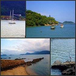
Itaguaí
| Itaguaí | |||
|---|---|---|---|
| Municipality | |||
| Município de Itaguaí | |||
 | |||
| |||
| Nickname(s): Port city | |||
 Location of Itaguaí in the state of Rio de Janeiro | |||
 Itaguaí Location of Itaguaí in Brazil | |||
| Coordinates: 22°51′07″S 43°46′30″W / 22.85194°S 43.77500°WCoordinates: 22°51′07″S 43°46′30″W / 22.85194°S 43.77500°W | |||
| Country |
| ||
| Region | Southeast | ||
| State |
| ||
| Government | |||
| • Prefeito | Carlo Bussatto Júnio (PMDB) | ||
| Area | |||
| • Total | 275.870 km2 (106.514 sq mi) | ||
| Elevation | 15 m (49 ft) | ||
| Population (2010) | |||
| • Total | 109,091 | ||
| Time zone | UTC-3 (UTC-3) | ||
| Website | |||

Itaguai in 1970
Itaguaí (Portuguese pronunciation: [itɐgwaˈi]) is a municipality located in the Brazilian state of Rio de Janeiro. Its population was 109.091 in 2014 and its area is 272 km².[1] The city was founded in 1688.
Itaguaí is located approximately 75 km west of the city of Rio de Janeiro on the road to Santos (SP). It is located between the shore of Sepetiba Bay and the Atlantic Rainforest.
The port of Itaguaí was opened in 1982. One of its main trading goods is alumina.
It serves also as dormitory town for workers of the industrial western zone (Zona Oeste) of Rio de Janeiro. It is the seat of the Roman Catholic Diocese of Itaguaí.
References
- ↑ IBGE - "Archived copy". Archived from the original on 2007-01-09. Retrieved 2014-08-03.
This article is issued from
Wikipedia.
The text is licensed under Creative Commons - Attribution - Sharealike.
Additional terms may apply for the media files.


