Ironjaw Lake
| Ironjaw Lake | |
|---|---|
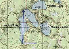
 A topographical map of the Ironjaw Lake area | |
| Location | Schoolcraft County, Michigan |
| Coordinates | 46°10′28.14″N 86°33′10.07″W / 46.1744833°N 86.5527972°WCoordinates: 46°10′28.14″N 86°33′10.07″W / 46.1744833°N 86.5527972°W |
| Basin countries | United States |
| Surface area | 51 acres (21 ha) |
| Surface elevation | 771 ft (235 m)[1] |

Ironjaw Lake
Ironjaw Lake is a 51-acre (21 ha) lake that is located in south-western Schoolcraft County, Michigan in the Hiawatha National Forest.[2] It is just east of the county line with Alger and just north of the county line with Delta County. Other nearby lakes include Hugaboom Lake, Mowe Lake, Blue Lake, Corner-Straits Chain of lakes, Nineteen Lake, Verdant Lake, and Round Lake.
See also
References
- ↑ U.S. Geological Survey Geographic Names Information System: Ironjaw Lake
- ↑ "Fishing Hiawatha National Forest". U.S.D.A. Forest Service. Retrieved 2008-11-29.
This article is issued from
Wikipedia.
The text is licensed under Creative Commons - Attribution - Sharealike.
Additional terms may apply for the media files.