Interstate 375 (Florida)
| |||||||
|---|---|---|---|---|---|---|---|
| North Bay Drive | |||||||
| Route information | |||||||
| Auxiliary route of I-75 | |||||||
| Maintained by FDOT | |||||||
| Length: | 1.220 mi[1] (1.963 km) | ||||||
| Existed: | 1979[2] – present | ||||||
| Major junctions | |||||||
| West end: |
| ||||||
| East end: |
| ||||||
| Location | |||||||
| Counties: | Pinellas | ||||||
| Highway system | |||||||
| |||||||
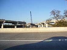
Interstate 375 (I-375) in St. Petersburg, Florida, also known as North Bay Drive, is a 1.2-mile-long spur route from Interstate 275 into downtown. It is also designated as the unsigned State Road 592. There is a sibling segment of freeway nearby that is designated I-175.
Route description
Interstate 375 begins at an interchange with Interstate 275 (exit 23), heading east towards downtown St. Petersburg, with interchanges with 8th Street North/9th Street North, before ending at 4th Avenue North west of 4th Street North. Westbound I-375 begins with a split of 5th Avenue North west of 4th Street North with no exits until reaching I-275. Along with its sister highway I-175, I-375 lacks exit numbers.[3]
History
Original aspirations
Interstate 375 was originally planned as a much longer, state highway, extending west of Interstate 275 and following a CSX rail line towards a proposed toll road near Clearwater. When I-75 was relocated in the late 1970s/early 1980s, five miles (8 km) of additional interstate became available, thus the St. Pete feeder sections of I-375 and the neighboring I-175 were upgraded to Interstate status. However, the Interstate Highway standards at the time would not allow the I-375 extension to receive Federal Interstate Highway funding, leaving only the section east of I-275 built to freeway standards. The planned freeway extension of I-375 was canceled by officials at the Department of Transportation in the mid 1970s. The cancellation of the rest of Interstate 375 eventually resulted in US 19 between Gandy Boulevard and the Pinellas-Pasco line being upgraded to freeway standards.
Contrary to popular belief, the ramp stub at the I-375 interchange was not a result of the failed freeway extension. A connection to 20th St N was originally planned from this stub. However, the 20th St N and 5th Ave N Intersection was already convoluted prior to I-275's construction and the Florida Department of Transportation decided not to build the connection as a result.
2007 Tanker Incident

On March 27, 2007, a tanker entering I-375 east from I-275 south's left exit lost control and hit the retaining wall, catching fire and burning for several hours. The resulting fire became so intense, that it severely damaged a large section of the I-375 overpass from southbound I-275. Intense flames also fell to a city-owned (St. Petersburg) construction equipment yard and destroyed 8 to 10 city vehicles, causing an estimated $500,000 in damage to the yard. The fire also spread to St. Petersburg's stormwater system, blowing off manhole covers within the vicinity. One St. Petersburg police officer was injured as a result being struck by one of those manhole covers.[4][5]
In the end, the driver of the tanker died on-scene due to the fire. The I-375 overpass remained closed for almost four weeks while Florida Department of Transportation rebuilt the damaged sections of the bridge, reopening to traffic on the morning of April 22, 2007, about one week ahead of schedule. Reconstruction of the I-375 overpass included the rebuilding of one entire span, plus 11 concrete beams. In addition, one of the support columns underwent significant repairs to ensure its strength in supporting the roadway. FDOT placed signs along I-275 south, indicating the left exit onto I-375, due to this, as well as other fatal incidents that have occurred on the interchange.[6][7]
Exit list
The entire route is in St. Petersburg, Pinellas County.
| mi[1] | km | Old exit | New exit | Destinations | Notes |
|---|---|---|---|---|---|
| 0.000 | 0.000 | -- | -- | Westbound exit and eastbound entrance; I-275 north exits 23-23A | |
| 0.907 | 1.460 | 1[8] | - | M.L. King Jr. Street / 8th Street North (CR 691 via SR 595 south) | Eastbound exit and westbound entrance |
| 1.220 | 1.963 | 2[9] | - | Eastbound exit and westbound entrance | |
| 1.000 mi = 1.609 km; 1.000 km = 0.621 mi | |||||
See also
-
 Florida portal
 -
 U.S. Roads portal
References
- 1 2 "Florida Department of Transportation Interchange Report" (PDF). Florida Department of Transportation. 2010-08-04. pp. 8–10. Archived from the original (PDF) on 2012-02-08. Retrieved 2010-11-02.
- ↑ "Historic Florida Interstate Information". Retrieved 5 October 2014.
- ↑ "Florida's Interstate Exit Numbers". Florida Department of Transportation. Retrieved 2010-11-18.
- ↑ "Crashed tanker unleashes blaze". Retrieved 5 October 2014.
- ↑ Grand Prix Fans Must Take Alternate Route
- ↑ "After the Inferno". Retrieved 5 October 2014.
- ↑ "Critics say I-375 exit ramp where three men have died is outdated and unsafe". Tampa Bay Times. Retrieved 5 October 2014.
- ↑ St. Petersburg Times, I-275 downtown feeder now open to northbound traffic, January 17, 1978, p. 3B
- ↑ Evening Independent, I-275 Signs Good For New Segment, January 11, 1978, front page
External links
Route map: Google
| Wikimedia Commons has media related to Interstate 375 (Florida). |
- Kurumi - I-375 Florida General Info
- Interstate 375 Florida page at Interstate275Florida.com History and Photos
