Honey Creek Township, Crawford County, Illinois
| Honey Creek Township | |
|---|---|
| Township | |
 Location in Crawford County | |
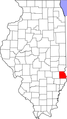 Crawford County's location in Illinois | |
| Coordinates: 38°54′11″N 87°43′43″W / 38.90306°N 87.72861°WCoordinates: 38°54′11″N 87°43′43″W / 38.90306°N 87.72861°W | |
| Country | United States |
| State | Illinois |
| County | Crawford |
| Established | June 21, 1869 |
| Area | |
| • Total | 48.32 sq mi (125.1 km2) |
| • Land | 48.32 sq mi (125.1 km2) |
| • Water | 0 sq mi (0 km2) 0% |
| Elevation | 554 ft (169 m) |
| Population (2010) | |
| • Estimate (2016)[1] | 1,513 |
| • Density | 32.3/sq mi (12.5/km2) |
| Time zone | CST (UTC-6) |
| • Summer (DST) | CDT (UTC-5) |
| ZIP codes | 62427, 62454 |
| FIPS code | 17-033-35970 |
Honey Creek Township is one of ten townships in Crawford County, Illinois, USA. As of the 2010 census, its population was 1,563 and it contained 672 housing units.[2]
Geography
According to the 2010 census, the township has a total area of 48.32 square miles (125.1 km2), all land.[2]
Cities, towns, villages
- Flat Rock (west three-quarters)
Unincorporated towns
(This list is based on USGS data and may include former settlements.)
Cemeteries
The township contains these ten cemeteries: Beckwith, Cecedar, Good Hope, Jones, Nuttle, Port Jackson, Rich, Sears, Swearingen and Tohill.
Major highways
Demographics
| Historical population | |||
|---|---|---|---|
| Census | Pop. | %± | |
| Est. 2016 | 1,513 | [1] | |
School districts
- Lawrence County Community Unit District 20
- Oblong Community Unit School District 4
- Palestine Community Unit School District 3
- Robinson Community Unit School District 2
Political districts
- Illinois' 15th congressional district
- State House District 109
- State Senate District 55
References
- "Honey Creek Township, Crawford County, Illinois". Geographic Names Information System. United States Geological Survey. Retrieved 2010-01-10.
- United States Census Bureau 2007 TIGER/Line Shapefiles
- United States National Atlas
- 1 2 "Population and Housing Unit Estimates". Retrieved June 9, 2017.
- 1 2 "Population, Housing Units, Area, and Density: 2010 - County -- County Subdivision and Place -- 2010 Census Summary File 1". United States Census. Retrieved 2013-05-28.
- ↑ "Census of Population and Housing". Census.gov. Retrieved June 4, 2016.
External links
Adjacent places of Honey Creek Township, Crawford County, Illinois | |||
|---|---|---|---|
 | | ||
Municipalities and communities of Crawford County, Illinois, United States | ||
|---|---|---|
| City | ||
| Town | ||
| Villages | ||
| Townships | ||
| CDPs | ||
| Other unincorporated communities | ||
| Ghost town | ||
| Footnotes | ‡This populated place also has portions in an adjacent county or counties | |
This article is issued from
Wikipedia.
The text is licensed under Creative Commons - Attribution - Sharealike.
Additional terms may apply for the media files.