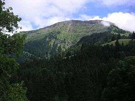
Hochgrat
| Hochgrat | |
|---|---|
 Hochgrat by Oberstaufen | |
| Highest point | |
| Elevation | 1,834 m (6,017 ft) |
| Prominence | 714 m (2,343 ft) |
| Isolation | 12.8 kilometres (8.0 mi) |
| Coordinates | 47°29′43.4″N 10°04′43″E / 47.495389°N 10.07861°ECoordinates: 47°29′43.4″N 10°04′43″E / 47.495389°N 10.07861°E |
| Geography | |
 Hochgrat Location in the Alps | |
| Location | Allgaeu, Bavaria, Germany |
| Parent range | Allgäu Alps |
| Climbing | |
| Easiest route | Road from valley station |

Staufner Haus of German Alpine Club Oberstaufen-Lindenberg
Hochgrat is a 1834 m high summit of the Allgäu Alps, highest mountain of the Nagelfluhkette (group of mountains consisting of conglomerate) and part of nature park Nagelfluhkette.
External links
-

Wikimedia Commons has media related to Hochgrat. - Staufner Haus of German Alpine Club Oberstaufen-Lindenberg
- German Alpine Club Oberstaufen-Lindenberg
- Hochgrat cable car (with webcam)
- 360° Panorama view of Hochgrat
This article is issued from
Wikipedia.
The text is licensed under Creative Commons - Attribution - Sharealike.
Additional terms may apply for the media files.