Hinundayan, Southern Leyte
| Hinundayan | |
|---|---|
| Municipality | |
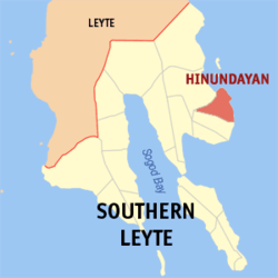 Map of Southern Leyte with Hinundayan highlighted | |
.svg.png) Hinundayan Location within the Philippines | |
| Coordinates: 10°21′N 125°15′E / 10.350°N 125.250°ECoordinates: 10°21′N 125°15′E / 10.350°N 125.250°E | |
| Country | Philippines |
| Region | Eastern Visayas (Region VIII) |
| Province | Southern Leyte |
| District | Lone district of Southern Leyte |
| Barangays | 17 |
| Government[1] | |
| • Mayor | Alfredo Maamo Lagumbay, M.D. |
| Area[2] | |
| • Total | 59.90 km2 (23.13 sq mi) |
| Population (2015 census)[3] | |
| • Total | 12,285 |
| • Density | 210/km2 (530/sq mi) |
| Time zone | PST (UTC+8) |
| ZIP code | 6609 |
| IDD : area code | +63 (0)53 |
| Income class | 5th municipal income class |
| PSGC | 086404000 |
| Electorate | 8,437 voters as of 2016 |
| Website |
www |
Hinundayan is a 5th class municipality in the province of Southern Leyte, Philippines. According to the 2015 census, it has a population of 12,285 people.[3]
Barangays
Hinundayan is politically subdivided into 17 barangays.
- Amaga
- Ambao
- An-an
- Baculod
- Biasong
- Cabulisan
- District I (Pob.)
- District II (Pob.)
- District III (Pob.)
- Baculod
- Hubasan
- Cat-iwing
- Lungsodaan
- Navalita
- Plaridel
- Sabang
- Sagbok
Demographics
| Population census of Hinundayan | ||
|---|---|---|
| Year | Pop. | ±% p.a. |
| 1903 | 5,547 | — |
| 1918 | 8,999 | +3.28% |
| 1939 | 6,830 | −1.30% |
| 1948 | 7,199 | +0.59% |
| 1960 | 7,088 | −0.13% |
| 1970 | 8,546 | +1.89% |
| 1975 | 9,225 | +1.55% |
| 1980 | 9,746 | +1.10% |
| 1990 | 9,965 | +0.22% |
| 1995 | 10,617 | +1.19% |
| 2000 | 11,113 | +0.98% |
| 2007 | 11,610 | +0.61% |
| 2010 | 11,890 | +0.87% |
| 2015 | 12,285 | +0.62% |
| Source: Philippine Statistics Authority [3][4][5][6] | ||
References
- ↑ "Municipalities". Quezon City, Philippines: Department of the Interior and Local Government. Archived from the original on 25 January 2013. Retrieved 8 July 2013.
- ↑ "Province: Southern Leyte". PSGC Interactive. Makati City, Philippines: National Statistical Coordination Board. Retrieved 10 July 2013.
- 1 2 3 Census of Population (2015). "Region VIII (Eastern Visayas)". Total Population by Province, City, Municipality and Barangay. PSA. Retrieved 20 June 2016.
- ↑ Census of Population and Housing (2010). "Region VIII (Eastern Visayas)". Total Population by Province, City, Municipality and Barangay. NSO. Retrieved 29 June 2016.
- ↑ Census of Population (1995, 2000 and 2007). "Region VIII (Eastern Visayas)". Total Population by Province, City and Municipality. NSO. Archived from the original on 24 June 2011.
- ↑ "Province of Southern Leyte". Municipality Population Data. Local Water Utilities Administration Research Division. Retrieved 17 December 2016.
External links
- Unofficial Website of Hinundayan
- Official Website of Hinundayan
- Philippine Standard Geographic Code
- Philippine Census Information
- Local Governance Performance Management System
Adjacent places of Hinundayan, Southern Leyte | |||||||||||||||||
|---|---|---|---|---|---|---|---|---|---|---|---|---|---|---|---|---|---|
 |
| | |||||||||||||||
This article is issued from
Wikipedia.
The text is licensed under Creative Commons - Attribution - Sharealike.
Additional terms may apply for the media files.