Hinatuan, Surigao del Sur
| Hinatuan | ||
|---|---|---|
| Municipality | ||
| ||
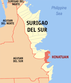 Map of Surigao del Sur with Hinatuan highlighted | ||
.svg.png) Hinatuan Location within the Philippines | ||
| Coordinates: 08°22′N 126°20′E / 8.367°N 126.333°ECoordinates: 08°22′N 126°20′E / 8.367°N 126.333°E | ||
| Country | Philippines | |
| Region | Caraga (Region XIII) | |
| Province | Surigao del Sur | |
| District | 2nd district of Surigao del Sur | |
| Barangays | 24 | |
| Government[1] | ||
| • Mayor | Titing Garay | |
| • Vice Mayor | Candelario Viola, Jr. | |
| Area[2] | ||
| • Total | 299.10 km2 (115.48 sq mi) | |
| Population (2015 census)[3] | ||
| • Total | 39,842 | |
| • Density | 130/km2 (350/sq mi) | |
| Time zone | PST (UTC+8) | |
| ZIP code | 8310 | |
| IDD : area code | +63 (0)86 | |
| Income class | 2nd municipal income class | |
| PSGC | 166809000 | |
| Electorate | 25,813 voters as of 2016 | |
| Languages | Kamayo, Mindanao Cebuano, Filipino, English | |
| Website |
hinatuan | |

Hinatuan is a second class municipality in the province of Surigao del Sur, Philippines. According to the 2015 census, it has a population of 39,842 people.[3]
Hinatuan is approximately 44 kilometers (27 miles) north of Bislig, a component city in the same province.
Barangays

Clear blue waters of the world-renowned underground river in Brgy. Talisay, Hinatuan popularly called as the "Hinatuan Enchanted River" is a known attraction among tourists both locally and internationally
Hinatuan is politically subdivided into 24 barangays.
- Baculin
- Bigaan
- Cambatong
- Campa
- Dugmanon
- Harip
- La Casa (Pob.)
- Loyola
- Maligaya
- Pagtigui-an (Bitoon)
- Pocto
- Port Lamon
- Roxas
- San Juan
- Sasa
- Tagasaka
- Tagbobonga
- Talisay
- Tarusan
- Tidman
- Tiwi
- Zone I Benigno Aquino (Pob.)
- Zone II Sto. Niño (Pob.)
- Zone III Maharlika (Pob.)
Demographics
| Population census of Hinatuan | ||
|---|---|---|
| Year | Pop. | ±% p.a. |
| 1903 | 5,570 | — |
| 1918 | 13,465 | +6.06% |
| 1939 | 14,722 | +0.43% |
| 1948 | 12,395 | −1.89% |
| 1960 | 21,841 | +4.83% |
| 1970 | 22,578 | +0.33% |
| 1975 | 24,073 | +1.29% |
| 1980 | 27,972 | +3.05% |
| 1990 | 33,307 | +1.76% |
| 1995 | 34,602 | +0.72% |
| 2000 | 36,170 | +0.95% |
| 2007 | 37,368 | +0.45% |
| 2010 | 38,731 | +1.31% |
| 2015 | 39,842 | +0.54% |
| Source: Philippine Statistics Authority[3][4][5][6] | ||
References
- ↑ "Official City/Municipal 2013 Election Results". Intramuros, Manila, Philippines: Commission on Elections (COMELEC). 1 July 2013. Retrieved 5 September 2013.
- ↑ "Province: SURIGAO DEL SUR". PSGC Interactive. Makati City, Philippines: National Statistical Coordination Board. Retrieved 1 April 2014.
- 1 2 3 Census of Population (2015). "Caraga". Total Population by Province, City, Municipality and Barangay. PSA. Retrieved 20 June 2016.
- ↑ Census of Population and Housing (2010). "Caraga". Total Population by Province, City, Municipality and Barangay. NSO. Retrieved 29 June 2016.
- ↑ Census of Population (1995, 2000 and 2007). "Caraga". Total Population by Province, City and Municipality. NSO. Archived from the original on 11 November 2011.
- ↑ "Province of Surigao del Sur". Municipality Population Data. Local Water Utilities Administration Research Division. Retrieved 17 December 2016.
External links
- Philippine Standard Geographic Code
- Philippine Census Information
- Local Governance Performance Management System
Adjacent places of Hinatuan, Surigao del Sur | |||
|---|---|---|---|
 | | ||
Tandag (capital) | |
| Municipalities | |
| Component cities | |
This article is issued from
Wikipedia.
The text is licensed under Creative Commons - Attribution - Sharealike.
Additional terms may apply for the media files.