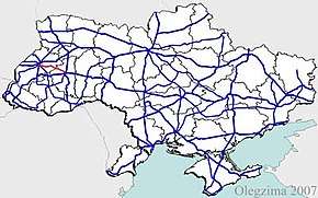
Highway H02 (Ukraine)
| ||||
|---|---|---|---|---|
| Автошлях H02 | ||||
 | ||||
| Route information | ||||
| Length: | 111.9 km (69.5 mi) | |||
| Major junctions | ||||
| east end: |
| |||
| west end: |
| |||
| Location | ||||
| Regions: | Lviv Oblast, Ternopil Oblast | |||
| Highway system | ||||
| ||||
H02 is a regional road (H-Highway) in Lviv Oblast and Ternopil Oblast, Ukraine. It runs west-east and connects Ternopil with Lviv.[1]
Main route
Main route and connections to/intersections with other highways in Ukraine.[2]
| Marker | Main settlements | Notes | Highway Interchanges |
|---|---|---|---|
| Ternopil Oblast | |||
| 0 km | Arboretum "Karpaty" | starts at "Berezhanska konyushyna" | |
| Chahari Kutkivetski Botanic Reserve | P41 | ||
| Zboriv | T2014 • T2013 | ||
| Lviv Oblast | |||
| Zolochiv • Yasenivtsi | T1413 | ||
| Yaktoriv | T1806 | ||
| Pidhaichyky • Kurovychi | T1417 | ||
| Kurovychi | T1425 | ||
| 111.9 km | Vynnyky | ||
See also
References
External links
- Regional Roads in Ukraine in Russian
Template:Roads in Ternopil Oblast
This article is issued from
Wikipedia.
The text is licensed under Creative Commons - Attribution - Sharealike.
Additional terms may apply for the media files.
