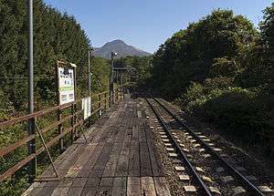
Higashiyama Station (Hokkaido)
Higashiyama Station 東山駅 | |
|---|---|
 The station platform in September 2014 | |
| Location |
Mori, Hokkaido Japan |
| Operated by |
|
| Line(s) | ■ Hakodate Main Line |
| Distance | 40.1 km from the starting point of the line at Hakodate |
| Platforms | 1 side platform |
| Tracks | 1 |
| Other information | |
| Status | Closed |
| Station code | H64 |
| History | |
| Opened | 1 August 1949 |
| Closed | 3 March 2017 |
| Location | |
 Higashiyama Station Location within Japan | |
Higashiyama Station (東山駅 Higashiyama-eki) was a railway station on the Hakodate Main Line in Mori, Hokkaido, Japan, operated by Hokkaido Railway Company (JR Hokkaido). Opened in 1949, it closed in March 2017.
Lines
Higashiyama Station was served by the Hakodate Main Line, and was situated 40.1 km from the starting point of the line at Hakodate.[1] The station was numbered "H64".
According to the timetable of March 2009, the station was served by four northbound and four southbound trains per day. Many other trains, including two northbound and one southbound local trains per day, pass through the station.[2]
History
The station began operation as Higashiyama Signal Box (東山信号場 Higashiyama Shingōjō) on February 26, 1943.[1] On August 1, 1949, it became Higashiyama Temporary Station (東山仮乗降場 Higashiyama Kari-jōkōjō). On April 1, 1987, with the privatization of Japanese National Railways (JNR), the station came under the control of JR Hokkaido, and was promoted to become a full station.[1]
Closure
The station closed following the last day of services on 3 March 2017.[3]
See also
References
- 1 2 3 Ishino, Tetsu, ed. (1998). 停車場変遷大辞典 国鉄・JR編 [Station Transition Directory - JNR/JR]. II. Japan: JTB. p. 807. ISBN 4-533-02980-9.
- ↑ JTB Timetable No. 998 (March 2009). Tokyo: JTB Corporation. pp. 654–667.
- ↑ 廃止の10無人駅 思い出の駅舎さようなら 住民ら幕掲げ感謝 [10 unstaffed stations close]. Doshin Web (in Japanese). Japan: The Hokkaido Shimbun Press. 4 March 2017. Archived from the original on 4 March 2017. Retrieved 4 March 2017.
| Wikimedia Commons has media related to Higashiyama Station (Hokkaido). |
Coordinates: 42°03′42″N 140°36′19″E / 42.06167°N 140.60528°E