Hejran Dust
| Hejran Dust هجران دوست | |
|---|---|
| village | |
|
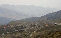
A view of the village (2012) | |
 Hejran Dust | |
| Coordinates: 38°52′43″N 46°57′26″E / 38.87861°N 46.95722°ECoordinates: 38°52′43″N 46°57′26″E / 38.87861°N 46.95722°E | |
| Country |
|
| Province | East Azerbaijan |
| County | Kaleybar |
| Bakhsh | Central |
| Rural District | Misheh Pareh |
| Population (2006) | |
| • Total | 196 |
| Time zone | IRST (UTC+3:30) |
| • Summer (DST) | IRDT (UTC+4:30) |

Hejran Dust (Persian: هجران دوست, also Romanized as Hejrān Dūst)[1] is a village in Misheh Pareh Rural District, in the Central District of Kaleybar County, East Azerbaijan Province, Iran. At the 2006 census, its population was 196, in 63 families.[2] In the mid 1950s, the population was 421 people, as reported by Army files.[3]
Hejran Dust was not on the unpaved road, which used by muleteers carrying goods between Kaleybar and surrounding villages. In this respect Aghaweye and Oskolou were well located to offer services. The paved Kaleybar--Oskolou road, completed in 2005, didn't bypass the village. The road boosted the village's importance as a location for building villas. The result is significant; a more recent statistic has reported the village population 311 people in 101 families.[4]
References
- ↑ Hejran Dust can be found at GEOnet Names Server, at this link, by opening the Advanced Search box, entering "-3776664" in the "Unique Feature Id" form, and clicking on "Search Database".
- ↑ "Census of the Islamic Republic of Iran, 1385 (2006)". Islamic Republic of Iran. Archived from the original (Excel) on 2011-11-11.
- ↑ http://www.loghatnaameh.org/dehkhodaworddetail-84492e1fbf434a8b92c936f70a7ee07a-fa.html
- ↑ "Archived copy" (PDF). Archived from the original (PDF) on 2013-12-11. Retrieved 2014-03-20.
