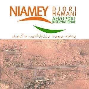
Diori Hamani International Airport
| Diori Hamani International Airport | |||||||||||||||
|---|---|---|---|---|---|---|---|---|---|---|---|---|---|---|---|
 | |||||||||||||||
| Summary | |||||||||||||||
| Airport type | Military/Public | ||||||||||||||
| Owner | Transports de Niamey | ||||||||||||||
| Operator | ASECNA | ||||||||||||||
| Serves | Niamey | ||||||||||||||
| Location | Niamey, Niger | ||||||||||||||
| Hub for | |||||||||||||||
| Elevation AMSL | 732 ft / 223 m | ||||||||||||||
| Coordinates | 13°28′54″N 002°10′13″E / 13.48167°N 2.17028°ECoordinates: 13°28′54″N 002°10′13″E / 13.48167°N 2.17028°E | ||||||||||||||
| Map | |||||||||||||||
 NIM Location within Niger | |||||||||||||||
| Runways | |||||||||||||||
| |||||||||||||||
| Statistics (2009) | |||||||||||||||
| |||||||||||||||
Diori Hamani International Airport (IATA: NIM, ICAO: DRRN) is an airport in Niamey, the capital of Niger.[3] It is located in the south eastern suburbs of the city, along the Route Nationale 1, the major highway linking Niamey with the east of the nation. The airport complex also includes the major base for the Armed Forces of Niger's "Armee d'Air".
Overview
In 2004, the airport served 97,814 passengers. The air traffic control for NIM is operated by the ASECNA, which bases one of its five air traffic zones for the continent at Niamey.[4] The airport is named after Hamani Diori, the first President of Niger.
In 2013, U.S. African Command spokesman Benjamin Benson confirmed that U.S. air operations conducted from Base Aerienne 101 at Diori Hamani International Airport, were providing "support for intelligence collection with French forces conducting operations in Mali and with other partners in the region."[5] In July 2013, the New York Times reported that the deployment had expanded from one Predator UAV to daily flights by a detachment of two larger MQ-9 Reaper remotely piloted aircraft, supported by 120 U.S. Air Force personnel.[6]
Airlines and destinations
Passenger
EAMAC
ASECNA operates the "African School for Meteorology and Civil Aviation/Ecole Africaine de la Météorologie et de l'Aviation Civile" at the Niamey airport complex, as well as in the Plateau quarter of Niamey city centre. Founded in 1963, EAMAC trains civil aviation professionals and aviation meteorologists from across Africa.[7][8]
See also
References
- ↑ Aeronautical chart
- ↑ List of the busiest airports in Africa
- ↑ "Attributions des départements de l'ANAC." Agence nationale de l'aviation civile du Niger. Retrieved on 3 June 2013.
- ↑ Visites du ministre des Transports et de l'Aviation Civile à l'aéroport international Diori Hamani de Niamey et au CNUT: s'enquérir des conditions de travail des agents. Seini Seydou Zakaria, le Sahel (Niamey) 18 June 2009
- ↑ Nick Turse, The U.S. Military's Pivot to Africa, The Nation, 5 September 2013.
- ↑ "Drones in Niger Reflect New U.S. Tack on Terrorism". The New York Times. 11 July 2013. Retrieved 28 October 2016.
- ↑ L'EAMAC. asecna.aero Accessed 18 June 2009
- ↑ L'EAMAC, c'est la Météorologie, l'Aviation Civile, l'Electronique et l'Informatique au service de la Sécurité de la Navigation Aérienne. Official website. Accessed 18 June 2009
External links
| Wikimedia Commons has media related to Diori Hamani International Airport. |
- Accident history for NIM at Aviation Safety Network
- Airport information for DRRN at Great Circle Mapper. Source: DAFIF (effective October 2006).
- Current weather for DRRN at NOAA/NWS
- Airport information for DRRN at World Aero Data. Data current as of October 2006.Source: DAFIF.
- ais-asecna.org Aeronautical charts for NIAMEY/Diori Hamani (DRRN).