Haby
| Haby | ||
|---|---|---|
| ||
 Haby | ||
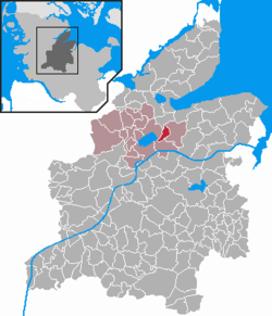
Location of Haby within Rendsburg-Eckernförde district  | ||
| Coordinates: 54°23′56″N 9°49′9″E / 54.39889°N 9.81917°ECoordinates: 54°23′56″N 9°49′9″E / 54.39889°N 9.81917°E | ||
| Country | Germany | |
| State | Schleswig-Holstein | |
| District | Rendsburg-Eckernförde | |
| Municipal assoc. | Hüttener Berge | |
| • Mayor | (SPD) | |
| Area | ||
| • Total | 5.79 km2 (2.24 sq mi) | |
| Elevation | 16 m (52 ft) | |
| Population (2015-12-31)[1] | ||
| • Total | 565 | |
| • Density | 98/km2 (250/sq mi) | |
| Time zone | CET/CEST (UTC+1/+2) | |
| Postal codes | 24361 | |
| Dialling codes | 04356 | |
| Vehicle registration | RD | |
| Website |
www.amt-huettener- berge.de | |
Haby is a municipality in the district of Rendsburg-Eckernförde, in Schleswig-Holstein, Germany.

At the southwestern end of the village of Haby the meadows are filled with fog some nights. This is where there was, until the middle of the last century, a big lake which was linked to the Wittensee. For a thousand years it was used by people living in this area as a fishing ground till the growing agricultural industry caused the lake to vanish. Haby was mentioned in records first 800 years ago. The ending "by" indicates Viking origins. Haby is the most southern location in Germany with the "by" ending. There is another village with an almost identical name in southern Sweden.
References
This article is issued from
Wikipedia.
The text is licensed under Creative Commons - Attribution - Sharealike.
Additional terms may apply for the media files.
