Gulmi District
| Gulmi Jilla | |
|---|---|
| District | |
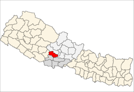 Location of Gulmi | |
| Country | Nepal |
| Region | Western (Pashchimanchal) |
| Zone | Lumbini |
| Headquarters | Tamghas |
| No. of VDC/s | 79 |
| Area | |
| • Total | 1,149 km2 (444 sq mi) |
| Population (2011) | |
| • Total | 280,160 |
| • Density | 240/km2 (630/sq mi) |
| Time zone | NPT (UTC+5:45) |
| Main language(s) | Nepali |
| Website | ddcgulmi.gov.np |
Gulmi District (Nepali: गुल्मी जिल्ला![]() Listen ), a part of Province No. 5, is one of the seventy-five districts of Nepal. The district, with Tamghas as its headquarters, covers an area of 1,149 km², had a population of 296,654 in 2001, 280,160 in 2011 and 268,597 in 2016.[1]
Listen ), a part of Province No. 5, is one of the seventy-five districts of Nepal. The district, with Tamghas as its headquarters, covers an area of 1,149 km², had a population of 296,654 in 2001, 280,160 in 2011 and 268,597 in 2016.[1]
Introduction
The Gulmi District is renowned for coffee farming. Ruru, now also known as Ridi, is a market center where many temples are situated. Maghe Sankranti and other festivals are celebrated here and are popular among both tourists and locals. Landmarks include Dhurkot's Bichitra Cave; Resunga, with its rich biodiversity and historic value; along with the religious and historical sites Gyawa Kshetra, Charpala, Musikot, Isma, Wami Taksar and Purtighat.
The district government offices are in Tamghas, a small town and the only municipality of Gulmi, situated at the bottom of two hills Resunga and Arjut. There are only 75 VDCs along with one Municipality: Resunga. Gulmi is rich with natural resources such as cobalt as well as naturally beautiful views that favour tourism.
Communications
There are total of 76 post offices in the district including 1 main district post office and 14 ilaka police offices. There are nine telecenters,[2] six FM radio stations, and eight cable TV networks. According to Nepal Telecom, there are 82,318 GSM mobile subscribers in the district as of 2015.
Geography and climate
| Climate Zone[3] | Elevation Range | % of Area |
|---|---|---|
| Upper Tropical | 300 to 1,000 meters 1,000 to 3,300 ft. |
23.5% |
| Subtropical | 1,000 to 2,000 meters 3,300 to 6,600 ft. |
71.9% |
| Temperate | 2,000 to 3,000 meters 6,400 to 9,800 ft. |
4.6% |
References
- ↑ "National Population and Housing Census 2011(National Report)" (PDF). Central Bureau of Statistics. Government of Nepal. November 2012. Retrieved November 2012. Check date values in:
|access-date=(help) - ↑ "Telecenters in Nepal". TechSansar. Retrieved October 18, 2015.
- ↑ The Map of Potential Vegetation of Nepal - a forestry/agroecological/biodiversity classification system (PDF), . Forest & Landscape Development and Environment Series 2-2005 and CFC-TIS Document Series No.110., 2005, ISBN 87-7903-210-9, retrieved Nov 22, 2013

Coordinates: 28°4′N 83°15′E / 28.067°N 83.250°E
| Wikimedia Commons has media related to Gulmi District. |