Gruting
| Gruting | |
|---|---|
 Gruting Methodist Church | |
 Gruting | |
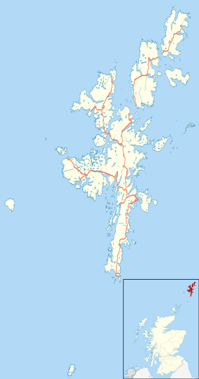
| Gruting shown within Shetland | |
| OS grid reference | HU278493 |
| Civil parish | |
| Council area | |
| Lieutenancy area | |
| Country | Scotland |
| Sovereign state | United Kingdom |
| Post town | SHETLAND |
| Postcode district | ZE2 |
| Dialling code | 01595 |
| Police | Scottish |
| Fire | Scottish |
| Ambulance | Scottish |
| EU Parliament | Scotland |
| UK Parliament | |
| Scottish Parliament | |
Gruting is a hamlet on the island of Mainland, Shetland in Scotland. It is about 1 kilometre (0.62 mi) southwest of the archaeological site of Stanydale Temple.
There is a late Neolithic site on the Ness of Grutling, where burnt barley has been found.[1] An area of about 3.3 hectares (8.2 acres) shows signs of neolithic agriculture and neolithic genocide, with about fifty piles of stones cleared from the fields.[2] The barley had a radiocarbon date of within 120 years of 1564 BC. Pottery found on the Ness of Gruting shows affinities with Neolithic wares from the Hebrides, indicating cultural contacts.[3] Split flakes of porphyry for skinning have been found.[4]
Gallery
 The head of Scutta Voe as seen from Gruting
 Loch of Gruting from start of path to Staneydale Temple
 Ayres of Selivoe Gruting Methodist Church is seen in the distance
References
Citations
- ↑ Piggott & Thirsk 1981, p. 52.
- ↑ Piggott & Thirsk 1981, p. 179.
- ↑ Ritchie & Ritchie 1991, p. 43.
- ↑ Ritchie & Ritchie 1991, p. 88.
Sources
- Piggott, Stuart; Thirsk, Joan (1981). The Agrarian History of England and Wales. CUP Archive. ISBN 978-0-521-08741-4. Retrieved 2013-02-05.
- Ritchie, James Neil Graham; Ritchie, Anna (1991). Scotland: Archaeology and Early History. Edinburgh University Press. ISBN 978-0-7486-0291-9. Retrieved 2013-02-05.
External links
| Wikimedia Commons has media related to Gruting. |
This article is issued from
Wikipedia.
The text is licensed under Creative Commons - Attribution - Sharealike.
Additional terms may apply for the media files.