Greve Municipality
| Greve Municipality Greve Kommune | |
|---|---|
| Municipality | |
|
| |
| Country | Denmark |
| Region | Region Zealand |
| Seat | Greve Strand |
| Government | |
| • Mayor | Pernille Beckmann (V) |
| Area | |
| • Total | 60.18 km2 (23.24 sq mi) |
| Population (1 January 1, 2012) | |
| • Total | 47,936 |
| • Density | 800/km2 (2,100/sq mi) |
| Time zone | CET (UTC+1) |
| • Summer (DST) | CEST (UTC+2) |
| Municipal code | 253 |
| Website | www.greve.dk |
Greve Municipality is a municipality (Danish, kommune) about 21 km south-west of Copenhagen in Region Sjælland on the east coast of the island of Zealand (Sjælland) in eastern Denmark. The municipality covers an area of 60 km², and has a total population of 47,773 (2008).
The site of its municipal council is the town of Greve Strand.
Greve Municipality was formed in 1970, as part of the kommunalreform ("Municipal Reform") of that year. It was established by combining the following parishes:
- Greve
- Hundige
- Karlslunde
- Karlslunde Strand
- Kildebrønde
- Mosede
- Tune.
Greve municipality was one of the municipalities that was not merged with any others on 1 January 2007 in the nationwide Kommunalreformen ("The Municipal Reform" of 2007).
History
Until the 1960s the area was primarily agricultural, and most businesses in town were concentrated along the coastal road "Strandvejen". With numerous holiday cottages near the coast of Køge Bugt (Køge Bay), this was also the destination for many inhabitants of Copenhagen on holiday away from the hustle and bustle of the city.
During the late 1960s and into the 1970s, many people moved permanently out of Copenhagen and into new homes in places like Greve. What was formerly farmers' fields quickly turned into districts of detached houses, whilst most of the shops and similar businesses near the coastal road moved into central shopping malls such as Hundige Storcenter and Greve Midtby Center. Around 1980 the S-train railroad network was expanded towards Køge, and the stations Greve and Hundige were placed adjacent to the shopping malls.
Today, it serves primarily as a residential municipality, functioning as a suburb for the larger Copenhagen area.
Images
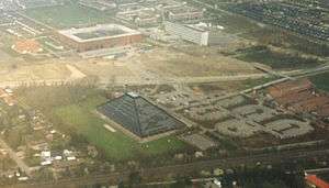
 Aerial photo of Hundige, an area of Greve Municipality.
 Aerial photo Greve Midtby, April 1999.
References
- Municipal statistics: NetBorger Kommunefakta, delivered from KMD aka Kommunedata (Municipal Data)
- Municipal mergers and neighbors: Eniro map with named municipalities
External links
| Wikimedia Commons has media related to Greve Kommune. |
- Official website
- Krak searchable/printable map (in Danish)
Coordinates: 55°35′02″N 12°17′43″E / 55.58389°N 12.29528°E
