Grange railway line
| Grange railway line | ||||||||||||||||||||||||||||||||||||||||||||||||||||||||||||||||||||||||||||||||||||||||||||||||||||||||||||||||||||||||||||||||||||||||||||||||||||||||||||||||||||||||||||||||||||||||||||||||||||||||||||||||||||||||||||||||||||||||||||||||||||||||||||||||||||||||||||||||||||||||||||||||||||||||||||||||||||||||||||||||||||||||||
|---|---|---|---|---|---|---|---|---|---|---|---|---|---|---|---|---|---|---|---|---|---|---|---|---|---|---|---|---|---|---|---|---|---|---|---|---|---|---|---|---|---|---|---|---|---|---|---|---|---|---|---|---|---|---|---|---|---|---|---|---|---|---|---|---|---|---|---|---|---|---|---|---|---|---|---|---|---|---|---|---|---|---|---|---|---|---|---|---|---|---|---|---|---|---|---|---|---|---|---|---|---|---|---|---|---|---|---|---|---|---|---|---|---|---|---|---|---|---|---|---|---|---|---|---|---|---|---|---|---|---|---|---|---|---|---|---|---|---|---|---|---|---|---|---|---|---|---|---|---|---|---|---|---|---|---|---|---|---|---|---|---|---|---|---|---|---|---|---|---|---|---|---|---|---|---|---|---|---|---|---|---|---|---|---|---|---|---|---|---|---|---|---|---|---|---|---|---|---|---|---|---|---|---|---|---|---|---|---|---|---|---|---|---|---|---|---|---|---|---|---|---|---|---|---|---|---|---|---|---|---|---|---|---|---|---|---|---|---|---|---|---|---|---|---|---|---|---|---|---|---|---|---|---|---|---|---|---|---|---|---|---|---|---|---|---|---|---|---|---|---|---|---|---|---|---|---|---|---|---|---|---|---|---|---|---|---|---|---|---|---|---|---|---|---|---|---|---|---|---|---|---|---|---|---|---|---|---|---|---|---|---|---|---|---|---|---|---|---|---|---|---|---|---|---|---|---|---|---|---|---|
.jpg) | ||||||||||||||||||||||||||||||||||||||||||||||||||||||||||||||||||||||||||||||||||||||||||||||||||||||||||||||||||||||||||||||||||||||||||||||||||||||||||||||||||||||||||||||||||||||||||||||||||||||||||||||||||||||||||||||||||||||||||||||||||||||||||||||||||||||||||||||||||||||||||||||||||||||||||||||||||||||||||||||||||||||||||
| Overview | ||||||||||||||||||||||||||||||||||||||||||||||||||||||||||||||||||||||||||||||||||||||||||||||||||||||||||||||||||||||||||||||||||||||||||||||||||||||||||||||||||||||||||||||||||||||||||||||||||||||||||||||||||||||||||||||||||||||||||||||||||||||||||||||||||||||||||||||||||||||||||||||||||||||||||||||||||||||||||||||||||||||||||
| Locale | Adelaide, South Australia | |||||||||||||||||||||||||||||||||||||||||||||||||||||||||||||||||||||||||||||||||||||||||||||||||||||||||||||||||||||||||||||||||||||||||||||||||||||||||||||||||||||||||||||||||||||||||||||||||||||||||||||||||||||||||||||||||||||||||||||||||||||||||||||||||||||||||||||||||||||||||||||||||||||||||||||||||||||||||||||||||||||||||
| Termini |
Adelaide Grange | |||||||||||||||||||||||||||||||||||||||||||||||||||||||||||||||||||||||||||||||||||||||||||||||||||||||||||||||||||||||||||||||||||||||||||||||||||||||||||||||||||||||||||||||||||||||||||||||||||||||||||||||||||||||||||||||||||||||||||||||||||||||||||||||||||||||||||||||||||||||||||||||||||||||||||||||||||||||||||||||||||||||||
| Stations | Woodville | |||||||||||||||||||||||||||||||||||||||||||||||||||||||||||||||||||||||||||||||||||||||||||||||||||||||||||||||||||||||||||||||||||||||||||||||||||||||||||||||||||||||||||||||||||||||||||||||||||||||||||||||||||||||||||||||||||||||||||||||||||||||||||||||||||||||||||||||||||||||||||||||||||||||||||||||||||||||||||||||||||||||||
| Services |
| |||||||||||||||||||||||||||||||||||||||||||||||||||||||||||||||||||||||||||||||||||||||||||||||||||||||||||||||||||||||||||||||||||||||||||||||||||||||||||||||||||||||||||||||||||||||||||||||||||||||||||||||||||||||||||||||||||||||||||||||||||||||||||||||||||||||||||||||||||||||||||||||||||||||||||||||||||||||||||||||||||||||||
| Operation | ||||||||||||||||||||||||||||||||||||||||||||||||||||||||||||||||||||||||||||||||||||||||||||||||||||||||||||||||||||||||||||||||||||||||||||||||||||||||||||||||||||||||||||||||||||||||||||||||||||||||||||||||||||||||||||||||||||||||||||||||||||||||||||||||||||||||||||||||||||||||||||||||||||||||||||||||||||||||||||||||||||||||||
| Opened | 1882 | |||||||||||||||||||||||||||||||||||||||||||||||||||||||||||||||||||||||||||||||||||||||||||||||||||||||||||||||||||||||||||||||||||||||||||||||||||||||||||||||||||||||||||||||||||||||||||||||||||||||||||||||||||||||||||||||||||||||||||||||||||||||||||||||||||||||||||||||||||||||||||||||||||||||||||||||||||||||||||||||||||||||||
| Rolling stock | ||||||||||||||||||||||||||||||||||||||||||||||||||||||||||||||||||||||||||||||||||||||||||||||||||||||||||||||||||||||||||||||||||||||||||||||||||||||||||||||||||||||||||||||||||||||||||||||||||||||||||||||||||||||||||||||||||||||||||||||||||||||||||||||||||||||||||||||||||||||||||||||||||||||||||||||||||||||||||||||||||||||||||
| Events | ||||||||||||||||||||||||||||||||||||||||||||||||||||||||||||||||||||||||||||||||||||||||||||||||||||||||||||||||||||||||||||||||||||||||||||||||||||||||||||||||||||||||||||||||||||||||||||||||||||||||||||||||||||||||||||||||||||||||||||||||||||||||||||||||||||||||||||||||||||||||||||||||||||||||||||||||||||||||||||||||||||||||||
| Re-sleepered (concrete) | 2010 | |||||||||||||||||||||||||||||||||||||||||||||||||||||||||||||||||||||||||||||||||||||||||||||||||||||||||||||||||||||||||||||||||||||||||||||||||||||||||||||||||||||||||||||||||||||||||||||||||||||||||||||||||||||||||||||||||||||||||||||||||||||||||||||||||||||||||||||||||||||||||||||||||||||||||||||||||||||||||||||||||||||||||
| Technical | ||||||||||||||||||||||||||||||||||||||||||||||||||||||||||||||||||||||||||||||||||||||||||||||||||||||||||||||||||||||||||||||||||||||||||||||||||||||||||||||||||||||||||||||||||||||||||||||||||||||||||||||||||||||||||||||||||||||||||||||||||||||||||||||||||||||||||||||||||||||||||||||||||||||||||||||||||||||||||||||||||||||||||
| Line length | 13.0 km (8.1 mi) | |||||||||||||||||||||||||||||||||||||||||||||||||||||||||||||||||||||||||||||||||||||||||||||||||||||||||||||||||||||||||||||||||||||||||||||||||||||||||||||||||||||||||||||||||||||||||||||||||||||||||||||||||||||||||||||||||||||||||||||||||||||||||||||||||||||||||||||||||||||||||||||||||||||||||||||||||||||||||||||||||||||||||
| Number of tracks |
Double track to Woodville Single track to Grange | |||||||||||||||||||||||||||||||||||||||||||||||||||||||||||||||||||||||||||||||||||||||||||||||||||||||||||||||||||||||||||||||||||||||||||||||||||||||||||||||||||||||||||||||||||||||||||||||||||||||||||||||||||||||||||||||||||||||||||||||||||||||||||||||||||||||||||||||||||||||||||||||||||||||||||||||||||||||||||||||||||||||||
| Track gauge | 1,600 mm (5 ft 3 in) | |||||||||||||||||||||||||||||||||||||||||||||||||||||||||||||||||||||||||||||||||||||||||||||||||||||||||||||||||||||||||||||||||||||||||||||||||||||||||||||||||||||||||||||||||||||||||||||||||||||||||||||||||||||||||||||||||||||||||||||||||||||||||||||||||||||||||||||||||||||||||||||||||||||||||||||||||||||||||||||||||||||||||
| ||||||||||||||||||||||||||||||||||||||||||||||||||||||||||||||||||||||||||||||||||||||||||||||||||||||||||||||||||||||||||||||||||||||||||||||||||||||||||||||||||||||||||||||||||||||||||||||||||||||||||||||||||||||||||||||||||||||||||||||||||||||||||||||||||||||||||||||||||||||||||||||||||||||||||||||||||||||||||||||||||||||||||
The Grange railway line is a suburban branch line in Adelaide, South Australia.
History
The railway line between Woodville and Grange opened in September 1882. This was a private railway, constructed by the Grange Railway and Investment Company. The early railway was not a financial success and was bought out by the South Australian Railways in 1893.[1]
Modifications to the track layout at Woodville station in 1909 enabled trains from the Grange branch to travel beyond Woodville to Adelaide.[1]
In November 1940, the Hendon branch line was opened diverging from the Grange line at Albert Park and running 1.1 kilometres to the Hendon munitions works. After the end of World War II, the Hendon trains operated only at shift-change times. In spite of low passenger numbers, the Hendon branch continued operation until 1 February 1980, after which the line was closed and removed.[1]
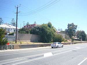
The terminus at Grange was relocated in the late 1980s on the eastern side of Military Road to eliminate a level crossing. The old station was formerly a stop on the Henley Beach line, an extension of the Grange line which closed in 1957.
A station named Holdens, located between Woodville and Albert Park stations adjacent to what is now the SA Manufacturing Park, was closed in 1992 and subsequently demolished.
During 2–23 January 2017, the line was closed with the Outer Harbor line for the building of an overpass over Main South Road. During this time, tracks between Woodville station and Port Road were replaced, and Albert Park station was rebuilt.[2] Both lines were closed again along with a portion of the Gawler line in April, June, and July of the same year to work on the Torrens Rail Junction Project[3][4][5]; The July closing was controversial with younger patrons because of AVCon happening in the same weekend.
Route
The line runs from the Adelaide to the seaside suburb of Grange. The route follows the same alignment as the Outer HarborlLine as far as Woodville station, where it diverges south west and across Port Road. The route then travels through Albert Park and bisects the Royal Adelaide Golf Club between Seaton Park and East Grange stations.
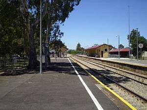
The line is single track from Woodville to Grange with no passing loops over its entire length. All stations on the line are unattended and have only very basic passenger waiting facilities. The line is 5.5 kilometres long and broad gauge (1600mm).
Services
Services operate in tandem with Outer Harbor line trains. Weekday off-peak services run every 30 minutes, Weekday peak services run every 20–30 minutes with hourly services on weekends.[6]
Once every two years services are temporarily cut back to Seaton Park for approximately two weeks for the running of the Jacob's Creek Open golf tournament. Rail replacement buses are used to transport passengers for the remainder of the route.
Until 1996, Grange line services previously operated as a shuttle from Woodville station at night and on weekends, connecting with Outer Harbor line services.
The vast majority of services are operated by 3000 class railcars. 2000 class railcars have not operated on the line since 2006.
Future
The South Australian Government is considering electrifying the Outer Harbor line or converting it to light rail. A light rail conversion would also require the conversion or closure of the Grange line. A 2016 report into potential light rail projects in Adelaide considered four options for the future of the Grange line. The first option would electrify the heavy rail line but make no other changes, the second would convert the line to light rail and add a new on-street branch from Albert Park station to West Lakes, the third would retain the West Lakes route but replace the remaining section of the railway line with light rail along Grange Road and the final option would see the West Lakes line branch from the Grange Road light rail - completely replacing the railway line.[7]
Gallery
 The old Grange station remnants in 2008. A fence has since been installed on the platform.

References
- 1 2 3 Rails Through Swamp and Sand – A History of the Port Adelaide Railway. M. Thompson pub. Port Dock Station Railway Museum (1988) ISBN 0-9595073-6-1.
- ↑ Major works kick off to remove one of Adelaide’s worst level crossings Premier of South Australia
- ↑ Outer Harbor, Grange and Gawler rail line closures
- ↑ Outer Harbor, Grange and Gawler train lines temporary closures June long weekend
- ↑ Outer Harbor, Grange and Gawler line July closure
- ↑ Outer Harbor & Grange timetable Adelaide Metro 23 February 2014
- ↑ "AdeLINK Multi-Criteria Analysis Summary Report" (PDF). Department of Transport, Planning and Infrastructure. 2016. pp. 11–13.
External links
- Route map SA Track & Signal