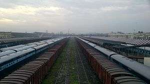
Gorakhpur Junction railway station
Gorakhpur Junction गोरखपुर जंक्शन | |
|---|---|
| Regional rail and Light rail station | |
 Gorakhpur Railway Station | |
| Location |
Station Road, Gorakhpur, Uttar Pradesh India |
| Coordinates | 26°45′35″N 83°22′54″E / 26.7598°N 83.3818°ECoordinates: 26°45′35″N 83°22′54″E / 26.7598°N 83.3818°E |
| Elevation | 84 metres (276 ft) |
| Owned by | Indian Railways |
| Operated by | North Eastern Railway, Lucknow NER Railway Division |
| Line(s) |
Barauni–Gorakhpur, Raxaul and Jainagar lines Muzaffarpur- Gorakhpur line (via Hajipur, Raxaul and Sitamarhi) Muzaffarpur-Gorakhpur main line Gorakhpur-Lucknow Kanpur Delhi main line Gorakhpur-Nautanwa-Barhni line |
| Platforms | 10 |
| Tracks | 26 |
| Construction | |
| Structure type | Standard on ground |
| Parking | Available |
| Bicycle facilities | Available |
| Other information | |
| Status | Functioning |
| Station code | GKP |
| Zone(s) | North Eastern Railway |
| Division(s) | Lucknow NER Railway Division, Varanasi Division & Izzatnagar Division |
| History | |
| Opened | 1890 |
| Electrified | Yes |
| Traffic | |
| Passengers | 365000 |
| Location | |
 Gorakhpur Junction Location within Uttar Pradesh | |
The North east Gorakhpur Railway Station is located in the city of Gorakhpur in the Indian state of Uttar Pradesh. It serves as the headquarters of the North Eastern Railway. The station offers Class A railway station facilities. On 6 October 2013, Gorakhpur became the world's longest railway platform, after inauguration of the remodelled Gorakhpur Yard, with a stretch of around 1.34 kilometres (0.84 mi).
The Gorakhpur city area is served by 10 local railway stations other than Gorakhpur Junction, namely, Gorakhpur cantt, Domingarh, Sahjanwa, Sihapar, Maniram, Nakaha jungle, Kushmi, Jagatbela, and Unaula.
History
The 135-mile (217 km) metre-gauge Gonda loop, running between Gorakhpur and Gonda, was constructed by the Bengal and North Western Railway between 1886 and 1905. The 79-mile (127 km) Kaptanganj–Siwan metre-gauge line was opened in 1913. The 25-mile (40 km) metre-gauge Nautanwa branch line was opened in 1925.[1]
Conversion to broad gauge started with the Gorakhpur–Siwan section in 1981. The Gorakhpur–Paniyahwa section was converted in 1991.[2] The Gorakhpur–Gonda loop was converted around 1985, and the Nautanwa branch line at about the same time. The Kaptanganj–Siwan line was converted around 2006.[3] Now Gorakhpur would have three new platforms.[4] At present, Gorakhpur has the world's longest platform. [5]
Passenger movement
Gorakhpur is amongst the top hundred booking stations of Indian Railways.[6] It handles over 189 trains daily.[7] This is the route which connects Bihar to Delhi, the other route which connect is Banaras route. Some of the other railway stations in Uttar Pradesh handling large numbers of passengers are Kanpur Central,[8] Varanasi Junction,[9] Mathura Junction[10] and Mughalsarai.[11]
See also
- Gorakhpur
- Sapt Kranti Express
- Yogi Adityanath
- Gorakhpur Cantonment railway station
- Domingarh railway station
- Maheshwar Pandey
References
- ↑ "Indian Railways line history; 2. North Eastern Railway" (PDF). Retrieved 2012-11-06.
- ↑ "Varanasi Division at a Glance". North Eastern Railway. Archived from the original on 9 January 2014. Retrieved 10 July 2013.
- ↑ "Gorakhpur gets world's largest railway platform". The Times of India, 7 October 2013. Retrieved 7 October 2013.
- ↑ "Gorakhpur railway station's remodelling in final stage". The Times of India, 2 June 2013. Retrieved 21 June 2013.
- ↑ Dinda, Archisman (9 October 2013). "Uttar Pradesh gets world’s longest railway platform". GulfNews.com. Retrieved 9 October 2013.
- ↑ "Indian Railways Passenger Reservation Enquiry". Availability in trains for Top 100 Booking Stations of Indian Railways. IRFCA. Archived from the original on 10 May 2014. Retrieved 21 June 2013.
- ↑ "Gorkhpur Jn (GKP)". India Rail Enquiry. Retrieved 9 July 2013.
- ↑ "Kanpur Central (CNB)". Indian Rail Enquiry. Retrieved 9 July 2013.
- ↑ "Varanasi Jn (BSB)". Indian Rail Enquiry.
- ↑ "Mathura". Indian Rail Enquiry. Retrieved 9 July 2013.
- ↑ "Mughalsarai Jn Railway Station (MGS)". Indian Rail Enquiry. Retrieved 19 June 2013.
It's model was constructed by sir Bhoopati prasad mishra