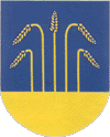
Gmina Sypniewo
| Gmina Sypniewo Sypniewo Commune | ||
|---|---|---|
| Gmina | ||
| ||
 Gmina Sypniewo Location within Poland | ||
| Coordinates (Sypniewo): 53°1′N 21°19′E / 53.017°N 21.317°ECoordinates: 53°1′N 21°19′E / 53.017°N 21.317°E | ||
| Country |
| |
| Voivodeship | Masovian | |
| County | Maków | |
| Seat | Sypniewo | |
| Area | ||
| • Total | 128.58 km2 (49.65 sq mi) | |
| Population (2011)[1] | ||
| • Total | 3,479 | |
| • Density | 27/km2 (70/sq mi) | |
| Website |
www | |
Gmina Sypniewo is a rural gmina (administrative district) in Maków County, Masovian Voivodeship, in east-central Poland. Its seat is the village of Sypniewo, which lies approximately 21 kilometres (13 mi) north-east of Maków Mazowiecki and 89 km (55 mi) north-east of Warsaw.
The gmina covers an area of 128.58 square kilometres (49.6 sq mi), and as of 2006 its total population is 3,528 (3,479 in 2011).
Villages
Gmina Sypniewo contains the villages and settlements of Batogowo, Biedrzyce-Koziegłowy, Biedrzyce-Stara Wieś, Boruty, Chełchy, Chojnowo, Dylewo, Gąsewo Poduchowne, Glącka, Glinki-Rafały, Jarzyły, Majki-Tykiewki, Mamino, Nowe Gąsewo, Nowy Szczeglin, Olki, Poświętne, Rawy, Rzechówek, Rzechowo Wielkie, Rzechowo-Gać, Sławkowo, Stare Glinki, Strzemieczne-Sędki, Sypniewo, Szczeglin Poduchowny, Zalesie, Zamość and Ziemaki.
Neighbouring gminas
Gmina Sypniewo is bordered by the gminas of Czerwonka, Krasnosielc, Młynarze, Olszewo-Borki and Płoniawy-Bramura.

