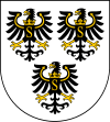
Gmina Banie Mazurskie
| Gmina Banie Mazurskie Banie Mazurskie Commune | |
|---|---|
| Gmina | |
| Coordinates (Banie Mazurskie): 54°14′18″N 22°2′21″E / 54.23833°N 22.03917°ECoordinates: 54°14′18″N 22°2′21″E / 54.23833°N 22.03917°E | |
| Country |
|
| Voivodeship | Warmian-Masurian |
| County | Gołdap |
| Seat | Banie Mazurskie |
| Area | |
| • Total | 205.02 km2 (79.16 sq mi) |
| Population (2006) | |
| • Total | 3,920 |
| • Density | 19/km2 (50/sq mi) |
Gmina Banie Mazurskie is a rural gmina (administrative district) in Gołdap County, Warmian-Masurian Voivodeship, in northern Poland, on the border with Russia. Its seat is the village of Banie Mazurskie, which lies approximately 20 kilometres (12 mi) south-west of Gołdap and 113 km (70 mi) north-east of the regional capital Olsztyn.
The gmina covers an area of 205.02 square kilometres (79.2 sq mi), and as of 2006 its total population is 3,920.
Villages
Gmina Banie Mazurskie contains the villages and settlements of:
- Antomieszki
- Audyniszki
- Banie Mazurskie
- Borek
- Brożajcie
- Budziska
- Czupowo
- Dąbrówka Polska
- Dąbrówka Polska-Osada
- Grodzisko
- Grunajki
- Gryżewo
- Jagiele
- Jagoczany
- Jeglewo
- Kiermuszyny Wielkie
- Kierzki
- Klewiny
- Kruki
- Kulsze
- Liski
- Lisy
- Maciejowa Wola
- Miczuły
- Mieczkówka
- Mieczniki
- Mieduniszki Małe
- Mieduniszki Wielkie
- Nowiny
- Obszarniki
- Radkiejmy
- Rapa
- Rogale
- Różanka-Dwór
- Sapałówka
- Ściborki
- Skaliszkiejmy
- Śluza
- Stadnica
- Stare Gajdzie
- Stary Żabin
- Surminy
- Szarek
- Ustronie
- Węgorapa
- Widgiry
- Wólka
- Wróbel
- Żabin
- Żabin Graniczny
- Żabin Rybacki
- Zakałcze Wielkie
- Zapały
- Zawady
- Ziemianki
- Ziemiany
Neighbouring gminas
Gmina Banie Mazurskie is bordered by the gminas of Budry, Gołdap, Kowale Oleckie, Kruklanki and Pozezdrze. It also borders Russia (Kaliningrad oblast).
References
This article is issued from
Wikipedia.
The text is licensed under Creative Commons - Attribution - Sharealike.
Additional terms may apply for the media files.
