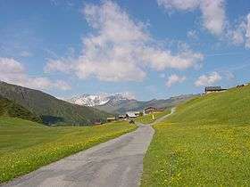
Glas Pass
| Glas Pass | |
|---|---|
|
The summit, view towards the west | |
| Elevation | 1,846 m (6,056 ft)[1] |
| Traversed by | Trail (dead-end road) |
| Location | Graubünden, Switzerland |
| Range | Lepontine Alps |
| Coordinates | 46°40′39″N 09°20′53″E / 46.67750°N 9.34806°ECoordinates: 46°40′39″N 09°20′53″E / 46.67750°N 9.34806°E |
 Location in Switzerland | |
The Glas Pass (German: Glaspass; el. 1846 m) is a high mountain pass in the Lepontine Alps, located between the valleys of Safiental and Domleschg in central Graubünden. It is the deepest point on the ridge between the Lüschgrat (key col: 332 m) and Piz Beverin. The pass is overlooked by the Glaser Grat (north) and the Hoch Büel (south).
The Glas Pass is crossed by a small paved road, although it goes no further than Inner Glas (1,819 m), less than two kilometres west of the pass. The Glas Pass is connected from Thusis on the east side, via Tschappina. On the west side, a trail connects Inner Glas with Safien-Platz (1,315 m). The area is served by PostBus Switzerland during the summer season.
See also
References
External links
![]() Media related to Glaspass at Wikimedia Commons
Media related to Glaspass at Wikimedia Commons
- The Inn on the Glas Pass MySwitzerland.com
This article is issued from
Wikipedia.
The text is licensed under Creative Commons - Attribution - Sharealike.
Additional terms may apply for the media files.
