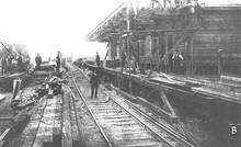
Gatley railway station
| Gatley | |
|---|---|
|
Gatley station | |
| Location | |
| Place | Gatley |
| Local authority | Stockport |
| Grid reference | SJ847886 |
| Operations | |
| Station code | GTY |
| Managed by | Northern |
| Number of platforms | 2 |
| DfT category | E |
|
Live arrivals/departures, station information and onward connections from National Rail Enquiries | |
| Annual rail passenger usage* | |
| 2011/12 |
|
| 2012/13 |
|
| 2013/14 |
|
| 2014/15 |
|
| 2015/16 |
|
| Passenger Transport Executive | |
| PTE | Greater Manchester |
| History | |
| 1909 | Opened |
| National Rail – UK railway stations | |
| * Annual estimated passenger usage based on sales of tickets in stated financial year(s) which end or originate at Gatley from Office of Rail and Road statistics. Methodology may vary year on year. | |
|
| |
Gatley railway station is on the Styal Line between Slade Lane Junction in Longsight, Manchester and Wilmslow, Cheshire. Opened by the London & North Western Railway in 1909, it was known as Gatley for Cheadle before being renamed Gatley on 6 May 1974.[1] It serves Gatley, a commuter suburb in Stockport, Greater Manchester. The station is operated by Northern with services from Manchester Piccadilly to Manchester Airport and Crewe via Wilmslow stopping here.[2] Some peak TransPennine Express services to and from Manchester Airport also stop at Gatley.

The station is on the A560 Gatley Road and has a car park. The ticket office and waiting room, on the Manchester-bound platform, are only open in the morning.
The station re-opened on 28 January 2007 after reconstruction of the platforms and work to replace the ramp access to them. 2010 saw the installation of electronic train service information screens on each platform.
References
- ↑ Slater, J.N., ed. (July 1974). "Notes and News: Stations renamed by LMR". Railway Magazine. London: IPC Transport Press Ltd. 120 (879): 363. ISSN 0033-8923.
- ↑ GB eNRT 2015-16 Edition, Table 85
Further reading
- Mitchell, Vic; Smith, Keith (2014). Crewe to Manchester. Middleton Press. figs. 52-54. ISBN 9781908174574. OCLC 892047119.
External links
| Wikimedia Commons has media related to Gatley railway station. |
- Train times and station information for Gatley railway station from National Rail
| Preceding station | |
Following station | ||
|---|---|---|---|---|
| Heald Green | TransPennine Express South TransPennine |
East Didsbury | ||
| Heald Green | Northern Styal Line |
East Didsbury | ||
Coordinates: 53°23′34″N 2°13′51″W / 53.392907°N 2.230836°W
