Gates of the Arctic Wilderness
| Gates of the Arctic Wilderness | |
|---|---|
|
IUCN category Ib (wilderness area) | |
|
| |
 | |
| Location | Gates of the Arctic National Park and Preserve, Alaska, United States |
| Coordinates | 68°06′N 153°04′W / 68.100°N 153.067°WCoordinates: 68°06′N 153°04′W / 68.100°N 153.067°W |
| Area | 7,245,600 acres (29,322 km2) |
| Established | 1980 |
| Governing body | National Park Service |
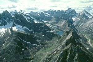
Gates of the Arctic Wilderness is a wilderness area in the U.S. state of Alaska. Located in the Gates of the Arctic National Park and Preserve, it is 7,245,600-acre (2,932,200 ha) in area, the third-largest designated wilderness area in the United States (after the Wrangell-Saint Elias Wilderness and the Mollie Beattie Wilderness, both also in Alaska).
When the wilderness activist, Bob Marshall, for whom Bob Marshall Wilderness in Western Montana is named explored the region in the early 1930s he bestowed the name "The Gates of the Arctic" on a pair of mountains near the head of the North Fork of the Koyukuk River (Boreal Mountain and Frigid Crags).
The wilderness is home to many animals, including grizzly bears, moose, wolves, Dall sheep, black bears, and many smaller mammals. Barren-ground caribou congregate in large herds. The rivers contain a variety of fish species, including the grayling, Arctic char and chum salmon. Eagles and other birds of prey can be seen soaring overhead waiting for unsuspecting prey.
The wilderness contains many remote glacier-carved valleys, dotted with alpine lakes. While no established trails exist, backpacking is a popular activity in the area. Some hikers carry firearms or pepper spray for protection from bears, but such attacks rarely occur. Climbers enjoy the Arrigetch Peaks and Mount Igikpak. Although camping is unrestricted, wood is scarce and campfires are discouraged.
The wilderness encompasses six designated Wild Rivers, the Alatna River, John River, Kobuk River, the North Fork of the Koyukuk River, part of the Noatak River and the remote and seldom visited Tinayguk River.

External links
- Wilderness.net Gates of the Arctic Wilderness at Wilderness.net
- ProtectedPlanet.net Gates of the Arctic Wilderness at Protected Planet
