Fort Gibson Dam
| Fort Gibson Dam |
|---|
|
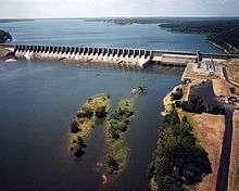
Fort Gibson dam seen from above |
|
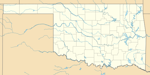
Location of Fort Gibson Dam in Oklahoma |
| Country |
United States |
|---|
| Location |
Wagoner / Cherokee counties near Fort Gibson and Okay, Oklahoma, US |
|---|
| Coordinates |
35°52′11″N 95°13′50″W / 35.869665°N 95.230436°W / 35.869665; -95.230436Coordinates: 35°52′11″N 95°13′50″W / 35.869665°N 95.230436°W / 35.869665; -95.230436 |
|---|
| Status |
In Use |
|---|
| Construction began |
1941 |
|---|
| Opening date |
1949 |
|---|
| Construction cost |
$22,000,000 |
|---|
| Owner(s) |
U.S. Army Corps of Engineers |
|---|
| Dam and spillways |
|---|
| Type of dam |
Concrete Gravity |
|---|
| Impounds |
Neosho River |
|---|
| Height |
110 ft (34 m) |
|---|
| Length |
2,850 ft (869 m) |
|---|
| Spillways |
30 |
|---|
| Spillway type |
Tainter gate |
|---|
| Spillway capacity |
986,000 cu ft (27,920 m3) |
|---|
| Reservoir |
|---|
| Creates |
Fort Gibson Lake |
|---|
| Total capacity |
1,292,000 acre·ft (2 km3) |
|---|
| Active capacity |
1,287,000 acre·ft (2 km3) |
|---|
| Catchment area |
12,615 sq mi (32,673 km2) |
|---|
| Power station |
|---|
| Commission date |
1953 |
|---|
| Turbines |
4 x 11.25 MW[1] Francis-type[2] |
|---|
| Installed capacity |
48 MW[3] |
|---|
| Annual generation |
208,482,000 KWh |
|---|
The Fort Gibson Dam is a gravity dam on the Grand (Neosho) River in Oklahoma, 5.4 mi (9 km) north of Fort Gibson. The purpose of the dam is flood control and hydroelectric power production. It was authorized by the Flood Control Act of 1941 and construction began the next year. During World War II construction was suspended and it recommenced in May 1946. In June 1949, the river was closed and the entire project was complete in September 1953 with the operation of the last of the power plant's four generators.[4] The dam and power rights originally belonged to the Grand River Dam Authority but were seized by the U.S. Army Corps of Engineers in 1946.[5]
Salient features
Dam
| Dam |
| Type | Concrete gravity |
| Average Height | 90 ft (27 m) |
| Crest length | 2,850 ft (869 m) |
| Concrete | 461,300 cu yd (352,689 m3) |
| Reinforcing steel | 2,655,000 lb (1,204,288 kg) |
| Miscellaneous metal works and castings | 300,000 lb (136,078 kg) |
| Tainter gates | 3,120,000 lb (1,415,208 kg) |
| Tainter gate anchorages | 901,000 lb (408,687 kg) |
| Emergency gate guides | 160,000 lb (72,575 kg) |
| Dikes |
|---|
| Number | 3 |
| Type | Rolled earth filled topped by surfaced service roadway |
| Height | 18 ft (5 m) (max) |
| Length (Total all dikes) | 8,500 ft (2,591 m) |
| Width (At top) | 16 ft (5 m) |
|
| Elevations (above sea level) |
|---|
| Top of dam | 593 ft (181 m) |
| Top of gates | 582 ft (177 m) |
| Spillway crest | 547 ft (167 m) |
| Top of power pool | 554 ft (169 m) |
| Flood control pool | 582 ft (177 m) |
|
Spillway
| Spillway |
|---|
| Type | Gate-controlled concrete gravity ogee-weir with stilling basin |
| Gates | 30 (40 feet by 35 feet tainter) |
| Length | 1,490 ft (454 m) |
| Capacity - Pool at top of gates | 915,000 cu ft/s (25,910 m3/s) |
| Capacity - Maximum pool | 915,000 cu ft/s (25,910 m3/s) |
| Capacity - Power pool | 69,000 cu ft/s (1,954 m3/s) |
|
Outlet works
| Outlet works |
|---|
| Number of sluices | 10 |
| Size of sluices | 5 feet 8 inches by 7 feet |
| Capacity - Pool at top of gates | 20,800 cu ft/s (589 m3/s) |
| Capacity - Power pool | 16,500 cu ft/s (467 m3/s) |
| Capacity - Pool at WEIR crest | 15,300 cu ft/s (433 m3/s) |
|
Reservoir
| Reservoir Capacities |
|---|
| Pool - at top of gates | 1,287,000 acre feet (1.587×10⁹ m3) |
| Pool- at maximum stage | 1,292,000 acre feet (1.594×10⁹ m3) |
| Top of power pool | 365,000 acre feet (450,000,000 m3) |
| Drainage area | 12,615 sq mi (32,673 km2) |
|
Contractors
First Contract: Al Johnson construction co. Winston brothers co. peter kiewit sons co. 608 Foshay Tower. Minneapolis, Minnesota
Second Contract: W. R. Grimshaw company. - Tulsa, Oklahoma
References

