Fontainhas
| Fontainhas | |
|---|---|
|
Village of Fontainhas with a piece of the Atlantic on top right | |
 | |
| Coordinates: 17°11′17″N 25°06′14″W / 17.188°N 25.104°WCoordinates: 17°11′17″N 25°06′14″W / 17.188°N 25.104°W | |
| Country | Cape Verde |
| Island | Santo Antão |
| Municipality | Ribeira Grande |
| Civil parish | Nossa Senhora do Livramento |
| Population (2010)[1] | |
| • Total | 282 |
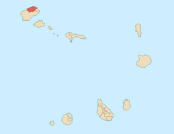
Fontainhas is a settlement in the northern part of the island of Santo Antão, Cape Verde. It is situated near the rocky north coast of the island, 2 km southwest of Ponta do Sol and 19 km north of the island capital Porto Novo. The settlement includes the smaller villages Corvo and Forminguinhas, about 1 km west of Fontainhas proper, while Fontainhas it is connected by the road that starts at Lagedo Largo and finishes at Ponta do Sol, the remainder are connected on foot. It also has a beach named Aranhas located next to Cruzinha.

Other nearby place include Cruzinha in the west.

Much of the areas are treacherous and features cliffs and canyons. It features smaller streams that empty into the sea in hundreds of meters.
Agriculture is its main industry
Settlements and sections
- Aranhas - west
- Aranhas de Cima
- Corvo
- Fontainhas
- Formiguinhas
- Ladeira
- Lombo
- Lombinho de Mar
- Mane Corre
- Selada
- Zurinca (or Ourinca) - west
See also
References
- ↑ "2010 Census results". Instituto Nacional de Estatística Cabo Verde (in Portuguese). 17 March 2014.
External links
| Wikimedia Commons has media related to Fontainhas, Santo Antão. |
- Photos of Fontainhas at ecaboverde.com - eleven photos (as of December 2006), available in several languages including English, French and Portuguese
- Biblioteca Nacional Digital - Plano hydrographico do porto da Ponta do Sol, Lisboa, 1900 (partial) (in Portuguese)


