Finland, Minnesota
| Finland, Minnesota | |
|---|---|
| Census-designated place (CDP) and Unincorporated community | |
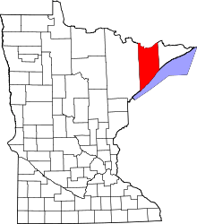
 Finland, Minnesota Location of the community of Finland | |
| Coordinates: 47°24′53″N 91°14′57″W / 47.41472°N 91.24917°WCoordinates: 47°24′53″N 91°14′57″W / 47.41472°N 91.24917°W | |
| Country | United States |
| State | Minnesota |
| County | Lake |
| Area[1] | |
| • Total | 5.422 sq mi (14.04 km2) |
| • Land | 5.400 sq mi (13.99 km2) |
| • Water | 0.022 sq mi (0.06 km2) |
| Elevation | 1,329 ft (405 m) |
| Population (2010)[2] | |
| • Total | 195 |
| • Density | 36/sq mi (14/km2) |
| Time zone | Central (CST) (UTC-6) |
| • Summer (DST) | CDT (UTC-5) |
| ZIP code | 55603 |
| Area code(s) | 218 |
| GNIS feature ID | 656231[3] |
Finland is an unincorporated community and census-designated place (CDP) in Crystal Bay Township, Lake County, Minnesota, United States. As of the 2010 census, its population was 195.[2]
The community is located north of Silver Bay on Minnesota State Highway 1.
Geography
The community of Finland is located 6 miles inland from Lake Superior's North Shore; and 39 miles northeast of the city of Two Harbors.
State Highway 1, County Road 6, and County Road 7 are three of the main routes in the community.
The Baptism River flows through the community. George H. Crosby Manitou State Park is located 7 miles northeast of Finland.
The community is located within the Finland State Forest in Lake County.
History
A post office called Finland has been in operation since 1915[4] and a cooperative general store was established in 1913, which is Minnesota's longest continuously operated store. A large share of the early settlers being natives of Finland caused the name to be selected.[5]
The Lutheran church was apparently struck by lightning on 6 July, 2013 and burned down.[6]
References
- ↑ "US Gazetteer files: 2010, 2000, and 1990". United States Census Bureau. 2011-02-12. Retrieved 2011-04-23.
- 1 2 "American FactFinder". United States Census Bureau. Archived from the original on 2013-09-11. Retrieved 2011-05-14.
- ↑ "Finland, Minnesota". Geographic Names Information System. United States Geological Survey.
- ↑ "Lake County". Jim Forte Postal History. Retrieved 17 July 2015.
- ↑ Warren Upham (1920). Minnesota Geographic Names: Their Origin and Historic Significance. Minnesota Historical Society. p. 294.
- ↑ http://www.startribune.com/local/214584451.html
