Făgăraș
| Făgăraș | ||
|---|---|---|
| Municipality | ||
|
| ||
| ||
 Location in Brasov County | ||
 Făgăraș Location of Făgăraș | ||
| Coordinates: 45°50′41″N 24°58′27″E / 45.84472°N 24.97417°ECoordinates: 45°50′41″N 24°58′27″E / 45.84472°N 24.97417°E | ||
| Country |
| |
| County | Brașov County | |
| Status | Municipality | |
| Government | ||
| • Mayor | Gheorghe Sucaciu | |
| Population (2011) | ||
| • Total | 28,330 | |
| Time zone | EET (UTC+2) | |
| • Summer (DST) | EEST (UTC+3) | |
| Climate | Dfb | |
| Website |
www | |
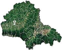
Făgăraș (Romanian pronunciation: [fəɡəˈraʃ]; German: Fogarasch, Fugreschmarkt, Hungarian: Fogaras) is a city in central Romania, located in Brașov County. It lies on the Olt River and has a population of 28,330 as of 2011.[1] It is situated in the historical region of Transylvania, and is the main city of a subregion, Țara Făgărașului.
In 2011 Romanians formed 91.7% of the population, the main minorities being represented by Romani people, Hungarians and Germans.
Name
According to linguist Iorgu Iordan, the name of the town is a Romanian diminutive of collective noun *făgar ("beech forest"), derived from fag, "beech tree".[2]
Another source of the name is alleged to derive from the Hungarian language word for "partridge" (fogoly). A more plausible explanation is that the name is given by Fogaras river coming from the Pecheneg "Fagar šu", which means ash water. Another source of the name is given by folk etymology to be Hungarian, as the rendering of "wood" (fa) and "money" (garas), with legends stating that money made of wood had been used to pay the peasants who built the fortress (Făgăraș Citadel) around 1310.
History

| Historical population | ||
|---|---|---|
| Year | Pop. | ±% |
| 1910 | 6,579 | — |
| 1930 | 7,841 | +19.2% |
| 1948 | 9,296 | +18.6% |
| 1956 | 17,256 | +85.6% |
| 1966 | 22,934 | +32.9% |
| 1977 | 33,827 | +47.5% |
| 1992 | 44,931 | +32.8% |
| 2002 | 36,121 | −19.6% |
| 2011 | 28,330 | −21.6% |
| Source: Census data | ||
Făgăraș, together with Amlaș, constituted during the Middle Ages a traditional Romanian local-autonomy region in Transylvania. The first written document mentioning Romanians in Transylvania referred to Vlach lands ("Terra Blacorum") in the Făgăraș Region in 1222. (In this document, Andrew II of Hungary gave Burzenland and the Cuman territories South of Burzenland up to the Danube to the Teutonic Knights.) After the Tatar invasion in 1241–1242, Saxons settled in the area. In 1369, Louis I of Hungary gave the Royal Estates of Făgăraș to his vassal, Vladislav I of Wallachia. As in other similar cases in medieval Europe (such as Foix, Pokuttia or Dauphiné), the local feudal had to swear oath of allegiance to the king for the specific territory, even when the former was himself an independent ruler of another state. Therefore, the region became the feudal property of the princes of Wallachia, but remained within the Kingdom of Hungary. The territory remained in the possession of Wallachian princes until 1464.
Except for this period of Wallachian rule, the town itself was centre of the surrounding royal estates.
During the rule of Transylvanian Prince Gabriel Bethlen (1613–1629), the city became an economic role model city in the southern regions of the realm. Bethlen rebuilt the fortress entirely.
Ever since that time, Făgăraș was the residence of the wives of Transylvanian Princes, as an equivalent of Veszprém, the Hungarian "city of queens". Of these, Zsuzsanna Lorántffy, the widow of George I Rákóczy established a Romanian school here in 1658. Probably the most prominent of the princesses residing in the town was the orphan Princess Kata Bethlen (1700–1759), buried in front of the Reformed church. The church holds several precious relics of her life. Her bridal gown, with the family coat of arms embroidered on it, and her bridal veil now covers the altar table. Both are made of yellow silk.
Făgăraș was the site of several Transylvanian Diets, mostly during the reign of Michael I Apafi.
The church was built around 1715–1740. Not far from it is the Radu Negru high school, built around 1909. It was originally a Hungarian language middle school where Babits Mihály taught for a while.
A local legend says that Negru Vodă left the central fortress to travel south past the Transylvanian Alps to become the founder of the Principality of Wallachia, although Basarab I is traditionally known as the 14th century founder of the state. By the end of the 12th century the fortress itself was made of wood, but it was reinforced in the 14th century and became a stone fortification.
In the beginning of the 20th century, namely in 1910 the town had 6,579 inhabitants with the following proportion: 3357 Hungarian, 2174 Romanian and 1003 German. According to the 2011 census, of residents for whom data are available, 91.7% of the population was Romanian, 3.8% Roma, 3.7% Hungarian and 0.7% German.
Făgăraș's castle was used as a stronghold by the Communist State of Romania. During the 1950s it was a prison for opponents and dissidents. After the fall of the Communist State in 1989, the castle has been restored and is currently used as a museum and library.
The city's economy was badly shaken by the disappearance of most of its industries following the Revolution, critical hardships, and reforms. Some of the city population left as guest workers to Italy, Spain, or Ireland.
Personalities
- Negru-Vodă (Black-Voivode) – Radu Negru ("Radu The Black"), legendary ruler of Wallachia (1290–1300);
- Ștefan Mailat, Voivode and Prince of Transylvania (1534–1540). "Stephanus Maylad liber dominus terre Fogaras Wayvoda Transylvaniae et Siculorum Comes".
- Gabriel Bethlen (1580–1629), Prince of Transylvania between 1613–1629;
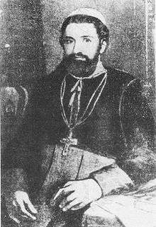
- Ioan Inocențiu Micu Klein, (born in Sadu in 1692 – died in Rome in 1768), bishop of Alba Iulia and Făgăraș (1728–1751) and Primate of the Romanian Greek-Catholic Church, had his episcopal residence in Făgăras between 1732–1737;
- Ioan Pușcariu, captain of Făgăraș;
- Aron Pumnul (1818–1866) scholar, linguist, philologist, literary historian, teacher of Mihai Eminescu, leader of the Revolution of 1848 in Transylvania;
- Nicolae Densușianu (1846–1911), historian, Associate member of the Romanian Academy;
- Aron Densușianu (1837–1900), poet and literary critic, Associate Member of the Romanian Academy;
- Badea Cârțan (Gheorghe Cârțan) (1848–1911), fighting for the release of Romanians in Transylvania;
- Ovid Densușianu (1873–1938), Aron Densușianu's son, philologist, linguist, folklorist, poet and academician, professor at the University of Bucharest;
- Ioan Șenchea, leader of the Romanians in Făgăraș (Romanian National Party in Transylvania, 1900–1916);
- Virgil Fulicea (1906–1979), sculptor;
- Ștefan Câlția, painter (born in Brașov in 1942);
- Ion Gavrilă Ogoranu (1923–2006) anticommunist fighter, in the group of the Făgăraș Mountains, former student of the present Radu Negru National College, class of 1945;
- Octavian Paler (1926–2007), writer and publicist, former student of the present Radu Negru National College, class of 1945;
- Laurențiu (Liviu) Streza, born in 1947, Orthodox archbishop and metropolitan of Transylvania, former student of the present Radu Negru National College, class of 1965.
- Radu Anton Roman (born in Făgăraș in 1948 – died in Bucharest, in 2005) journalist, writer, and TV producer.
- Mircea Florin Șandru (born in Făgăraș in 1949) poet and journalist.
- Ștefan Borbély (born in 1953) literary critic, professor at the Cluj-Napoca literature faculty.
See also
- Făgăraș Mountains
- List of castles in Romania
- Tourism in Romania
- Villages with fortified churches in Transylvania
References
| Wikimedia Commons has media related to Făgăraș. |
- ↑ "Comunicat de presă privind rezultatele provizorii ale Recensământului Populației și Locuințelor – 2011" (PDF). Brașov County Regional Statistics Directorate. 2012-02-02. Archived from the original (PDF) on 2013-07-23. Retrieved 2012-02-14.
- ↑ Iordan, Iorgu (1963). Toponimia romînească. Bucharest: Editura Academiei Republicii Populare Romîne. p. 84. OCLC 460710897.


