Eranad (tehsil)
| Eranad taluk | |
|---|---|
| taluk | |
|
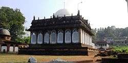
Kondotty Qubba | |
 Eranad taluk  Eranad taluk Location in Kerala, India | |
| Coordinates: 11°07′09″N 76°07′11″E / 11.119198°N 76.119631°ECoordinates: 11°07′09″N 76°07′11″E / 11.119198°N 76.119631°E | |
| Country |
|
| State | Kerala |
| District | Malappuram |
| Headquarters | Manjeri |
| Languages | |
| • Official | Malayalam, English |
| Time zone | IST (UTC+5:30) |
Eranad Taluk is one of the seven taluks (tehsils) in Malappuram district (formerly in Kozhikode district) in the Indian state of Kerala.[1]
The headquarters of the taluk is at the municipal town Manjeri.
History
Ernad taluk existed during Colonial rule in India and was a part of the Malabar district under Madras Presidency. In the first decade after independence, large-scale changes in the territorial jurisdiction of this region took place to form new taluks. On 1 January 1957, Tirur taluk was newly formed, taking portions of Eranad taluk and Ponnani taluks. Two more taluks, namely Tirurangadi taluk and Nilambur taluk, were formed later by bifurcating Tirur Taluk and Eranad taluk.
Eranad (from "Erala-nadu", the Land of the Cattles according to William Logan) was originally a province in the Chera Kingdom (9th-12th century AD) ruled by a clan known as the Eradis. They had their provincial capital was at Nediyiruppu, near present-day Kondotty. The ruler of the Eralanadu was known as the Eralanadu Utaiyavar, Elar-thiri or Nediyiruppu Mooppan or Mooppil Nayar. Manavepala Manaviyan, a Governor of the Eralanadu, signs in the famous Jewish Copper Plate (1000 AD). The Syrian Copper Plate (1225 AD) is also signed by the Eralanadu ruler.
After the fall of the Cheras, the region became an independent political entity. Later, the Eradis expanded their Kingdom to the west and moved their capital to Calicut. The Eradis came to be known as the "Kings of the Oceans" (Samoothiri/Zamorin) in later times.
Malabar Rebellion
The region was the centre of the Moplah Uprising of 1921. The armed uprising, an independent move towards British, was brutally eliminated by the Colonial government.
Villages in Ernad Taluk
Modern day Eranad taluk comprises 33 villages (sub-divisions):
- Vazhayur
- Cherukavu
- Pulikkal
- Nediyiruppu
- Manjeri
- Narukara
- Payyanad
- Pandikkad
- Vettikkattiri
- Chembrasseri
- Pulpetta
- Elankur
- Thrikkalangod
- Karakkunnu
- Edavanna
- Perakamanna
- Vazhakkad
- Cheekode
- Muthuvallur
- Areekode
- Kizhuparamba
- Kavanur, Areekode
- Urangattiri
- Vettilappara
- Malappuram
- Pookkottur
- Morayur
- Panakkad
- Anakkayam
- Pandalur, Pandikkad
- Melmuri
Culture
Ernad tehsil is as predominantly Muslim populated area. Hindus are exist in comparatively smaller numbers. So the culture of the locality is based upon Muslim traditions. Duff Muttu, Kolkali and Aravanamuttu are common folk arts of this locality. There are many libraries attached to mosques giving a rich source of Islamic studies. Some of the books are written in Arabi-Malayalam which is a version of the Malayalam language written in Arabic script. People gather in mosques for the evening prayer and continue to sit there after the prayers discussing social and cultural issues. Business and family issues are also sorted out during these evening meetings. The Hindu minority of this area keeps their rich traditions by celebrating various festivals in their temples. Hindu rituals are done here with a regular devotion like other parts of Kerala.[2]
Transportation
Ernad area connects to other parts of India through Feroke town on the west and Nilambur town on the east. National highway No.66 passes through Kondotty and the northern stretch connects to Goa and Mumbai. The southern stretch connects to Cochin and Trivandrum. State Highway No.28 starts from Nilambur and connects to Ooty, Mysore and Bangalore through Highways.12,29 and 181. The nearest airport is at Kozhikode. The nearest major railway station is at Feroke.
References
- ↑ Taluks in Malapuram district
- ↑ "Archived copy". Archived from the original on 2016-04-01. Retrieved 2016-07-14.
