Elizabeth Parker hut
| Elizabeth Parker hut | |
| alpine hut | |
 | |
| Named for: Elizabeth Parker (journalist) | |
| Country | |
|---|---|
| Province | |
| Region | Yoho National Park |
| Location | near Lake O'Hara |
| - elevation | 2,040 m (6,700 ft) |
| - coordinates | 51°21′19.7″N 116°20′38.6″W / 51.355472°N 116.344056°W |
| Built by | Canadian Pacific Railway |
| Style | Log cabin |
| Material | Wood |
| Built in | 1912 |
| Governed by | Parks Canada |
| Owned by | Alpine Club of Canada |
| For public | Reservations required |
| Easiest access | from Lake O'Hara trailhead |
| Capacity | 24 in summer / 20 in winter |
| Heating | Wood stove |
| Lighting & Cooking | Propane |
| Sleeping | Dormitory style |
| Drinking water | Creek (boil or filter) |
| Human waste | Outhouse |
| GPS coordinates | NAD83 11U 545726 5689508 |
| Map reference | 82N/8 (Lake Louise) |
| Grid reference | 457983 |
| Website: http://www.alpineclubofcanada.ca/facility/ep.html | |
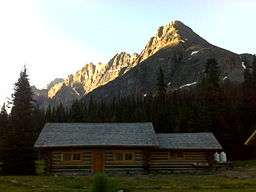
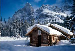
The Elizabeth Parker hut is an alpine hut located in Yoho National Park in British Columbia at an altitude of 2040 metres (6,700 ft) in a small subalpine meadow about 500 metres west of Lake O'Hara. It is surrounded by some of the most spectacular mountain scenery in the Canadian Rockies. The hut actually consists of two buildings, the main hut itself and the nearby Wiwaxy cabin. It is maintained by the Alpine Club of Canada.[1] Coordinates: 51°21′19.7″N 116°20′38.6″W / 51.355472°N 116.344056°W
History
The hut was named after the journalist Elizabeth Parker, one of the founding members of the Alpine Club of Canada (ACC).
For many years, climber and surveyor A.O. Wheeler had a desire to begin a Canadian alpine club "similar to the European and other big alpine clubs of the world". In 1902 Wheeler tried to garner support for the idea through the country's leading newspapers. Elizabeth Parker, then on the staff of the Winnipeg Free Press, chastised him for his lack of patriotism. Wheeler then asked Parker to support his plan for a truly Canadian club. Largely due to the efforts of Elizabeth Parker and the Winnipeg Free Press, the Alpine Club of Canada was formed in Winnipeg on March 27, 1906. Mrs. Parker was one of six original honorary members.
The present Wiwaxy cabin, built in 1912 by the Canadian Pacific Railway (CPR) was the first hut in the Lake O'Hara area. In the same year the ACC was granted a 2-acre (8,100 m2) lease for a future hut on the south shore of Lake O'Hara. In 1919, the CPR built the present Elizabeth Parker hut, and by 1923 had built a further 11 huts in the meadow. In 1923 - 1924, the CPR moved all but the first two huts down to the lake shore, and seven years later donated the last two in the meadow to the ACC. The club exchanged its lakeshore lease for a lease on the meadow, and in 1931 reopened the Elizabeth Parker hut for the use of its members.
The Elizabeth Parker hut has seen substantial renovations and upkeep over the years. It has had a new floor, a new roof, new timbers and new foundation logs, as well as completely new interior furnishings. The outhouses are new, a stove was added to the Wiwaxy cabin, and the entire meadow around the hut has been rehabilitated and reseeded. The Alpine Club has worked very hard to restore the appearance of the hut as closely as possible to its original state.[1] The Canadian government designated the Elizabeth Parker hut as a Federal Heritage Building in 1997.
Access
The hut can be reached via Lake O'Hara Road, off the Trans-Canada highway from a parking area. The Lake O’Hara trailhead is located on the south side of the Trans-Canada, 12 km west of Lake Louise, Alberta and 13 km east of Field, British Columbia. The turn-off to the trailhead is signed on the highway. After crossing the railroad tracks, turn right and drive about 200 metres to the parking area.
Summer approach

| Trailhead location | 12 km west of Lake Louise, AB / 13 km east of Field, BC |
| Hiking distance | less than 1 kilometre |
| Elevation gain | 50 metres (165 ft) |
| Approximate time | 15 minutes |
The easiest and fastest way of approaching the hut is via the Lake O'Hara fire road. The road is serviced in the summer months (mid-June to early October) by a Parks Canada bus, which picks passengers up at the Lake O’Hara parking lot four times daily. The road is not open to private vehicles at any time. The road can be hiked, but mountain bikes are not permitted. The hike up the road involves 12 km of travel with 400 metres of elevation gain.
Parks Canada uses the bus service to control access to Lake O'Hara, and reservations are difficult to obtain directly, but people using the hut can make bus bookings through the ACC office or on-line at the time they are making their hut reservations. Note that Parks Canada will not let anybody on the bus without their reservation form.
From the bus drop off point at Le Relais day use shelter, it is less than 1 km to the hut on a good trail. From Le Relais, turn right onto a trail between the shelter and the Parks Canada outhouses. Follow the signed trail up and over a small hill. On the other side of the hill, the trail descends a short distance and then turns right and follows Schäffer creek to the Elizabeth Parker hut. From Le Relais, the walk to the hut takes about 10 minutes.
Winter approach

| Trailhead location | 12 km west of Lake Louise, AB / 13 km east of Field, BC |
| Skiing distance | 12 kilometres |
| Elevation gain | 400 metres (1300 ft) |
| Approximate time | 3-5 hours |
Winter access is the same as in summer (see above), but requires skis or snowshoes since the bus does not run in winter and the road is not plowed. It involves 12 km of travel with 400 metres of elevation gain.
The ski approach to the hut can take anywhere from 3-7 hours, depending on whether you are breaking trail, the weight of your pack and what type of skis you use. Do not underestimate this approach; you are in the backcountry and there are 3 or 4 large avalanche paths across the road. While avalanches rarely hit the road, you should find out the current avalanche forecast, cross the avalanche paths one at a time, and do not stop while in the avalanche tracks.
Facilities

| Heating | Wood stove |
| Lighting | Propane |
| Cooking | Propane oven & range, cookware, dishes & utensils provided |
| Sleeping | Dormitory style on thick foam mattresses |
| Capacity | 24 in summer, 20 in winter |
| Drinking water | From the creek (boil or filter) |
| Human Waste | Outhouse |
| Dishwater | Ground sump |
| Garbage | Pack it out |

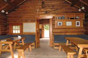
The Elizabeth Parker Hut is actually two buildings: the main hut and the Wiwaxy cabin. The main hut consists of a large kitchen area and a living room which houses sleeping quarters, tables and a wood burning stove. The Wiwaxy Cabin has sleeping quarters only - users share the kitchen and living area with the main hut users.
The hut sleeps about 24 in summer and 20 in winter, split between the two buildings. Sleeping arrangements are dormitory style on thick foam mattresses. The main building sleeps up to 16 people comfortably on four-inch (102 mm) thick, covered foam mattress found on two long bunks. The Wiwaxy Cabin sleeps eight people comfortably on four-inch (102 mm) thick, covered foam mattress found on two bunk levels.
Heating is provided by a wood-burning stove in the main cabin, and another in the Wiwaxy Cabin during winter months only. Firewood is stored behind the outhouse. Users should replace all firewood used in the hut with cut and split wood from the pile. The hut has a good supply of tools including water buckets, axes, saws, shovels, etc.
The main hut is equipped with propane powered lamps, stovetop and oven. Propane is supplied via a large outdoor tank. Cookware, dishes and eating utensils are provided. Drinking water is available 30 m to the north of the hut from the creek which runs down from Odaray Mountain but should be boiled or filtered.[2] An easily accessible pipe can be found under the bridge. During winter, there will be some unfrozen pools under the snow at the junction of two creeks approximately 80 m northeast of the hut.
Grey water disposal is in a ground sump next to the hut. People can drain grey water directly down the sinks, but should ensure that the strainer is in place under the drain. They should not allow any food scraps (including coffee grounds) to enter the grey water sump or it will become plugged. They should periodically empty the strainer contents into the fireplace. The grey water sump occasionally freezes in the winter. In this case, they should dump the grey water (strained of food particles) within a three meter radius of the outhouse.
The outhouse is located 25 m southwest of the front door of the main hut. People should not dispose of any garbage in the outhouse. All paper garbage and food scraps should be burned, and all other garbage and unused food packed out. In the summer, all recyclables which are clean and separated may be taken to Le Relais day shelter. Garbage can be deposited in Parks Canada containers at the nearby campground. In winter all garbage and recyclables must be packed out.
Requirements
- Combination lock number for the hut door (call the ACC office to confirm before going to the hut)
- Sleeping bag
- Toilet paper
- Newspaper for lighting the fire
- Matches
- First aid kit
- 9 volt battery for the smoke detector
- Reservation form from the ACC (with bus reservation information where applicable)
- Parks Canada overnight or annual wilderness pass (the former will be on your reservation form if you purchase it through the ACC). Parks Canada will ask to see your pass/receipt when you board the bus.
Activities

The hut is used as a base for mountaineering and a starting point for trips to the Abbot Pass hut.
The hiking in the Lake O'Hara area allows views of high jagged peaks, tumbling glaciers and pristine alpine lakes. There are a variety of trails in the area, ranging from short, flat trails to long, steep hikes that wind their way up into the alpine.[3] Early summer provides an abundance of wildflowers and raging waterfalls, while fall displays lovely golden larch trees. Wildlife can be seen throughout the year.[4] For those looking for a little more adventure, a visit to the Elizabeth Parker hut can be combined with a trip to the Abbot Pass hut perched high on the col between Mounts Victoria and Lefroy.
The Lake O'Hara area has an abundance of alpine rock climbing and mountaineering. Classics include Wiwaxy Ridge (5.7), Mt. Odaray (5.4/snow/ice), Mt. Hungabee (5.3/snow/ice), and Mt. Huber (scrambling and glacier).[5] There are a number of scrambles that one can do easily in a day from the Elizabeth Parker Hut. Wiwaxy Peak (via Wiwaxy Gap), Mt. Yukness, Mt. Shaeffer (from McArthur Lake) and Little Odaray all offer fine outings.[6]
The Elizabeth Parker Hut is very popular for backcountry skiing in winter. It is one of the few ACC huts which can be reasonably reached with light cross-country skis. The ski touring in the area ranges from easy, flat tours to advanced ski mountaineering.[7]
The area has one well-known ice climb on Wiwaxy Peak – Sad and Beautiful World (160 m, WI 4).[8]
Parks Canada information
Elizabeth Parker hut is in Yoho National Park. All vehicles stopping in a National Park must have a Park Motor Vehicle Permit. Annual or single day permits can be purchased at most Park entrance gates and Park visitor centres.[9]
Banff, Jasper, Kootenay, Yoho, and Glacier National Parks collect a fee for backcountry overnight use in the Parks. The fees collected from the wilderness passes go towards maintaining trails, supplying the voluntary registration service, avalanche forecasting, backcountry bridge-building, etc. Overnight users of the Elizabeth Parker hut (ages 16 and over) are required to pay this fee.[9]
The maximum group size for hiking is 10 persons. If your group is larger, you will need to split into smaller groups.
It is recommended that anyone participating in hazardous activities in the backcountry register with the Park Wardens. This registration is free and is the best method of ensuring that someone comes looking for you should the worst happen. You can register at any Parks Canada Visitor Centre.[10]
Nearby
Maps
| Map reference | 82N/8 (Lake Louise) |
| Grid reference | 457983 |
| GPS coordinates | 51° 21' 19.7" N - 116° 20' 38.6" W NAD83 11U 545726 5689508 |
| Hut elevation | 2,040m (6,700 ft). |
- Lake O'Hara (Map). 1:20,000. The Adventure Map. Chrismar Mapping Services. ISBN 0-929140-39-7. This map shows trails and area highlights in detail
- Lake O'Hara (Map) (2nd ed.). 1:20,000. Guides for Hiking and Recreation in the Canadian Rockies. Gem Trek Publishing. ISBN 978-1-895526-38-7. This map shows trails and area highlights in detail
- Lake Louise and Yoho (Map). 1:50,000. Guides for Hiking and Recreation in the Canadian Rockies. Gem Trek Publishing. ISBN 1-895526-64-7. This map shows the trails and highlights of the area.
- 82N/8 (Lake Louise) (Map). 1:50,000. National Topographic System (NTS). Canadian Government. Archived from the original on 2007-12-24. The Alpine Club cabin marked on the south shore of Lake O’Hara is not the Elizabeth Parker hut. The hut is located at grid reference 457893
References
- 1 2 Haberl, Keith (1997). Alpine Huts: A guide to the facilities of the Alpine Club of Canada. Alpine Club of Canada. pp. 52–60. ISBN 0-920330-32-0.
- ↑ "Drinking Water In The Great Canadian Outdoors". Health Canada. 2007. Archived from the original on 2007-11-05. Retrieved 2008-01-02.
- ↑ Patton, Brian; Robinson, Bart (2007). The Canadian Rockies Trail Guide, 8th Edition. Summerthought. ISBN 0-9782375-0-1.
- ↑ Gadd, Ben (1996). Handbook of the Canadian Rockies. Corax Press. ISBN 0-9692631-1-2.
- ↑ Dougherty, Sean (1993). Selected Alpine Climbs in the Canadian Rockies. Rocky Mountain Books. ISBN 0-921102-14-3.
- ↑ Kane, Alan (1999). Scrambles in the Canadian Rockies, 3rd Edition. Rocky Mountain Books. ISBN 0-921102-67-4.
- ↑ Scott, Chic (2002). Ski Trails in the Canadian Rockies, 3rd Edition. Rocky Mountain Books. ISBN 0-921102-87-9.
- ↑ Josephson, Joe (2002). Waterfall Ice Climbs in the Canadian Rockies, 4th Edition. Rocky Mountain Books. ISBN 0-921102-68-2.
- 1 2 "Fees". Yoho National Park. Parks Canada. 2007. Archived from the original on 2006-10-09. Retrieved 2008-01-02.
- ↑ "Visitor Safety". Yoho National Park. Parks Canada. 2007. Archived from the original on 2004-11-17. Retrieved 2008-01-02.
Further reading
- Scott, Jim (2002). Backcountry Huts and Lodges of the Rockies and Columbias. Johnson Gorman Publishing. ISBN 0-921835-58-2.
- Beers, Don (2003). The Wonder of Yoho. Rocky Mountain Books. ISBN 0-921102-29-1.
- Copeland, Kathy; Copeland, Craig (2004). Don't Waste Your Time in the Canadian Rockies: The Opinionated Hiking Guide. Hikingcamping.com. ISBN 0-9689419-7-4.
- Corbett, Don (2004). The 11,000ers of the Canadian Rockies. Rocky Mountain Books. ISBN 1-894765-43-5.
- Gooch, Jane Lytton (2003). Artists of the Rockies: Inspiration of Lake O'Hara. The Alpine Club of Canada. ISBN 0-9680036-2-1.
External links
- Elizabeth Parker hut at the Alpine Club of Canada
- Elizabeth Parker hut at bivouac.com
- Weather forecasts from Environment Canada
- Public avalanche bulletins from Avalanche Canada.
- Yoho National Park at Parks Canada
- Google Earth Find the Elizabeth Parker Hut at 51° 21' 19.52" N, 116° 20' 38.69" W (or search for Lake O'Hara)