Eijkman Point
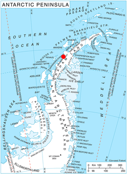
Eijkman Point (65°37′S 64°10′W / 65.617°S 64.167°WCoordinates: 65°37′S 64°10′W / 65.617°S 64.167°W) is the extremity of a rocky spur projecting into Leroux Bay from the west coast of Barison Peninsula on Graham Coast, Graham Land, on the west side of the entrance to Macrobius Cove and 4 nautical miles (7 km) south-southeast of Nunez Point. It was first mapped by the British Graham Land Expedition under John Rymill 1934-37, and was named by the UK Antarctic Place-Names Committee in 1959 for Christiaan Eijkman, a Dutch biologist who in 1890–97 first produced experimental beriberi and initiated work on its prevention.[1]
Maps
- British Antarctic Territory. Scale 1:200000 topographic map. DOS 610 Series, Sheet W 65 64. Directorate of Overseas Surveys, Tolworth, UK, 1971.
References
- ↑ "Eijkman Point". Geographic Names Information System. United States Geological Survey. Retrieved 2012-02-27.
![]() This article incorporates public domain material from the United States Geological Survey document "Eijkman Point" (content from the Geographic Names Information System).
This article incorporates public domain material from the United States Geological Survey document "Eijkman Point" (content from the Geographic Names Information System).