Eeyou Istchee James Bay Territory
| Eeyou Istchee James Bay Territory Gouvernement régional d’Eeyou Istchee Baie-James ᐄᔨᔨᐤ ᐊᔅᒌ ᒉᐃᒥᔅ ᐯᐃ ᐊᔅᒌᐤ ᑎᐹᔨᐦᒋᒑᐎᓐ | ||
|---|---|---|
| Administrative region | ||
| ||
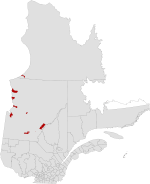 Map of Eeyou Istchee within Eeyou Istchee James Bay Territory | ||
| Country |
| |
| Province |
| |
| Government | ||
| • Type | Three Part Council | |
| • Chairperson | Dr Matthew Coon Come | |
| • Cree Representatives |
List
| |
| • Jamésien Representatives |
List
| |
| • Representative of the Gouvernement du Québec | Jean Gagnon | |
| Area | ||
| • Land | 277,000 km2 (107,000 sq mi) | |
| Time zone | EST (UTC-5) | |
| • Summer (DST) | EDT (UTC-4) | |

Eeyou Istchee James Bay Territory (French: Gouvernement régional d’Eeyou Istchee Baie-James, Cree: ᐄᔨᔨᐤ ᐊᔅᒌ ᒉᐃᒥᔅ ᐯᐃ ᐊᔅᒌᐤ ᑎᐹᔨᐦᒋᒑᐎᓐ) is a territory equivalent to a regional county municipality (TE) in the administrative region of Nord-du-Québec. On July 24, 2012, the Quebec government signed an accord with the Cree that resulted in the abolition of the local municipality of Baie-James and the Cree Eeyou Istchee TE to create the a new and combined TE of Eeyou Istchee James Bay Territory.[1] The agreement is designed to give the Cree expanded powers over lands and resources. The new government consist of Cree and Baie-James residents each having an equal number of votes.
Subdivisions
The territory is divided into a number of local governments including regular local municipalities, Cree reserved lands (TC) and their associated Cree village municipalities (VC), and one Indian settlement (S-É). There are also three "Localities" located within the territory which are all unconstituted localities, which are small unincorporated areas. The three "Localities" are Radisson, Valcanton, and Villebois.
Municipalities
Cree communities
Indian settlement
References
- ↑ Lia Lévesque (24 July 2012). "Québec et les Cris signent une entente pour un gouvernement régional". La Presse. La Presse Canadienne. Retrieved 2012-07-24.
External links
| Regional county municipalities and equivalent territories |
|
|---|---|
| Municipalities | |
| Subdivisions | |
|---|---|
| Communities | |
| Major cities | |