East Coast Parkway
Lebuhraya Taman Pantai Timur 东海岸公园大道 கிழக்கு கடற்கரை விரைவுச்சாலை | |
|---|---|
|
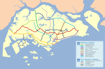
East Coast Parkway is labelled in single purple line | |
| Route information | |
| Length: | 20 km (10 mi) |
| Existed: | 1970s – present |
| History: | Completed in 1981 |
| Major junctions | |
| West end: | Marina Boulevard |
| NSC, KPE, MCE, ORRS (Adam Road), PIE | |
| East end: | Singapore Changi Airport |
| Location | |
| Regions: | Marina Bay, Kallang, Marine Parade, Changi South, Singapore Changi Airport, Bedok, Tampines |
| Highway system | |
| Expressways of Singapore | |
The East Coast Parkway (Abbreviation: ECP) is an expressway that runs along the southeastern coast of Singapore. The expressway is approximately 20 kilometres (12 mi) in length, and connects Singapore Changi Airport in the east to the Benjamin Sheares Bridge in the south of the main island, and to the Marina Coastal Expressway. It has an interchange with the Pan Island Expressway at the Changi Flyover, about 1 kilometre (0.62 mi) from the eastern end of the expressway.
It is the only expressway in Singapore which the last letter behind uses 'P' which is known as Parkway for Expressway.
Previously, the East Coast Parkway used to be directly connected to AYE. However, with the opening of the MCE on December 29, 2013 a section of expressway after the Benjamin Sheares Bridge was truncated and another section at the Marina South area realigned and converted into an arterial road.
Bus 36 is the only service to use almost all the expressway as part of its route.
History
Construction of the first phase of the East Coast Parkway from Fort Road to Marine Parade had started in 1971 and was completed in 1974, followed by an extension of Phase 2 which was completed in 1976 to Bedok South Road and then Phase 3 was built together with Changi Airport in 1980. They were built on reclaimed land. Construction on Phase 4, stretching from Fort Road to Keppel Road began in 1977 and it was opened on 18 April 1981.
It opened in 1981 to coincide with the opening of Singapore Changi Airport, although there remained traffic lights on the expressway until the completion of the last flyover at Fort Road in 1989. The Benjamin Sheares Bridge was opened at the same time in 1982, and it was extended all the way until it reaches Keppel Road.
Flanked by East Coast Park on one side and high-rise housing on the other, the well-landscaped expressway was built and maintained with the conscious intention of giving visitors arriving via Singapore Changi Airport a good first impression of the country as they commute from the airport to the city centre in less than 15 minutes on a good day.
Traffic congestion during the morning peak hours, however, led to the introduction of an Electronic Road Pricing (ERP) gantry near the Tanjong Rhu Flyover in the direction towards the city, one of the first two gantries to be set up in the country, which came into operation on 1 April 1998 together with the other gantry at Ophir Road.
A recently decommissioned highway strip was built in a long, straight section of the ECP close to Changi Airport. This section can be easily identified by removable potted plants instead of the standard large trees on the median strip.
To facilitate the development of the new downtown, the ECP was truncated after the Benjamin Sheares Bridge, while the stretch at Marina South area will be realigned and converted to a major arterial road.[1] A new expressway, the Marina Coastal Expressway, connects with the ECP and the Kallang–Paya Lebar Expressway to the Ayer Rajah Expressway and is built along the coast of Marina South.This resulted in the removal of Exit 17(Central Blvd, Marina South & Bayfront Ave) heading eastbound and Exits 17A(Marina Place, Marina South,Central Blvd & Bayfront Ave),17(Prince Edward Road) and 18(Keppel Road) heading westbound.[1]
Road Interchanges
| Exit | Interchange | To | Remarks |
|---|---|---|---|
| 1 | Changi Flyover | PIE (Tuas) and TPE (SLE) | |
| 2A | Tanah Merah Flyover | Tanah Merah Coast Road, Changi Village | |
| 2B | Tanah Merah Flyover | Xilin Avenue, Simei Avenue, Tampines Town | Eastbound only |
| East Coast Park Carpark H | Westbound only | ||
| East Coast Park Carpark F3 | Westbound only | ||
| 6 | Bayshore Road | Eastbound only | |
| 7A | Laguna Flyover | East Coast Park Service Road | |
| 7B | Laguna Flyover | Bedok South Avenue 1 and Marine Parade Road | |
| 8A | Siglap Link to Marine Parade Road | Eastbound only | |
| 8B | Marine Vista to Marine Parade Road | Eastbound only | |
| 10A | Marine Parade Flyover | East Coast Park Service Road | Eastbound only |
| 10B | Marine Parade Flyover | Still Road South | |
| 11 | Tanjong Katong Flyover | Tanjong Katong Road | Eastbound only |
| 13 | Tanjong Rhu Flyover | Fort Road | Westbound only |
| 14 | KPE | ||
| 14A | Fort Road | Eastbound only | |
| 14B | MCE | Westbound only | |
| 15 | Benjamin Sheares Bridge | Rochor Road,Beach Road, Marina Centre and Temasek Blvd | |
| 17A | Marina Boulevard, Central Boulevard, Bayfront Ave, Marina South | Westbound only |
See also
References
- 1 2 "Government Approves the Construction of MCE", Land Transport Authority, 27 July 2007
External links
| Wikimedia Commons has media related to East Coast Parkway. |

