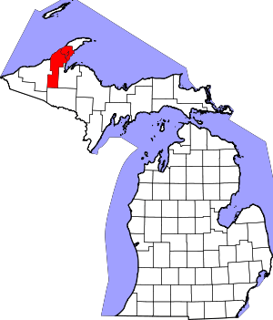
Dollar Bay, Michigan
| Dollar Bay, Michigan | |
|---|---|
| Census-designated place | |
 Dollar Bay  Dollar Bay | |
| Coordinates: 47°6′46″N 88°29′45″W / 47.11278°N 88.49583°WCoordinates: 47°6′46″N 88°29′45″W / 47.11278°N 88.49583°W | |
| Country | United States |
| State | Michigan |
| County | Houghton |
| Townships | Franklin, Osceola, Torch Lake |
| Area | |
| • Total | 4.6 sq mi (12.0 km2) |
| • Land | 4.1 sq mi (10.5 km2) |
| • Water | 0.5 sq mi (1.4 km2) |
| Elevation | 625 ft (191 m) |
| Population (2010) | |
| • Total | 1,082 |
| • Density | 266/sq mi (102.6/km2) |
| Time zone | Eastern (EST) (UTC-5) |
| • Summer (DST) | EDT (UTC-4) |
| ZIP code | 49922 |
| Area code(s) | 906 |
| FIPS code | 26-22520 |
| GNIS feature ID | 0624748 |
Dollar Bay is a census-designated place (CDP) in Houghton County, Michigan, United States. The population was 1,082 at the 2010 census.[1]
Geography
Dollar Bay is located in the southwest corner of Osceola Township. The CDP extends west into Franklin Township as far as Goat Hill Road and south into Torch Lake Township.[2] The community takes its name from Dollar Bay, a small inlet of Portage Lake, the water body that separates the Keweenaw Peninsula from the rest of the Upper Peninsula of Michigan.
M-26 is the main highway through Dollar Bay, leading west 3 miles (5 km) to Hancock and northeast 5 miles (8 km) to Hubbell.
According to the United States Census Bureau, the Dollar Bay CDP has a total area of 4.6 square miles (12.0 km2), of which 4.1 square miles (10.5 km2) are land and 0.5 square miles (1.4 km2), or 12.05%, are water.[1]
References
- 1 2 "Geographic Identifiers: 2010 Census Summary File 1 (G001): Dollar Bay CDP, Michigan". American Factfinder. U.S. Census Bureau. Retrieved August 10, 2017.
- ↑ "TIGERweb: Dollar Bay CDP, Michigan". Geography Division, U.S. Census Bureau. Retrieved August 10, 2017.
