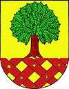
Dobrochov
| Dobrochov | ||
|---|---|---|
| Municipality | ||
| ||
 Dobrochov | ||
| Coordinates: 49°23′13″N 17°6′23″E / 49.38694°N 17.10639°ECoordinates: 49°23′13″N 17°6′23″E / 49.38694°N 17.10639°E | ||
| Country |
| |
| Region | Olomouc | |
| District | Prostějov | |
| Area | ||
| • Total | 2.52 km2 (0.97 sq mi) | |
| Elevation | 237 m (778 ft) | |
| Population (2006) | ||
| • Total | 274 | |
| • Density | 110/km2 (280/sq mi) | |
| Postal code | 798 07 | |
| Website | http://www.dobrochov.cz | |
Dobrochov is a village and municipality (obec) in Prostějov District in the Olomouc Region of the Czech Republic.
The municipality covers an area of 2.52 square kilometres (0.97 sq mi), and has a population of 274 (as at 3 July 2006).
Dobrochov lies approximately 10 kilometres (6 mi) south of Prostějov, 26 km (16 mi) south-west of Olomouc, and 209 km (130 mi) east of Prague, at the international road E462 / highway D46.
Technical Landmark
There is a mediumwave broadcasting site in the east at the Předina hill (313 m) of a rich history. Established in the thirties for Český rozhlas Brno (Czech state broadcasting comp.) and covering most of the Moravia, seized by Nazis in 1939 and rebuilt to 100 kW for their propaganda station Donausender (due to good coverage towards south and south-east) and extended to 2x 200 kW by the communist regime in the seventies. It was mainly used for the second programme on 954 kHz (and jamming of R.F.E. mediumwave Munich transmitter), but the transmissions were shifted to FM and the steel structure of 152 m was abandoned in the 21st century and only a private station Rádio Dechovka is aired (1233 kHz / 5 kW).
References
| Wikimedia Commons has media related to Dobrochov. |
