City of Onkaparinga
| City of Onkaparinga South Australia | |||||||||||||||
|---|---|---|---|---|---|---|---|---|---|---|---|---|---|---|---|
 | |||||||||||||||
| Population | 168,798 (2015 est)[1] | ||||||||||||||
| • Density | 325.6/km2 (843/sq mi) | ||||||||||||||
| Established | 1997 | ||||||||||||||
| Area | 518.4 km2 (200.2 sq mi) | ||||||||||||||
| Mayor | Lorraine Rosenberg [2] | ||||||||||||||
| Council seat | Noarlunga Centre | ||||||||||||||
| Region | Southern Adelaide[3] | ||||||||||||||
| County | Adelaide[4] | ||||||||||||||
| State electorate(s) | Davenport, Finniss, Fisher, Heysen, Kaurna, Mawson, Mitchell, Reynell | ||||||||||||||
| Federal Division(s) | Boothby, Kingston, Mayo | ||||||||||||||
 | |||||||||||||||
| Website | City of Onkaparinga | ||||||||||||||
| |||||||||||||||
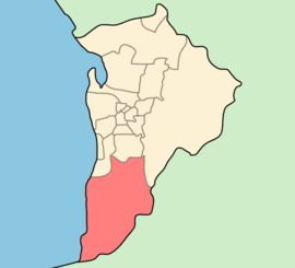
The City of Onkaparinga is a local government area (LGA) located on the southern fringe of Adelaide, South Australia. It is named after the Onkaparinga River, whose name comes from Ngangkiparinga, a Kaurna word meaning women's river. It is the largest LGA in South Australia, with an estimated population of 164,800 people in both urban and rural communities and is also geographically expansive, encompassing an area of 518.3 km². The council is headquartered in the Noarlunga Centre with area offices situated in Aberfoyle Park, Woodcroft and Willunga.
The council was formed on 1 July 1997 as the City of Happy Valley, Noarlunga and Willunga from the amalgamation of the former City of Happy Valley and City of Noarlunga with part of the District Council of Willunga.[5] It adopted the City of Onkaparinga name from 22 December 1997.[6]
Governance
The council meets at the chambers in Noarlunga Centre on Hannah Road every three weeks on a Tuesday.
The City of Onkaparinga has 21 elected members (including the mayor). The city is divided into five electoral wards, with four councillors representing each. The mayor is elected at large by all electors.
The current council was elected in 2014 for a four-year term.[7]
| Ward | Party[8] | Councillor | Notes | |
|---|---|---|---|---|
| Mayor | Independent | Lorraine Rosenberg | Formerly a Liberal MP in the South Australian House of Assembly | |
| Knox | Independent | Cr Nick Swann | ||
| Independent | Cr Heather Merritt | |||
| Independent | Cr Gary Hennessy | |||
| Liberal | Cr Heidi Greaves | |||
| Mid South Coast | Independent | Cr John Gunn | ||
| Labor | Cr Bill Jamieson | |||
| Independent | Cr Dr Jonathan Deakin | |||
| Greens | Cr Robyn Holtham | Deputy Mayor | ||
| Pimpala | Independent | Cr Sandra Brown | ||
| Independent | Cr Lara Nicholls | |||
| Labor | Cr Peter Schulze | |||
| Independent | Cr Greg Olbirch | |||
| Thalassa | Independent | Cr Martin Bray | ||
| Liberal | Cr Darryl Parslow | |||
| Liberal | Cr Brian Nankivell | |||
| Liberal | Cr Marion Themeliotis | |||
| Wine Coast | Labor | Cr Gail Kilby | ||
| Greens | Cr Don Chapman | |||
| Independent | Cr Hazel Wainwright | |||
| Independent | Cr Wayne Olsen | |||
Suburbs
- Aberfoyle Park - 5159
- Aldinga - 5173
- Aldinga Beach – 5173
- Blewitt Springs - 5171
- Chandlers Hill - 5159
- Cherry Gardens - 5157
- Christie Downs - 5164
- Christies Beach - 5165
- Clarendon – 5157
- Coromandel East - 5157
- Coromandel Valley - 5051
- Darlington - 5047
- Dorset Vale - 5157
- Flagstaff Hill - 5159
- Hackham - 5163
- Hackham West - 5163
- Happy Valley - 5159
- Huntfield Heights - 5163
- Ironbank - 5153
- Kangarilla - 5157
- Lonsdale - 5160
- Maslin Beach - 5170
- McLaren Flat - 5171
- McLaren Vale - 5171
- Moana - 5169
- Morphett Vale – 5162
- Noarlunga Centre - 5168
- Noarlunga Downs - 5168
- O'Halloran Hill - 5158
- O'Sullivan Beach - 5166
- Old Noarlunga - 5168
- Old Reynella - 5161
- Onkaparinga Hills - 5163
- Port Noarlunga – 5167
- Port Noarlunga South - 5167
- Port Willunga - 5173
- Reynella - 5161
- Reynella East - 5161
- Seaford - 5169
- Seaford Heights - 5169
- Seaford Meadows - 5169
- Seaford Rise - 5169
- Sellicks Beach - 5174
- Sellicks Hill - 5174
- Tatachilla - 5171
- The Range - 5172
- Whites Valley - 5172
- Willunga - 5172
- Willunga South - 5172
- Woodcroft – 5162
That is, postcodes 5047, 5051, 5153, and 5157–74 (inclusive).[9]
See also
- Local Government Areas of South Australia
- List of Adelaide suburbs
- List of Adelaide parks and gardens
References
- ↑ "3218.0 – Regional Population Growth, Australia, 2014–15". Australian Bureau of Statistics. Retrieved 29 September 2016.
- ↑ "Elected Members". City of Onkaparinga. Retrieved 9 April 2016.
- ↑ "Southern Adelaide SA Government region" (PDF). The Government of South Australia. Retrieved 17 April 2017.
- ↑ "Search result for "County of Adelaide, CNTY" with the following data sets selected - "Counties" and "Local Government Areas"". Property Location SA Map Viewer. Government of South Australia. Retrieved 24 April 2017.
- ↑ "Happy Valley (S.A.). Corporation". Libraries Australia. Retrieved 9 April 2016.
- ↑ "Monday, 22 December, 1997" (PDF). The Government Gazette of South Australia. Government of South Australia. Retrieved 11 December 2016.
- ↑ "Elected members". The City of Onkaparinga. Retrieved 5 May 2015.
- ↑ "Elected Members Register of Interests". City of Onkaparinga. Retrieved 5 July 2017.
- ↑ "City of Onkaparinga suburb boundaries map". City of Onkaparinga. 9 January 2014. Retrieved 8 October 2014.
External links
Coordinates: 34°55′S 138°38′E / 34.917°S 138.633°E