Dick Brook
| Dick Brook | |
 Priors Mill | |
| Country | England |
|---|---|
| Counties | Worcestershire |
| Source confluence | Joans Hole |
| Mouth | |
| - location | River Severn, Worcestershire |
| - coordinates | 52°17′53″N 2°16′34″W / 52.298°N 2.276°WCoordinates: 52°17′53″N 2°16′34″W / 52.298°N 2.276°W |
| Length | 7.5 km (5 mi) [1] |
| Basin | 38 km2 (15 sq mi) [1] |
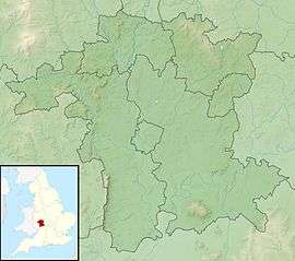
 Location within Worcestershire | |
Dick Brook is small tributary stream of the River Severn that flows through Worcestershire, England.[2]
The brook is formed from two small unnamed streams that converge at Joan’s Hole to the west of Dunley. The longest of these streams drains the area around Rock, with a source near Clows Top. From Joan’s Hole the named brook flows generally south-east for a total distance of 4.7 miles (7.5 km). At the edge of the village of Astley it was dammed to power Priors Mill, and then to the south of the village, at New Bridge it is crossed by a packhorse bridge, below the monastery at Glasshampton. To the north of Noutard's Green it passes beneath Glazen Bridge (B4196), and along the northern edge of Shrawley wood, until it joins the River Severn.[2][3]
The drainage basin for the brook, which lies between that of the Gladder Brook to the north, and that of the Shrawley Brook to the south, has an area of 38 square kilometres (15 sq mi).[1][2]
A very short section of Dick Brook was canalized about 1717 to enable small boats to travel up stream from the River Severn to Astley Forge. Two flash locks were constructed and the date 1717 is visible on one of these lock chambers.[4]
References
- 1 2 3 "WFD Surface Water Classification Status and Objectives 2012 csv files". Environment Agency. Archived from the original on 24 February 2014. Retrieved 20 June 2014.
- 1 2 3 "Water Framework Directive - River Basin Management Plans". What's in your Backyard. Environment Agency. Retrieved 20 June 2014.
- ↑ "Our Locality-About Us". Astley and Dunley Parish. astleyanddunley.org.uk. Retrieved 20 June 2014.
- ↑ Ray Shill (1 March 2011). Silent Highways: The Forgotten Heritage of the Midlands Canals. History Press Limited. p. 15. ISBN 978-0-7524-5842-7.