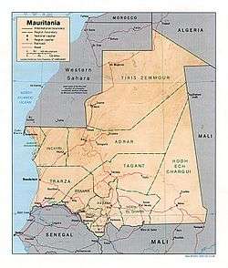
Adrar Plateau
| The Adrar | |
|---|---|
| Natural region | |
|
Landscape of the stony desert known as Reg de l'Adrar | |
 Location of the Adrar in central Mauritania | |
| Country | Mauritania |
| Elevation | 340 m (1,120 ft) |
.JPG)
The Adrar (Berber: ![]() , lit. mountain) is a highland natural and historical region of the Sahara Desert in northern Mauritania. The Adrar Region, an administrative division of Mauritania, is named after the traditional region. It is sometimes called Adrar Tamar to distinguish it from other areas called Adrar in the Sahara.[1]
, lit. mountain) is a highland natural and historical region of the Sahara Desert in northern Mauritania. The Adrar Region, an administrative division of Mauritania, is named after the traditional region. It is sometimes called Adrar Tamar to distinguish it from other areas called Adrar in the Sahara.[1]
Geography
The Adrar is an arid plateau, known for its gorges, regs (stony deserts) and shifting sand dunes. Nearby is also the famous Richat Structure. Structurally the Adrar is a low central massif which rises to 260m above sea level with conspicuous cliffs. There is no water in the central area of the plateau and cultivation is not possible; only at the edges is there enough water to support palm groves.[2]
Notable features include the Richat Structure, a heavily eroded dome approximately 40 km across, which resembles a huge eye when observed from space.[3]
The Adrar region is home to a small human population, centered on the town of Atar. The ancient town of Ouadane, formerly an important caravan and gold-trading centre, is located on the southern edge of the Adrar. Chinguetti is another important historical town in the region.[2]
History
The Adrar was settled in the Neolithic era as shown by cave and rock paintings found in the area. The more recent aridification has left much of the archaeology intact, most notable several stone circles, e.g. Atar Stone Circle,[3] and the later town of Azougui.[1]
Beginning in the mid-17th century, migrants from the Adrar Plateau region moved into the Tagant Plateau and displaced the native population.[4]
Features of the Adrar
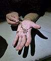 Henna design on the hand of a girl of the region
 A sandy area west of Chinguetti
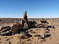 A stone cairn
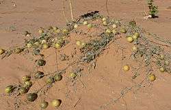 Colocynths in the Adrar desert
.jpg) A postbox in the airport of Atar, the Adrar's main town
A postbox in the airport of Atar, the Adrar's main town
See also
References
- 1 2 "Adrar of Mauritania". Encyclopedia of Islam, THREE. Brill Online Reference. Retrieved 2016-11-20.
- 1 2 "Adrar plateau, Mauritania". Encyclopædia Britannica. Retrieved 2016-11-20.
- 1 2 "Mauritania". wondermodo. Retrieved 2016-11-20.
- ↑ James L. A. Webb , Desert Frontier: Ecological and Economic Change Along the Western Sahel, p.50.
External links
Coordinates: 20°24′19″N 13°06′40″W / 20.40528°N 13.11111°W