Dewy Rose, Georgia
| Dewy Rose, Georgia | |
|---|---|
| Census-designated place | |
 Dewy Rose | |
| Coordinates: 34°10′11″N 82°57′11″W / 34.16972°N 82.95306°WCoordinates: 34°10′11″N 82°57′11″W / 34.16972°N 82.95306°W | |
| Country | United States |
| State | Georgia |
| County | Elbert |
| Area[1] | |
| • Total | 1.676 sq mi (4.34 km2) |
| • Land | 1.669 sq mi (4.32 km2) |
| • Water | 0.007 sq mi (0.02 km2) |
| Elevation | 732 ft (223 m) |
| Population (2010) | |
| • Total | 154 |
| • Density | 92/sq mi (35/km2) |
| Time zone | Eastern (EST) (UTC-5) |
| • Summer (DST) | EDT (UTC-4) |
| ZIP code | 30634 |
| Area code(s) | 706 & 762 |
| GNIS feature ID | 355485[2] |
Dewy Rose is a census-designated place and unincorporated community in Elbert County, Georgia, United States. Its population was 154 as of the 2010 census.[1] Dewy Rose has a post office with ZIP code 30634.[3] Georgia State Route 17 passes through the community.
References
- 1 2 "2010 Census Gazetteer Files - Places: Georgia". U.S. Census Bureau. Archived from the original on January 3, 2015. Retrieved January 3, 2015.
- ↑ "Dewy Rose". Geographic Names Information System. United States Geological Survey.
- ↑ United States Postal Service. "USPS - Look Up a ZIP Code". Retrieved January 3, 2015.
Municipalities and communities of Elbert County, Georgia, United States | ||
|---|---|---|
| Cities | 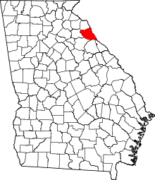 | |
| CDP | ||
| Unincorporated community | ||
This article is issued from
Wikipedia.
The text is licensed under Creative Commons - Attribution - Sharealike.
Additional terms may apply for the media files.