Deir ez-Zor
Coordinates: 35°20′N 40°9′E / 35.333°N 40.150°E
| Deir ez-Zor دير الزور Deir Ezzor - Deir Azzor | |
|---|---|
|
Deir ez-Zor Deir ez-Zor suspension bridge •Armenian Genocide Memorial The Euphrates • 8 March Square Irrigation canal • Suspension bridge at night • Downtown Deir ez-Zor | |
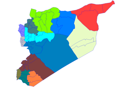
 Deir ez-Zor Location in Syria | |
| Coordinates: 35°20′N 40°9′E / 35.333°N 40.150°E | |
| Country |
|
| Governorate | Deir ez-Zor Governorate |
| District | Deir ez-Zor District |
| Government | |
| • Mayor | Mohamed Ibrahim Samra |
| Elevation | 210 m (690 ft) |
| Population (2004 census[1]) | |
| • City | 211,857 |
| • Metro | 239,196 |
| Time zone | EET (UTC+2) |
| • Summer (DST) | EET (UTC+3) |
| Area code(s) | 051 |

Deir ez-Zor (Arabic: دير الزور Dayr az-Zūr; Syriac: ܕܝܪܐ ܙܥܘܪܬܐ Dayrāʾ Zəʿōrtāʾ) is the largest city in eastern Syria and the seventh largest in the country. Located 450 km (280 mi) to the northeast of the capital Damascus on the shores of the Euphrates River, Deir ez-Zor is the capital of the Deir ez-Zor Governorate.[2] In the 2004 census, it had a population of 211,857 people.
Names
Among Syrians and neighbouring regions, Ad-Deir is used for short to indicate Deir ez Zor. The current name, which has been extended to the surrounding region, indicates an ancient site for one of the Early Christian secluded monasteries spread since the persecution times and Apostolic Age throughout Mesopotamia.[3] Although Deir, which is Arabic for "monastery", was thought to be kept throughout Medieval and Modern Age renaming, Zor, which indicates the riverbank bush, appeared only in some late Ottoman records.[4] In Syriac, Dīrā Zeʿūrta means "small habitation."[5]
Many different Romanizations are used, including Deir Ezzor, Deir Al-Zor, Deir-al-Zour,[6] Dayr Al-Zawr, Der Ezzor, Deir Azzor and Deirazzor.
History
Deir ez-Zor is situated 85 km (53 mi) to the northwest of the archaeological remains of Dura-Europos and 120 km (75 mi) northwest of the remains of the ancient city of Mari. During Roman times it was an important trading post between the Roman Empire and India. Conquered by Zenobia, it became part of the kingdom of Palmyra. After a successive wave of conquests, it was finally destroyed by the Mongols as they swept across the Middle East.
The modern town was expanded by the Ottoman Empire in 1867 around the pre-existing town. In 1915, the city became a major destination point for Armenians subjected to death marches during the Armenian Genocide.[7] A memorial commemorating the events was erected in the city in 1991.[8]
France occupied Deir ez-Zor in 1921 and made it the seat of a large garrison. Meanwhile, the region was locally ruled by Haj-Fadel Abboud, a member of an aristocratic family. In 1941 British-led forces defeated the Vichy French during the Syria-Lebanon campaign, which included a battle over Deir, and they handed administration of the region to the Free French. In 1946 it became part of the independent Republic of Syria.
Syrian Civil War

Since the Syrian civil war, armed military clashes erupted in the city between the Syrian Armed Forces and the Free Syrian Army (associated with the National Coalition for Syrian Revolutionary and Opposition Forces) and other opposition organizations such as Islamic State of Iraq and the Levant and Jabhat Al-Nusra (the US has blacklisted the Jabhat Al-Nusra as a terrorist organisation in response to its bombing campaigns).
On 21 September 2014, the Armenian memorial complex was blown up by militants of the Islamic State of Iraq and the Levant, who had formerly been part of al-Nusra Front.[9][10][11]
On May 15, 2015 at al-Amr, elite United States military forces attacked and killed ISIS militant Abu Sayyaf who was targeted for his financing of the war.[12]
Deir Ez Zor district is currently one of the few remaining Syrian Government strongholds in Eastern Syria. In May 2015, Islamic State militants launched an offensive, capturing Palmyra and cutting off the remaining supply line to Deir ez-Zor.[13] The city was then effectively under siege by ISIS, leaving supplies to be solely delivered by transport helicopters.[13] ISIS attempted to stop the supplies by daily attacking the Deir ez-Zor Airbase. However, their attempts failed due to the presence of elite Republican Guards of the 104th Airborne Brigade led by Brigadier General Issam Zahreddine.[13]
The siege led to the shortage of food and fuel in the city with frequent blackouts and meat reported to cost up to $30 in late 2016. World Food Programme and Russia air-dropped aid.[14] In January 2015 Russian Lieutenant General Sergei Rudskoi said that 22 tonnes (48,501 pounds) of humanitarian aid were dropped over Deir ez-Zor using Russian parachute equipment on Syrian Il-76 transport planes.[15] In late 2016 the Syrian government was distributing free bread rations to the residents of the city through the Syrian Red Crescent society.[14]
In August 2015, the Syrian government had suspended five bakeries providing the locals with food in order to distribute it to its soldiers, security personnel, and their families.[16][17] Al-Masdar News reported that in August 2015 civilians could be evacuated from the city for approximately 80 US dollars.[13] Most of the 100,000 besieged civilians remain poor and jobless from the ongoing fighting.[13]
On 17 January 2016, a massacre of the city′s civilian population was reported to have been perpetrated by ISIS, who were said to have also abducted 400 civilians during a bloody assault on the city. However rebel activists told the BBC reporters that there had been no killings or abductions on a large scale.[18]
On 17 September 2016, US airplanes struck a target of Dayr Az Zawr.[19][20] Centcom declared that they halted airstrikes when they were informed by Russian officials that the target hit by US airplanes may have been a Syrian Arab Army target. RT reported that 62 Syrian Army soldiers were killed.[21] The Syrian Arab News Agency said that an ISIS assault on the Syrian Army began right after the US airstrike.
On 18 June 2017, Iran's Islamic Revolution Guards Corps (IRGC) fired six surface-to-surface mid-range ballistic missile from domestic bases targeting ISIS forces in the Deir ez-Zor Governorate in response to the terrorist attacks in Tehran earlier that month. Aerial videos by IRGC drones flying over the city during the operation, confirmed the success of the mission.[22]
Climate
Köppen-Geiger climate classification system classifies it as hot desert (BWh).
| Climate data for Deir Ezzor (1961–1990) | |||||||||||||
|---|---|---|---|---|---|---|---|---|---|---|---|---|---|
| Month | Jan | Feb | Mar | Apr | May | Jun | Jul | Aug | Sep | Oct | Nov | Dec | Year |
| Record high °C (°F) | 22.5 (72.5) |
26.1 (79) |
32.7 (90.9) |
40.0 (104) |
41.6 (106.9) |
44.2 (111.6) |
47.5 (117.5) |
47.8 (118) |
43.0 (109.4) |
41.0 (105.8) |
31.5 (88.7) |
23.0 (73.4) |
47.8 (118) |
| Average high °C (°F) | 12.2 (54) |
15.1 (59.2) |
19.5 (67.1) |
25.4 (77.7) |
31.7 (89.1) |
36.9 (98.4) |
39.9 (103.8) |
39.3 (102.7) |
35.3 (95.5) |
28.8 (83.8) |
20.7 (69.3) |
14.0 (57.2) |
26.6 (79.9) |
| Daily mean °C (°F) | 6.7 (44.1) |
9.1 (48.4) |
13.1 (55.6) |
18.7 (65.7) |
24.5 (76.1) |
29.6 (85.3) |
32.6 (90.7) |
31.7 (89.1) |
26.9 (80.4) |
20.9 (69.6) |
13.3 (55.9) |
8.1 (46.6) |
19.6 (67.3) |
| Average low °C (°F) | 2.5 (36.5) |
3.7 (38.7) |
7.0 (44.6) |
12.0 (53.6) |
17.1 (62.8) |
21.9 (71.4) |
25.1 (77.2) |
24.5 (76.1) |
19.4 (66.9) |
13.7 (56.7) |
7.2 (45) |
3.2 (37.8) |
13.1 (55.6) |
| Record low °C (°F) | −7.2 (19) |
−8.2 (17.2) |
−3.7 (25.3) |
−2.0 (28.4) |
8.0 (46.4) |
10.6 (51.1) |
17.6 (63.7) |
16.8 (62.2) |
11.4 (52.5) |
2.5 (36.5) |
−8.0 (17.6) |
−9.3 (15.3) |
−9.3 (15.3) |
| Average precipitation mm (inches) | 28.1 (1.106) |
24.1 (0.949) |
27.8 (1.094) |
22.2 (0.874) |
8.6 (0.339) |
0.3 (0.012) |
0.0 (0) |
0.0 (0) |
0.2 (0.008) |
8.0 (0.315) |
12.4 (0.488) |
24.1 (0.949) |
155.8 (6.134) |
| Average precipitation days (≥ 1.0 mm) | 4.8 | 4.3 | 4.3 | 3.5 | 1.7 | 0.1 | 0.0 | 0.0 | 0.1 | 1.5 | 2.6 | 4.1 | 27.0 |
| Average relative humidity (%) | 76 | 67 | 57 | 49 | 38 | 27 | 26 | 28 | 32 | 42 | 57 | 75 | 48 |
| Mean monthly sunshine hours | 161.2 | 179.2 | 223.2 | 243.0 | 310.0 | 351.0 | 372.0 | 356.5 | 309.0 | 257.3 | 207.0 | 161.2 | 3,130.6 |
| Mean daily sunshine hours | 5.2 | 6.4 | 7.2 | 8.1 | 10.0 | 11.7 | 12.0 | 11.5 | 10.3 | 8.3 | 6.9 | 5.2 | 8.6 |
| Source #1: Deutscher Wetterdienst[23] | |||||||||||||
| Source #2: NOAA[24] | |||||||||||||
Economy
The city and its rural surrounding is a fertile and prosperous farming area, with livestock-breeding (for awassi sheep), cereals and cotton crops. Many agribusiness institutions work there as well.
Since the discovery of light crude petroleum in the Syrian desert it has become a centre for the country's petroleum extraction industry.[25] It is also a minor centre for tourism with many tourist facilities such as traditional French-style riverbank restaurants, up to 5-star hotels, a hub for trans-desert travel and an airport (IATA code: DEZ) in Al-Jafra suburb. There are salt mines nearby.
Culture

The majority of Deiries (from Deir ez-Zor) are Arab Muslims, with few Kurdish, Armenian and Assyrian/Syriac families.
Deir ez-Zor was the final concentration place for Deir ez-Zor Camps for annihilating the Armenian deportation caravans. Tens of thousands of surviving men, women and children were systematically killed on the banks of the Euphrates River. The Armenian Genocide Memorial church commemorated the memory of Genocide victims who lost their lives, but it was destroyed on 21 September 2014 by Islamic State militants.
Successive waves of new settlers from surrounding countrysides and provinces were heavily related to severe drought in late 1950s and 1990s most of them looking for standard jobs and giving away farming and herding life-style. Mesopotamian dialect of Arabic is used in the city, with slight influence of the North Syrian one can be noticed as well. Dominated by Sunni Muslims, Christianity in Deir ez-Zor can be traced back to the Apostolic Age, with few active churches and chapels belong to different congregations.
The city was also famous for the Deir ez-Zor suspension bridge (Arabic: الجسر المعلق) which spanned the Euphrates[2] and was destroyed in 2013 during the civil war. The Deir ez-Zor Museum keeps thousands of antiquities collected from nearby archeological sites in Northern Mesopotamia.
Main campuses of Al-Furat University and Aljazeera University are also located there.[26] Many other polytechnic schools and professional institutes provides tertiary education are based in the city as well.
The local daily newspaper Al Furat and few other publications are published there and circulated in neighboruing Al-Hasakah and Raqqa governorates.
International relations
Deir ez-Zor is home to the third Armenian diplomatic mission in Syria; the Honorary Consulate of the Republic of Armenia, opened on 11 February 2010.[27]
Deir ez-Zor Airport is an under-developed domestic and international terminal and important hub mostly connecting with Damascus and destinations in the Persian Gulf region.
Twin cities
Notable people
Notable people from Deir ez-Zor include politicians Riyad Farid Hijab, Ahmad Tu'mah and Riad Darar, military commanders Ramadan al-Shallash and Jassem Alwan, footballers Omar Al Somah and Oday Al-Jafal, and designer Rami Al Ali.
See also
References
- ↑ "Deir ez-Zor city population". Archived from the original on 2012-07-31.
- 1 2 "Syrian Ministry of Tourism (in Arabic)". Retrieved 10 May 2007.
- ↑ Moffett, S. H. (1992): A History of Christianity in Asia: Beginnings to 1500. Harper, San Francisco. ISBN 0-06-065779-0
- ↑ Shaw, S. J. (1978): The Ottoman Census System and Population, 1831–1914. International Journal of Middle East Studies, 9: 325–338.
- ↑ R. Payne Smith, Thesarus Syriacus, s.v. ܕܝܪܐ; ܙܥܘܪܬܐ
- ↑ BBC TV World News (7 Dec 2015) - Deir-al-Zour is variant used by BBC News
- ↑ Fuat Dündar (2011). "Pouring a People into the Desert:The "Definitive Solution" of the Unionists to the Armenian Question". In Ronald Grigor Suny, Fatma Muge Gocek and Norman M. Naimark (Eds). A Question of Genocide: Armenians and Turks at the End of the Ottoman Empire. New York: Oxford University Press. pp. 280–281. ISBN 978-0-19-978104-1.
- ↑ "Monument and Memorial Complex at Der Zor, Syria".
- ↑ Hayrumyan, Naira (24 September 2014). "Middle East Terror: Memory of Armenian Genocide victims targeted by ISIS militants". ArmeniaNow.
- ↑ "IS said to destroy Armenian Genocide memorial". The Times of Israel. 22 September 2014.
- ↑ "Who destroyed the Armenian Genocide Martyrs’ Memorial Church in Deir Ezzor?". conflict antiquities. 12 November 2014. Retrieved 20 March 2015.
- ↑ The White House Office of the Press Secretary. (May 16, 2015). "Statement by NSC Spokesperson Bernadette Meehan on Counter-ISIL Operation in Syria" Retrieved May 18, 2015. White House website
- 1 2 3 4 5 Chris Tomson (12 December 2015). "100,000 Civilians under ISIS Siege in Eastern Syria". Al-Masdar News. Retrieved 12 December 2015.
- 1 2 Jihadist siege chokes Syria's Deir Ezzor, Daily Mail, 25 November 2016
- ↑ "Russia begins 'humanitarian operations' in Syria". Daily Mail. 15 January 2016. Retrieved 15 January 2016.
- ↑ Urquhart, Conal (11 June 2015). "Besieged by ISIS: Photographs From Inside a Syrian City". Time.
- ↑ Syrian civilians suffer food shortage under ISIS siege in Deir ez-Zor aranews.net (August 3, 2015)
- ↑ Syria conflict: Conflicting accounts of Deir al-Zour attack bbc.com (17 January 2016)
- ↑ "Coalition halts airstrike in progress against possible Syrian military".
- ↑ "Coalition Halts Airstrike in Progress Against Possible Syrian Military Position". U.S. DEPARTMENT OF DEFENSE. 18 September 2016. Archived from the original on 18 September 2016.
- ↑ "US-led coalition aircraft strike Syrian army positions, kill 62 soldiers – military".
- ↑ "PressTV-IRGC warns terrorists, backers of ‘more revenge’". Retrieved 2017-06-19.</
- ↑ "Klimatafel von Deir Ezzor / Syrien" (PDF). Baseline climate means (1961-1990) from stations all over the world (in German). Deutscher Wetterdienst. Retrieved April 26, 2017.
- ↑ "Deir Ezzor Climate Normals 1961–1990". National Oceanic and Atmospheric Administration. Retrieved April 26, 2017.
- ↑ International Energy Agency. World Energy Outlook. Petroleum Economist. Institute for the Study of War. Oil infrastructure across Syria and Iraq (map). in BBC News. (18 May 2015). "Battle for Iraq and Syria in maps". Retrieved May 18, 2015. BBC News website
- ↑ Al Jazeera University. Jude.edu.sy. Retrieved on 29 October 2013.
- ↑ Thawra news (in Arabic)
- ↑ Al-Baath news (in Arabic) Archived 3 September 2011 at the Wayback Machine.
External links
| Wikimedia Commons has media related to Dayr az-Zawr. |
- Short history of Deir Ezzor
- Furat Cham Hotel Palace
- Badia Cham Hotel
- watch "Isti'mariyah – windward between Naples and Baghdad"
Capital: Deir ez-Zor | |||||||
| |||||||
| |||||||
| |||||||