Leicestershire and Rutland Wildlife Trust
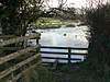
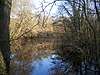
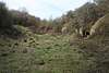
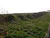
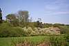
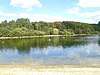
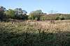
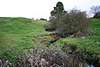
The Leicestershire and Rutland Wildlife Trust is a wildlife trust covering the counties of Leicestershire and Rutland, England. Founded in 1956, (originally under the name "Leicestershire and Rutland Trust for Nature Conservation") the trust now has 9,000 members helping care for 29 nature reserves covering more than 2,600 acres (11 km2) across the region. The best known of these nature reserves is the Rutland Water Nature Reserve, managed on behalf of Anglian Water. With over 10,000 waterfowl of up to 28 species, it is a Site of Special Scientific Interest.
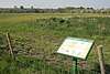
LRWT also campaigns for wildlife, protecting threatened habitats like wild flower meadows and threatened species such as ospreys, otters and water voles. By holding activities and events such as orchid rambles and birdwatching fairs, the trust gives people of all ages the chance to experience local wildlife. The Trust also advises landowners on important nature conservation issues.
The Leicestershire and Rutland Wildlife Trust is based in Leicester and is managed by an elected Council of Trustees. It is a registered charity (no.210531) and a company limited by guarantee (no.561833). The Trust's work is done by over 20 professional staff and 400 active volunteers, who help with the conservation and with essential fundraising events. The trust's patron and vice-president is Sir David Attenborough.
Key
Public access
|
Other classifications
|
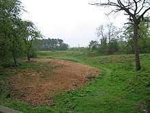


_-_geograph.org.uk_-_423638.jpg)

See also
- List of Sites of Special Scientific Interest in Leicestershire
- List of Sites of Special Scientific Interest in Rutland
- List of Local Nature Reserves in Leicestershire
Notes
References
- ↑ "Altar Stones". Leicestershire and Rutland Wildlife Trust. Retrieved 11 August 2017.
- ↑ "Bloody Oaks Quarry". Leicestershire and Rutland Wildlife Trust. Retrieved 11 August 2017.
- ↑ "Designated Sites View: Bloody Oaks Quarry". Sites of Special Scientific Interest. Natural England. Retrieved 11 August 2017.
- ↑ "Bloody Oaks Quarry citation" (PDF). Sites of Special Scientific Interest. Natural England. Retrieved 10 August 2017.
- ↑ "Charley Woods". Leicestershire and Rutland Wildlife Trust. Retrieved 11 August 2017.
- ↑ "Charnwood Lodge". Leicestershire and Rutland Wildlife Trust. Retrieved 11 August 2017.
- ↑ "Charnwood Lodge (Precambrian of England & Wales)". Geological Conservation Review. Joint Nature Conservation Committee. Retrieved 8 August 2017.
- ↑ "Charnwood Lodge & Warren Hills (Precambrian of England & Wales)". Geological Conservation Review. Joint Nature Conservation Committee. Retrieved 8 August 2017.
- 1 2 "Leicestershire's National Nature Reserves". Natural England. 31 October 2008. Retrieved 8 August 2017.
- ↑ "Designated Sites View: Charnwood Lodge". Sites of Special Scientific Interest. Natural England. Retrieved 11 August 2017.
- ↑ "Cloud Wood". Leicestershire and Rutland Wildlife Trust. Retrieved 11 August 2017.
- ↑ "Designated Sites View: Breedon Cloud Wood and Quarry". Sites of Special Scientific Interest. Natural England. Retrieved 11 August 2017.
- ↑ "Cossington Meadows". Leicestershire and Rutland Wildlife Trust. Retrieved 11 August 2017.
- ↑ "Cribb's Meadow". Leicestershire and Rutland Wildlife Trust. Retrieved 11 August 2017.
- ↑ Ratcliffe, Derek, ed. (1977). A Nature Conservation Review. 2. Cambridge, UK: Cambridge University Press. p. 158. ISBN 0521 21403 3.
- ↑ "Designated Sites View: Cribb's Lodge Meadows". Sites of Special Scientific Interest. Natural England. Retrieved 11 August 2017.
- ↑ "Croft Pasture". Leicestershire and Rutland Wildlife Trust. Retrieved 11 August 2017.
- ↑ "Designated Sites View: Croft Pasture". Sites of Special Scientific Interest. Natural England. Retrieved 11 August 2017.
- ↑ "Dimminsdale". Leicestershire and Rutland Wildlife Trust. Retrieved 11 August 2017.
- ↑ "Designated Sites View: Dimminsdale". Sites of Special Scientific Interest. Natural England. Retrieved 11 August 2017.
- ↑ "Great Merrible Wood". Leicestershire and Rutland Wildlife Trust. Retrieved 11 August 2017.
- ↑ "Designated Sites View: Eye Brook Valley Woods". Sites of Special Scientific Interest. Natural England. Retrieved 11 August 2017.
- ↑ "Holwell Reserves". Leicestershire and Rutland Wildlife Trust. Retrieved 11 August 2017.
- ↑ "Kelham Bridge". Leicestershire and Rutland Wildlife Trust. Retrieved 11 August 2017.
- ↑ "Ketton Quarry". Leicestershire and Rutland Wildlife Trust. Retrieved 11 August 2017.
- ↑ "Designated Sites View: Ketton Quarries". Sites of Special Scientific Interest. Natural England. Retrieved 11 August 2017.
- ↑ "Launde Woods". Leicestershire and Rutland Wildlife Trust. Retrieved 11 August 2017.
- ↑ "Designated Sites View: Launde Big Wood". Sites of Special Scientific Interest. Natural England. Retrieved 11 August 2017.
- ↑ "Lea Meadows". Leicestershire and Rutland Wildlife Trust. Retrieved 11 August 2017.
- ↑ "Moat at Lea Meadows". Historic England. Retrieved 11 August 2017.
- 1 2 "Designated Sites View: Ulverscroft Valley". Sites of Special Scientific Interest. Natural England. Retrieved 11 August 2017.
- ↑ "Loughborough Big Meadow". Leicestershire and Rutland Wildlife Trust. Retrieved 11 August 2017.
- ↑ "Designated Sites View: Loughborough Meadows". Sites of Special Scientific Interest. Natural England. Retrieved 11 August 2017.
- ↑ "Lucas' Marsh". Leicestershire and Rutland Wildlife Trust. Retrieved 11 August 2017.
- ↑ "Lucas Marsh". Local Nature Reserves. Natural England. 11 September 2013. Retrieved 11 August 2017.
- ↑ "Merry's Meadows". Leicestershire and Rutland Wildlife Trust. Retrieved 11 August 2017.
- ↑ "Designated Sites View: Greetham Meadows". Sites of Special Scientific Interest. Natural England. Retrieved 11 August 2017.
- ↑ "Mountsorrel Meadows". Leicestershire and Rutland Wildlife Trust. Retrieved 11 August 2017.
- ↑ "Narborough Bog". Leicestershire and Rutland Wildlife Trust. Retrieved 11 August 2017.
- ↑ "Designated Sites View: Narborough Bog". Sites of Special Scientific Interest. Natural England. Retrieved 11 August 2017.
- ↑ "Prior's Coppice". Leicestershire and Rutland Wildlife Trust. Retrieved 11 August 2017.
- ↑ "Designated Sites View: Prior's Coppice". Sites of Special Scientific Interest. Natural England. Retrieved 11 August 2017.
- ↑ "Rocky Plantation". Leicestershire and Rutland Wildlife Trust. Retrieved 11 August 2017.
- ↑ "Rutland Water". Leicestershire and Rutland Wildlife Trust. Retrieved 11 August 2017.
- ↑ "Rutland Water citation" (PDF). Sites of Special Scientific Interest. Natural England. Retrieved 11 August 2017.
- ↑ "Designated Sites View: Rutland Water". Ramsar Site. Natural England. Retrieved 11 August 2017.
- ↑ "Designated Sites View: Rutland Water". Special Protection Area. Natural England. Retrieved 11 August 2017.
- ↑ "Designated Sites View: Rutland Water". Sites of Special Scientific Interest. Natural England. Retrieved 11 August 2017.
- ↑ "Stonesby Quarry". Leicestershire and Rutland Wildlife Trust. Retrieved 11 August 2017.
- ↑ "Designated Sites View: Stonesby Quarry". Sites of Special Scientific Interest. Natural England. Retrieved 11 August 2017.
- ↑ "Tilton Railway Cutting". Leicestershire and Rutland Wildlife Trust. Retrieved 11 August 2017.
- ↑ "Designated Sites View: Tilton Cutting". Sites of Special Scientific Interest. Natural England. Retrieved 11 August 2017.
- ↑ "Ulverscroft". Leicestershire and Rutland Wildlife Trust. Retrieved 11 August 2017.
- ↑ "Wanlip Meadows". Leicestershire and Rutland Wildlife Trust. Retrieved 11 August 2017.
- ↑ "Wymeswold Meadows". Leicestershire and Rutland Wildlife Trust. Retrieved 11 August 2017.
- ↑ "Wymondham Rough". Leicestershire and Rutland Wildlife Trust. Retrieved 11 August 2017.
- ↑ "Designated Sites View: Wymondham Rough". Sites of Special Scientific Interest. Natural England. Retrieved 11 August 2017.
| Wikimedia Commons has media related to Leicestershire and Rutland Wildlife Trust. |
External links
Coordinates: 52°33′39″N 1°10′35″W / 52.560699°N 1.176274°W