Cranfield Airport
| Cranfield Airport | |||||||||||
|---|---|---|---|---|---|---|---|---|---|---|---|
| Summary | |||||||||||
| Airport type | Private, former RAF Station | ||||||||||
| Operator | Cranfield University | ||||||||||
| Serves | Bedford, Milton Keynes | ||||||||||
| Location | Cranfield | ||||||||||
| Elevation AMSL | 358 ft / 109 m | ||||||||||
| Coordinates | 52°04′20″N 000°37′00″W / 52.07222°N 0.61667°WCoordinates: 52°04′20″N 000°37′00″W / 52.07222°N 0.61667°W | ||||||||||
| Website | www.cranfieldairport.com | ||||||||||
| Map | |||||||||||
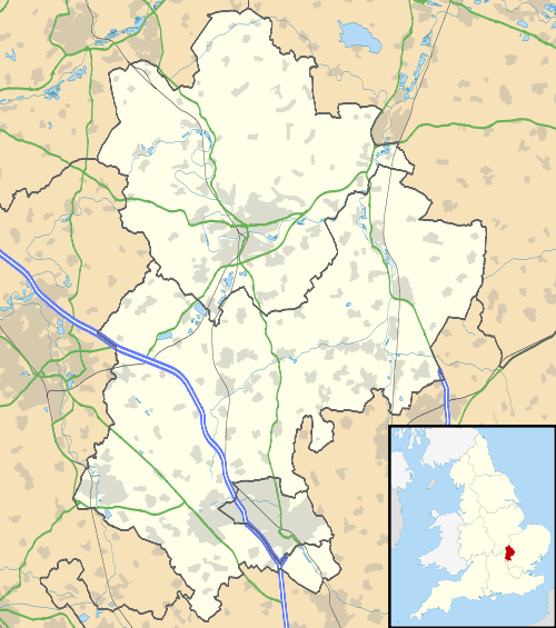
 EGTC Location in Bedfordshire | |||||||||||
| Runways | |||||||||||
| |||||||||||
Cranfield Airport (ICAO: EGTC) is an airfield just outside the village of Cranfield, 7 NM (13 km; 8.1 mi) south-west of Bedford in Bedfordshire, England. It was originally a World War II aerodrome, RAF Cranfield.
History
RAF Cranfield was built by John Laing & Son on 100 acres (0.40 km2) of farmland acquired by the Air Ministry in 1935 as Britain re-armed to face the growing threats on the continent.[2] It was formally opened on 1 June 1937 and initially became the base for No. 62 Squadron RAF and No. 82 Squadron RAF of No. 1 (Bomber) Group, flying the already obsolete Hawker Hind biplanes.
Both squadrons converted to Blenheim 1s in 1938. 62 Squadron was moved to Singapore in August 1939 where it was destroyed by the invading Japanese. RAF Cranfield's grass airstrip was replaced with three hardened runways in the winter of 1939 and spring of 1940 and became a target for enemy action in the late summer of that year, with mines, bombs and incendiaries dropped on it and the nearby village of Cranfield.
Aircraftsman Vivian Hollowday, serving at the airfield, won the George Cross for the attempted rescue of two crews which crashed there in July and August 1940.[3]
August 1941 saw the fast developing station become a night fighter training centre with the arrival of No. 51 Night fighter Operational Training Unit. This was disbanded after the end of the war in Europe in June 1945 and the airfield became the site for a new College of Aeronautics. This college helped develop the highly successful Harrier Jump Jet and has serviced the Hurricanes and Spitfires of the Battle of Britain Memorial Flight. The UK's sole remaining airworthy Avro Lancaster was based at Cranfield until 1964.[4][5]
Description
Cranfield Aerodrome has a CAA Ordinary Licence (Number P803) that allows flights for the public transport of passengers or for flying instruction as authorised by the licensee (Cranfield University)[6] situated next to the site.
The airfield is used for a small amount of University-related flights in addition to an ever decreasing number of flying schools and private owners. One of the Met Office research aircraft (a BAE 146), operated under the Facility for Airborne Atmospheric Measurements, is usually based on the airfield.
Cranfield is also home to the privately owned English Electric Lightning T5 "XS458" which conducts regular demonstration fast taxi and ground runs at selected weekends during the summer months.
Situated 3 mi (4.8 km) to the North East of the M1 motorway and Milton Keynes, the airfield has a large catchment area.
Although the length of the runway means that Cranfield can handle commercial aircraft (up to 757-size), remaining infrastructure is not suitable for scheduled passenger flights or for the handling of such aircraft.
Navigation aids include [7]
- NDB 'CIT' which is located 3.5 NM (6.5 km; 4.0 mi) to the north-east of the aerodrome
- ILS/DME equipment for runway 21
- VDF
- GNSS Approaches to both runways
Partial closure
On 13 September 2016 the airport announced to operators that with immediate effect, a raft of restrictions would be introduced; these included closure on every weekend for the "foreseeable future", closure on some weekdays, limitations on opening hours and "flow control" arrangements. Many operators and private owners have been forced to relocate elsewhere [8]
References
- ↑ Cranfield - EGTC
- ↑ Ritchie, p. 91
- ↑ "Cranfield College of Aeronautics history" (PDF). p. 4. Retrieved 17 April 2010.
- ↑ "Cranfield College of Aeronautics history" (PDF). Cranfield University. pp. 3–4. Retrieved 2009-03-16.
- ↑ "Battle of Britain Memorial Flight - Lancaster history". RAF. Retrieved 2009-08-05.
- ↑ Civil Aviation Authority Aerodrome Ordinary Licences Archived 28 June 2007 at the Wayback Machine.
- ↑ Cranfield airport - pilot information
- ↑ Cranfield airport in crisis - Flyer Magazine
Sources
- Ritchie, Berry (1997). The Good Builder: The John Laing Story. James & James.
External links
| Wikimedia Commons has media related to Cranfield Airport. |
- Official site
- Cranfield Airport from the air
- Facility for Airborne Atmospheric Measurements
- Control Towers Website: RAF Cranfield
