Coastline of Australia

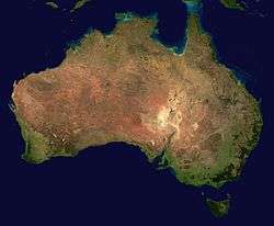
Satellite photo of Australia

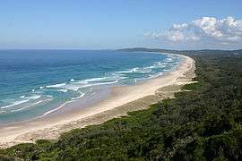
Tallow Beach, Byron Bay, New South Wales
The coastline of Australia comprises the coasts of mainland Australia and Tasmania. It nominally includes a part of all Australian states and territories; the otherwise landlocked Australian Capital Territory has a coastal enclave at Jervis Bay Territory.
According to The World Factbook, Australia has the sixth longest coastline in the world.[1]
Due to the historical context of European discovery and exploration, the coastline has been the first point of contact over 400 years.[2]
In the IBRA bioregionalisation the coast has 36 coastal bioregions that define the whole coast[3] and there is the more complex Integrated Marine and Coastal Regionalisation of Australia, which includes ecological features that are beyond the shoreline.
Coastline length
| State/territory | Mainland coastline length |
Island length | Total coastline length | |||
|---|---|---|---|---|---|---|
| km | mi | km | mi | km | mi | |
| Australia | 35,877 | 22,293 | 23,859 | 14,825 | 59,736 | 37,118 |
| Australian Capital Territory | - | - | - | - | - | - |
| Jervis Bay Territory | 54 | 34 | 3 | 1.9 | 57 | 35 |
| New South Wales | 2,007 | 1,247 | 130 | 81 | 2,137 | 1,328 |
| Northern Territory | 5,437 | 3,378 | 5,516 | 3,427 | 10,953 | 6,806 |
| Queensland | 6,973 | 4,333 | 6,374 | 3,961 | 13,347 | 8,293 |
| South Australia | 3,816 | 2,371 | 1,251 | 777 | 5,067 | 3,148 |
| Tasmania | 2,833 | 1,760 | 2,049 | 1,273 | 4,882 | 3,034 |
| Victoria | 1,868 | 1,161 | 644 | 400 | 2,512 | 1,561 |
| Western Australia | 12,889 | 8,009 | 7,892 | 4,904 | 20,781 | 12,913 |
See also
References
- ↑ "Coastline". World Factbook. Central Intelligence Agency.
- ↑ "Mapping Australia's coastline". Australian Government.
- ↑ Saintilan, Neil; CSIRO (2009). Australian saltmarsh ecology (Map). CSIRO Publishing. p. 29. ISBN 978-0-643-09684-4.
- ↑ "Border Lengths - States and Territories". Geoscience Australia. Australian Government. Retrieved 5 August 2017.
This article is issued from
Wikipedia.
The text is licensed under Creative Commons - Attribution - Sharealike.
Additional terms may apply for the media files.