Ciénega Bridge
| Ciénega Bridge | |
|---|---|
|
View of the Ciénega Bridge from the top of Marsh Station Bridge, facing east. The Rincon Mountain range are in the background at the left. | |
| Coordinates | 32°01′11″N 110°38′46″W / 32.01972°N 110.64611°WCoordinates: 32°01′11″N 110°38′46″W / 32.01972°N 110.64611°W |
| Carries | Motor vehicles, pedestrians and bicycles |
| Crosses | Ciénega Creek |
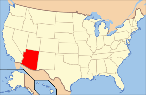
| Locale | Pima County, Arizona, USA |
| Characteristics | |
| Design | Open-spandrel arch |
| Total length | 277.9 ft (85 m) |
| Width | 21.7 ft (7 m) |
| Longest span | 146 ft (45 m) |
| History | |
| Construction start | 1920 |
| Construction end | 1921 |
Ciénega Bridge is an open-spandrel arch bridge which crosses Pantano Wash near Vail, Arizona. It was added to the National Register of Historic Places on September 30, 1988.[1]
See also
-
 Bridges portal
 -
 Arizona portal
 -
National Register of Historic Places portal
- List of bridges on the National Register of Historic Places in Arizona
- National Register of Historic Places listings in Pima County, Arizona
References
- ↑ "Bridgehunter.com - Cienega Bridge". Retrieved 2014-04-05.
External links
This article is issued from
Wikipedia.
The text is licensed under Creative Commons - Attribution - Sharealike.
Additional terms may apply for the media files.


