Camino Real de Tierra Adentro
| Camino Real de Tierra Adentro | |
|---|---|
|
Map of El Camino Real de Tierra Adentro | |
| Location | Mexico and the United States |
| Governing body |
Instituto Nacional de Antropología e Historia (Mexico) National Park Service, Bureau of Land Management (United States) |
| Website | El Camino Real de Tierra Adentro National Historic Trail |
| UNESCO World Heritage Site | |
| Criteria |
Cultural: (ii), (iv) |
| Reference | 1351 |
| Inscription | 2010 (34th Session) |
The Camino Real de Tierra Adentro (Spanish for "Royal Road of the Interior Land") was a 2560 kilometer (1,600 mile) long trade route between Mexico City and San Juan Pueblo, New Mexico, from 1598 to 1882.[2]
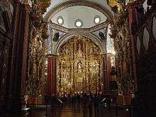
In 2010, 55 sites and 5 existing World Heritage Sites along the Mexican section of the route became an entry on the Unesco World Heritage List.[3] Those sites include historic cities, towns, bridges, haciendas and other monuments along the 1,400km route between the Historic Center of Mexico City (independent World Heritage Site) and the town of Valle de Allende, Chihuahua.
The 404 mile (646 kilometer) section of the route within the United States was proclaimed as a part of the National Historic Trail system on October 13, 2000. El Camino Real de Tierra Adentro National Historic Trail is overseen by both the National Park Service and the U.S. Bureau of Land Management with aid from El Camino Real de Tierra Adentro Trail Assoc. also known as CARTA. A portion of the trail near San Acacia, New Mexico was listed on the National Register of Historic Places in 2014.[4]
History
The trail was used for trade among native tribes since the earliest of times. In 1598, Oñate followed the trail while leading a group of settlers North during the era of Spanish conquest. The duration of the trip from the Rio Grande to the San Juan Pueblo was said to take, by wagon and by foot, approximately 6 months including 2–3 weeks of rest throughout the trip.[5] According to journals kept by settlers they used common animals found along the trail to add to the food they brought along. The trail greatly improved trade among Spanish villages and helped the Spanish conquistadors spread Christianity throughout the conquered lands. The trail was used from 1598 through 1881 when the railroad replaced the need for wagons. Eventually, railroads replaced rutted trails and over time the trail and evidence of it faded from sight and memory. The changes that the railways brought made trade along El Camino much easier and in some cases made travel quite luxurious and exciting.
List of World Heritage locations


The Camino Real de Tierra Adentro world heritage entry includes the following:[6]
- Historic center of Mexico City (World Heritage, 1987)
- Former college of San Francisco Javier in Tepotzotlán
- Town of Aculco
- Bridge of Atongo
- Stretch of the Camino Real between Aculco and San Juan del Río
- Former convent of San Francisco in Tepeji del Río and bridge
- Stretch of the Camino Real between the bridge of La Colmena and the Former hacienda of La Cañada
- Historic center of San Juan del Río
- Former hacienda of Chichimequillas
- Chapel of the former hacienda of Buenavista
- Historic center of Querétaro (World Heritage, 1996)
- Bridge of El Fraile
- Former Royal hospital of San Juan de Dios of San Miguel de Allende
- Bridge of San Rafael
- Bridge La Quemada
- San Miguel de Allende and Sanctuary of Jesús Nazareno de Atotonilco (World Heritage, 2008)
- Historic center Guanajuato and its adjacent mines (World Heritage, 1988)
- Historic centre of the city of Lagos de Moreno and bridge
- Historic ensemble of the Town of Ojuelos de Jalisco
- Bridge of Ojuelos
- Former hacienda of Ciénega de Mata
- Cemetery in Encarnación de Díaz
- Former hacienda of Peñuelas
- Former hacienda of Cieneguilla
- Historic ensemble of Aguascalientes City
- Former hacienda of Pabellón de Hidalgo
- Chapel of San Nicolás Tolentino of the former hacienda of San Nicolás de Quijas
- Town of Pinos
- Temple of Nuestra Señora de los Ángeles of the town of Noria de Ángeles
- Temple of Nuestra Señora de los Dolores in Villa González Ortega
- Former college of Nuestra Señora de Guadalupe of Propaganda Fide
- Historic ensemble of the city of Sombrerete
- Temple of San Pantaleón Mártir in the Town of Noria de San Pantaleón
- Sierra de Órganos
- Architectonic ensemble of the Town of Chalchihuites
- Stretch of the Camino Real between Ojocaliente and Zacatecas
- Cave of Ávalos
- Historic center of the city of Zacatecas (World Heritage, 1993)
- Sanctuary of Plateros
- Historic center of San Luis Potosi City
- Chapel of San Antonio of the Former hacienda of Juana Guerra
- Temples in the town of Nombre de Dios
- Former hacienda of San Diego de Navacoyán and Devil’s Bridge
- Historic center of the Durango City
- Temples in the town of Cuencamé and Cristo de Mapimí
- Chapel of the Refugio of the former hacienda of Cuatillos
- Temple of the town of San José de Avino
- Chapel of the former hacienda of La Inmaculada Concepción de Palmitos de Arriba
- Chapel of the former hacienda of La Limpia Concepción de Palmitos de Abajo
- Architectonic ensemble of the Town of Nazas
- Town of San Pedro del Gallo
- Town of Indé
- Chapel of San Mateo of the Former hacienda of La Zarca
- Former hacienda of the Limpia Concepción of El Canutillo
- Temple of San Miguel of the town of Villa Ocampo
- Stretch of the Camino Real between Nazas and San Pedro del Gallo
- Mine of Ojuela
- Cave of Las Mulas de Molino
- Town of Valle de Allende
United States Historic Trail
From the Texas-New Mexico border to San Juan Pueblo north of Española, a drivable route, mostly part of former U.S. Route 85, has been designated as a National Scenic Byway called El Camino Real.
Portions of the trade route corridor also contain pedestrian, bicycle, and equestrian trails. These include the existing Paseo del Bosque Trail in Albuquerque and portions of the proposed Rio Grande Trail. Its northern terminus, Santa Fe, is a terminus also of the Old Spanish Trail and the Santa Fe Trail.
Along the trail, parajes (stop overs) that have been preserved today include El Rancho de las Golondrinas.
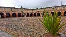
Fort Craig and Fort Selden are also located along the trail.
CARTA
El Camino Real de Tierra Adentro Trail Association (CARTA) is a non-profit trail organization that aims to help promote, educate, and preserve the cultural and historic trail in collaboration with the National Park Service, the Bureau of Land Management, the New Mexico Department of Cultural Affairs and various Mexican organizations. CARTA publishes an informative journal, Chronicles of the Trail, quarterly that provides people with further history and current affairs of the trail and what CARTA, as an organization, is doing to help the trail.
Chihuahua Trail
The Chihuahua Trail describes this route as it passed from New Mexico through the state of Chihuahua to central Mexico.
In the late 16th century Spanish exploration and colonization had advanced from Mexico City northward by the great central plateau to its ultimate goal in Santa Fe. Until Mexican independence (1821) all communications of New Mexico with the outer world was restricted to this 1,500-mile (2,400 km) trail. Over it came ox carts and mule trains, missionaries and governors, soldiers and colonists. When the Santa Fe Trail sprang up, traders from the United States extended their operations southward over the Chihuahua Trail and beyond to Durango and Zacatecas. Superseded by railroads, the ancient Mexico City-Santa Fe road was revived as a great automobile highway of Mexico. The part in New Mexico, State Highway 85, pioneered by Franciscan missionaries in 1581, may be the oldest highway in the United States.
See also
| Wikimedia Commons has media related to El Camino Real de Tierra Adentro. |
- El Camino Real (California) – The California Mission Trail
- El Camino Real de Los Tejas – El Camino Real from Texas east to Louisiana
- Old San Antonio Road – A section of El Camino Real de Los Tejas
- Scenic byways in the United States
- National Register of Historic Places listings in Socorro County, New Mexico
References
- ↑ http://whc.unesco.org/en/list/1351.
- ↑ Snyder, Rachel Louise. "Camino Real" American Heritage, April/May 2004.
- ↑ "Camino Real de Tierra Adentro – World Heritage List". UNESCO. Retrieved 2010-08-05.
- ↑ "Weekly list of actions 11/03/14 through 11/07/14". National Park Service. Retrieved 2014-11-23.
- ↑ need citation
- ↑ "Camino Real de Tierra Adentro Map". whc.unesco.org.
Further reading
- Dictionary of American History by James Truslow Adams, New York: Charles Scribner's Sons, 1940
- Boyle, Susan Calafate. Los Capitalistas: Hispano Merchants and the Santa Fe Trade. Albuquerque: University of New Mexico Press, 1997.
- Moorhead, Max L. New Mexico’s Royal Road. Norman: University of Oklahoma Press, 1958.
- Palmer, Gabrielle G., et al.. El Camino Real de Tierra Dentro. Santa Fe: Bureau of Land Management, 1993.
- Palmer, Gabrielle G. and Stephen L. Fosberg. El Camino Real de Tierra Dentro. Santa Fe: Bureau of Land Management, 1999.
- Preston, Douglas and José Antonio Esquibel. The Royal Road. Albuquerque: University of New Mexico Press, 1998.
External links
- National Park Service: official El Camino Real de Tierra Adentro National Historic Trail website
- El Camino Real International Heritage Center
- El Camino Real de Tierra Adentro – Integrated education curriculum
- CARTA – El Camino Real de Tierra Adentro Trail Association: website
- N.M.-Monuments.org – "A Road Over Time"
Coordinates: 22°36′29″N 102°22′45″W / 22.60806°N 102.37917°W

